Skip to main content Skip to main navigation Skip to search
ABARES - Land use and management

Top navigation abares

  • Department
  • Ministers
  • Media Centre
Main menu

Main navigation ACLUMP

  • Land home
    Land home
  • About ACLUMP
    About ACLUMP
  • Land use
    Land use
  • Publications
    Publications
  • Data download
    Data download
  • Latest news
    Latest news
Department of Agriculture

Breadcrumb

  1. DAFF Home
  2. ABARES
  3. Land use and management
  4. Land management practices
  5. Mapping ground cover management

Secondary ACLUMP

  • Land Management Practices
    • Collating LMP Information
    • Data and Maps
    • Drivers for LMP Information
    • Information System
    • Mapping ground cover management
    • Publications

Mapping ground cover management

Ground cover provides the protective layer of living and decaying plant material on the soil surface. Farmers and graziers impact on ground cover through their daily management. Management practices that reduce ground cover degrade the soil and water assets that support agricultural production and biodiversity. Programs that achieve adoption of practices that maintain or improve ground cover can be expected to provide a high return on investments.

​ACLUMP State and Territory partners are developing nationally consistent land management practice mapping based on characteristic patterns of ground cover in agricultural systems. Towards this end, ACLUMP have:

  • prepared a database of cropping calendars for broadacre crops and improved pastures for natural resource management regions with user guide and metadata,

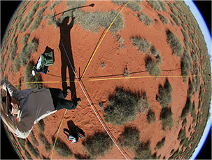
  • assessed the suitability of existing monitoring sites for use in a national network of sites to measure fractional cover according to the Queensland Statewide Landcover and Trees Study's (SLATS) modified discrete point sampling method - the approach endorsed by all jurisdictions, and

  • held a workshop to assess remote sensing products to report change in ground cover management under agricultural land uses nationally. Outputs from this workshop included; a background paper, workshop proceedings "Developing national protocols to map ground cover management in cropping and grazing systems (2010)", a conference paper and poster.

To detect and monitor land management practices impacting ground cover, ACLUMP recommend using a fractional cover remotely sensed product. The selected product will need standardised on-ground measurements for calibration and validation, and an assessment of its accuracy to estimate fractional cover, particularly in cropping areas.

National ground cover monitoring is currently underway supported by the department​ ​and Caring for our Country focusing initially on the rangelands using a MODIS-based fractional cover product.

Measuring fractional ground cover using discrete point sampling along three star shaped transects within a pastoral environment.
Measuring fractional ground cover using discrete point sampling along three star-shaped transects within a pastoral environment (Queensland Department of Science, Information Technology, Innovation and the Arts).

​​Links

  • Ground cover monitoring for Australia
  • Status of Land Management Practices: Activities of ACLUMP (2010)
Thanks for your feedback.
Thanks! Your feedback has been submitted.

We aren't able to respond to your individual comments or questions.
To contact us directly phone us or submit an online inquiry

CAPTCHA
This question is for testing whether or not you are a human visitor and to prevent automated spam submissions.

Please verify that you are not a robot.

Skip
Page last updated: 08 September 2023

We acknowledge the continuous connection of First Nations Traditional Owners and Custodians to the lands, seas and waters of Australia. We recognise their care for and cultivation of Country. We pay respect to Elders past and present, and recognise their knowledge and contribution to the productivity, innovation and sustainability of Australia’s agriculture, fisheries and forestry industries.

Artwork: Protecting our Country, Growing our Future
© Amy Allerton, contemporary Aboriginal Artist of the Gumbaynggirr, Bundjalung and Gamilaroi nations.

Footer

  • Contact us
  • Accessibility
  • Disclaimer
  • Privacy
  • FOI

© Department of Agriculture, Fisheries and Forestry

Facebook X LinkedIn Instagram