
ACLUMP State and Territory partners undertook pilot projects to trial methods for 'mapping' land management practices information.
The pilot projects involved collaboration with other organisations such as catchment management authorities, industry groups and other government agencies. Land management practices information was collated and mapped via surveys of land managers, information from local experts, existing data from agencies, industry and local groups, cross-landscape transects (or windscreen surveys), field mapping, and remote sensing via interpretation of aerial photography or satellite imagery.
The outcomes of these pilots are informing the on-going development of LUMIS.
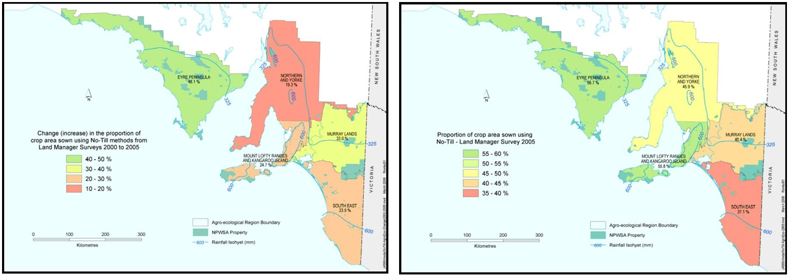
An example of land management practice use and change from the Land Manager Survey conducted for the agricultural regions of South Australia (Department of Water, Land and Biodiversity Conservation