The capacity to measure and report change in land use over time is critical to evaluating and monitoring trends in agricultural productivity and natural resource condition. Change information is also needed to identify priorities for public investment in natural resource management and to assess its effectiveness.
Researchers, policymakers and land managers need accurate and timely information on land use change to help analyse its impacts and manage its consequences. An improved understanding of agricultural land use change is central to an informed analysis of agriculture, food and fibre security, forestry, water management, mining, climate change mitigation and adaptation, population, urban expansion, biodiversity protection, community development and landscape aesthetics.
Reporting
The choice of method for reporting land use change generally depends on the problem being addressed, end use of the analysis, scale and accuracy of the data, and an available time-series. Where fine scaled time-series data are available, spatial analysis can provide important insight into the nature of land use change. Where such detailed analysis is limited due to data availability, simple statistical analyses can provide important insights.
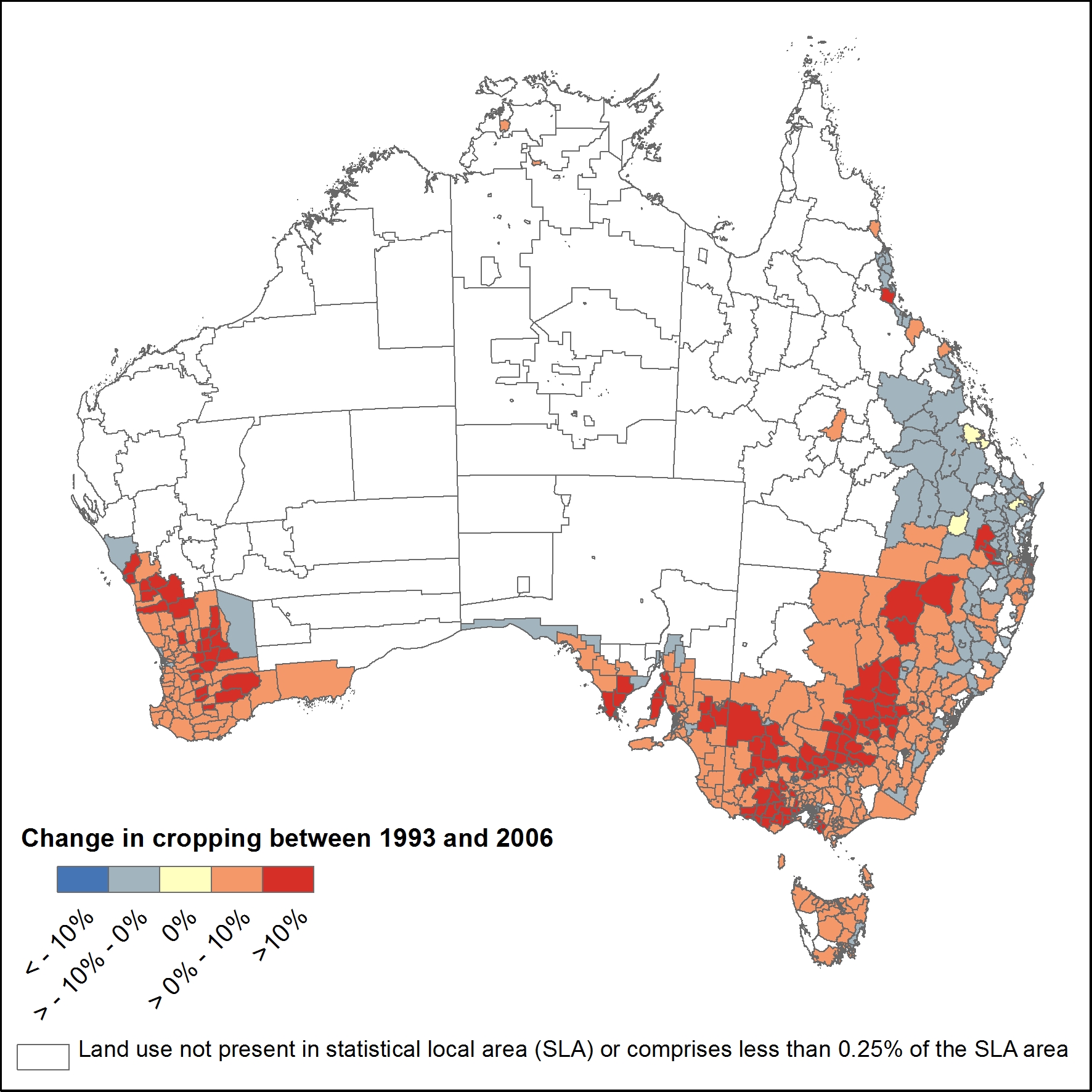
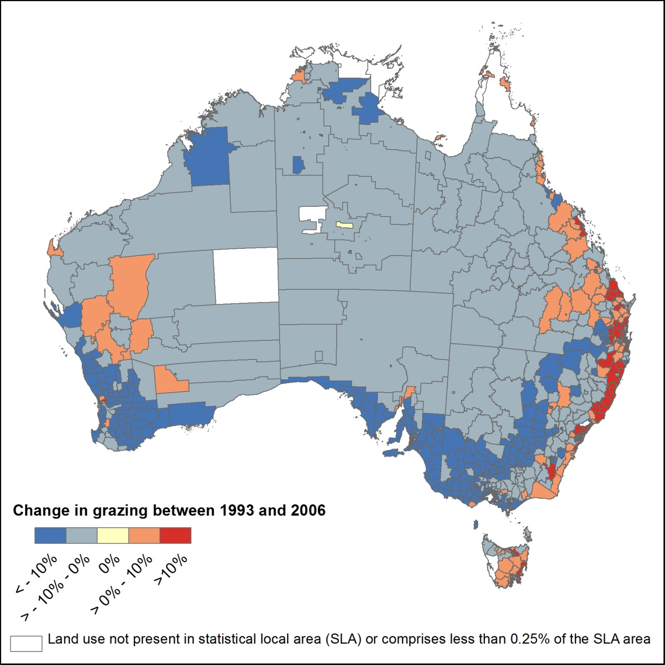
In 2013, ABARES released the report Towards national reporting on land use change in Australia which describes changes in key land uses (grazing, cropping and nature conservation) over the period 1992-93 to 2005-06, nationally and at the regional scale. It draws heavily on the ABARES time series of national scale land use maps and Australian Bureau of Statistics (ABS) agricultural statistics as these are the most reliable and consistent for reporting on land use change at the national level.
This report builds on the ABARES Science and Economics Insights Report Landscapes in transition: tracking land use change in Australia in scoping our capacity to consistently report on land use change at the national level using currently available national datasets. It outlines the current extent of agricultural land use in Australia, and describes how agricultural land use is changing. It highlights the dynamic nature of agricultural land use and the pressures for change from alternative land uses. Changes in some land uses, such as grazing, cropping, nature conservation and plantation forestry as well as changes in peri-urban environments, are also discussed.
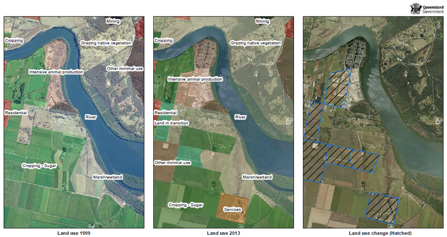
Shifting the Goalposts: Land Use Change in Queensland
As sugar cane farming has become less comercially viable, producers in Queensland have looked to diversify into other avenues of income. This has led to significant changes in land use with broad-reaching economic impacts. This example shows a transition from sugar cane cropping into grazing, aquaculture and tourism: