
The annual ABARES Fishery Status Reports are an independent assessment of the biological status of commercial fish stocks and the economic status of fisheries managed, or jointly managed, by the Australian Government (Commonwealth fisheries).
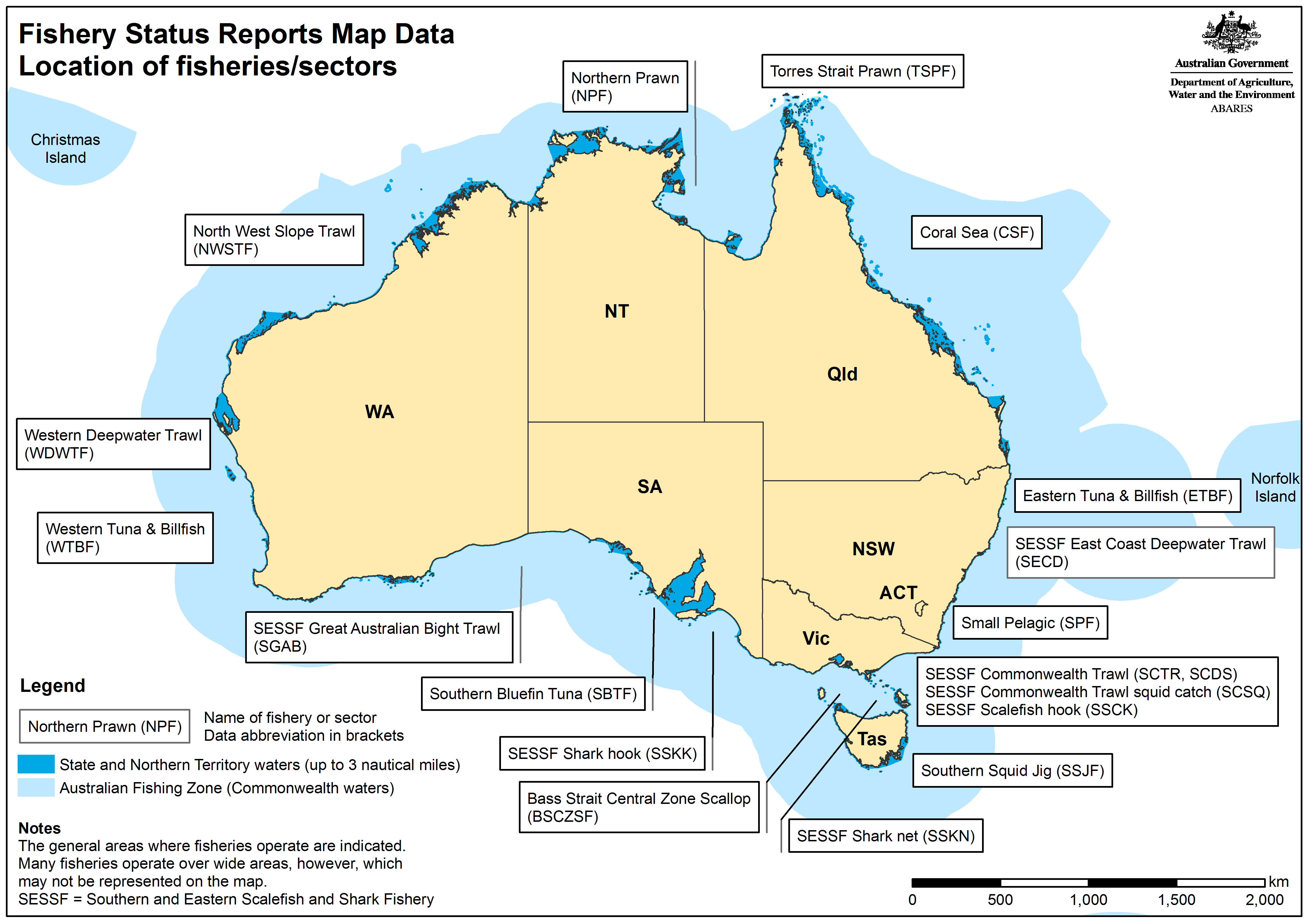
ABARES Annual Fishery Status Reports Map Data are digital representations of the two thematic components of the maps in the ABARES Fishery Status Reports: relative fishing intensity and the maximum area of waters fished.
Relative fishing intensity shows areas where five or more fishing vessels operated and the relative effort expended or the catch. Maximum area fished shows the total area where fishing occurred at a resolution of one degree (approximately 111 x 111 km).
The maps were compiled from logbook data supplied by the Australian Fisheries Management Authority (AFMA). Data are supplied for all Australian Government-managed (Commonwealth) fisheries where there has been activity reported in at least one year since 2010. The number of years for which data are supplied varies from year to year depending on the amount of activity in the fishery. The data are supplied as feature classes in Esri file geodatabases.
Because of a change to the reporting timeline in 2025, map data are not available for the Southern and Eastern Scalefish and Shark Fishery, with the exception of Commonwealth Trawl Sector squid catch, and the Small Pelagic Fishery. For map data on these fisheries, please refer to Fishery Status Reports 2024.
ABARES Fishery Status Reports Map Data: User guide 2025
If you have difficulty accessing these files, contact us for help.
Datasets by Fishery/sector
This dataset presents maps of fishing intensity and maximum area fished of ocean waters by all Australian Government-managed fisheries combined.
This dataset corresponds to Chapter 1 in the 2025 Fisheries Status Report.
his dataset presents maps of fishing intensity and maximum area fished of ocean waters within the Bass Strait Central Zone Scallop Fishery.
This dataset corresponds to Chapter 2 in the 2025 Fisheries Status Report.
This dataset presents maps of fishing intensity and maximum area fished of ocean waters within the Coral Sea Fishery.
This dataset corresponds to Chapter 3 in the 2025 Fisheries Status Report.
This dataset presents maps of fishing intensity and maximum area fished of ocean waters within the Northern Prawn Fishery.
This dataset corresponds to Chapter 4 in the 2025 Fisheries Status Report.
This dataset presents maps of fishing intensity and maximum area fished of ocean waters within the North West Slope Trawl Fishery.
This dataset corresponds to Chapter 5 in the 2025 Fisheries Status Report.
This dataset presents maps of fishing intensity and maximum area fished of ocean waters within the Small Pelagic Fishery.
This dataset corresponds to Chapter 6 in the 2025 Fisheries Status Report.
If you have difficulty accessing these files, contact us for help.
Southern and Eastern Scalefish and Shark Fishery (SESSF) Sectors and Sub-Sectors
This dataset presents maps of fishing intensity and maximum area fished of ocean waters within the SESSF Commonwealth Trawl Sector trawl sub-sector.
This dataset corresponds to Chapter 8 in the 2024 Fisheries Status Report.
This dataset presents maps of fishing intensity and maximum area fished of ocean waters within the SESSF Commonwealth Trawl Sector Danish-seine sub-sector.
This dataset corresponds to Chapter 8 in the 2024 Fisheries Status Report.
This dataset presents maps of fishing intensity and maximum area fished of ocean waters within the SESSF Commonwealth Trawl Sector Danish-seine sub-sector.
This dataset corresponds to Chapter 8 in the 2024 Fisheries Status Report.
This dataset presents maps of fishing intensity and maximum area fished of ocean waters within the SESSF East Coast Deepwater Trawl Sector.
This dataset corresponds to Chapter 9 in the 2024 Fisheries Status Report.
This dataset presents maps of fishing intensity and maximum area fished of ocean waters within the SESSF Great Australian Bight Sector.
This dataset corresponds to Chapter 10 in the 2024 Fisheries Status Report.
This dataset presents maps of fishing intensity and maximum area fished of ocean waters within the SESSF Gillnet Hook and Trap Sector Shark Hook sub-sector.
This dataset corresponds to Chapter 11 in the 2024 Fisheries Status Report.
This dataset presents maps of fishing intensity and maximum area fished of ocean waters within the SESSF Gillnet Hook and Trap Sector Shark Gillnet sub-sector.
This dataset corresponds to Chapter 11 in the 2024 Fisheries Status Report.
This dataset presents maps of fishing intensity and maximum area fished of ocean waters showing the catch of squid by the SESSF Commonwealth Trawl Sector.
This dataset corresponds to Chapter 12 in the 2025 Fisheries Status Report.
This dataset presents maps of fishing intensity and maximum area fished of ocean waters showing the catch of squid by the Southern Squid Jig Fishery.
This dataset corresponds to Chapter 12 in the 2025 Fisheries Status Report.
This dataset presents maps of fishing intensity and maximum area fished of ocean waters showing the catch of squid by the Western Deepwater Trawl Fishery.
This dataset corresponds to Chapter 13 in the 2025 Fisheries Status Report.
This dataset presents maps of fishing intensity and maximum area fished of ocean waters showing the catch of squid by the Torres Strait Prawn Fishery.
This dataset corresponds to Chapter 17 in the 2025 Fisheries Status Report.
This dataset presents maps of fishing intensity and maximum area fished of ocean waters within the Eastern Tuna and Billfish Fishery.
This dataset corresponds to Chapter 20 in the 2025 Fisheries Status Report.
This dataset presents maps of fishing intensity and maximum area fished of ocean waters within the Southern Bluefin Tuna Fishery.
This dataset corresponds to Chapter 22 in the 2025 Fisheries Status Report.
This dataset presents maps of fishing intensity and maximum area fished of ocean waters within the Western Tuna and Billfish Fishery.
This dataset corresponds to Chapter 23 in the 2025 Fisheries Status Report.
If you have difficulty accessing these files, contact us for help.