Skip to main content Skip to main navigation Skip to search
ABARES - Forests Australia

Top navigation abares

  • Department
  • Ministers
  • Media Centre
Main menu

Main navigation Forests Australia

  • Home
    Home
  • Australia’s forests
    Australia’s forests
  • State of the forests reports
    State of the forests reports
  • Product statistics
    Product statistics
  • Plantation statistics
    Plantation statistics
  • Data and maps
    Data and maps
  • Publications
    Publications
Department of Agriculture

Breadcrumb

  1. DAFF Home
  2. ABARES
  3. Forests Australia
  4. Data, maps and tools
  5. Forest spatial data
  6. Regional Forest Agreements boundaries

Secondary Forests Australia

  • Spatial data
    • Forests of Australia
    • Tenure of Australia's forests
    • Australia's Indigenous land and forest estate
    • Fires in Australia's forests
    • Regional Forestry Hubs boundaries
    • Australia's plantations

Regional Forest Agreements and Comprehensive Regional Assessment boundaries

Publication date: 24 February 2025

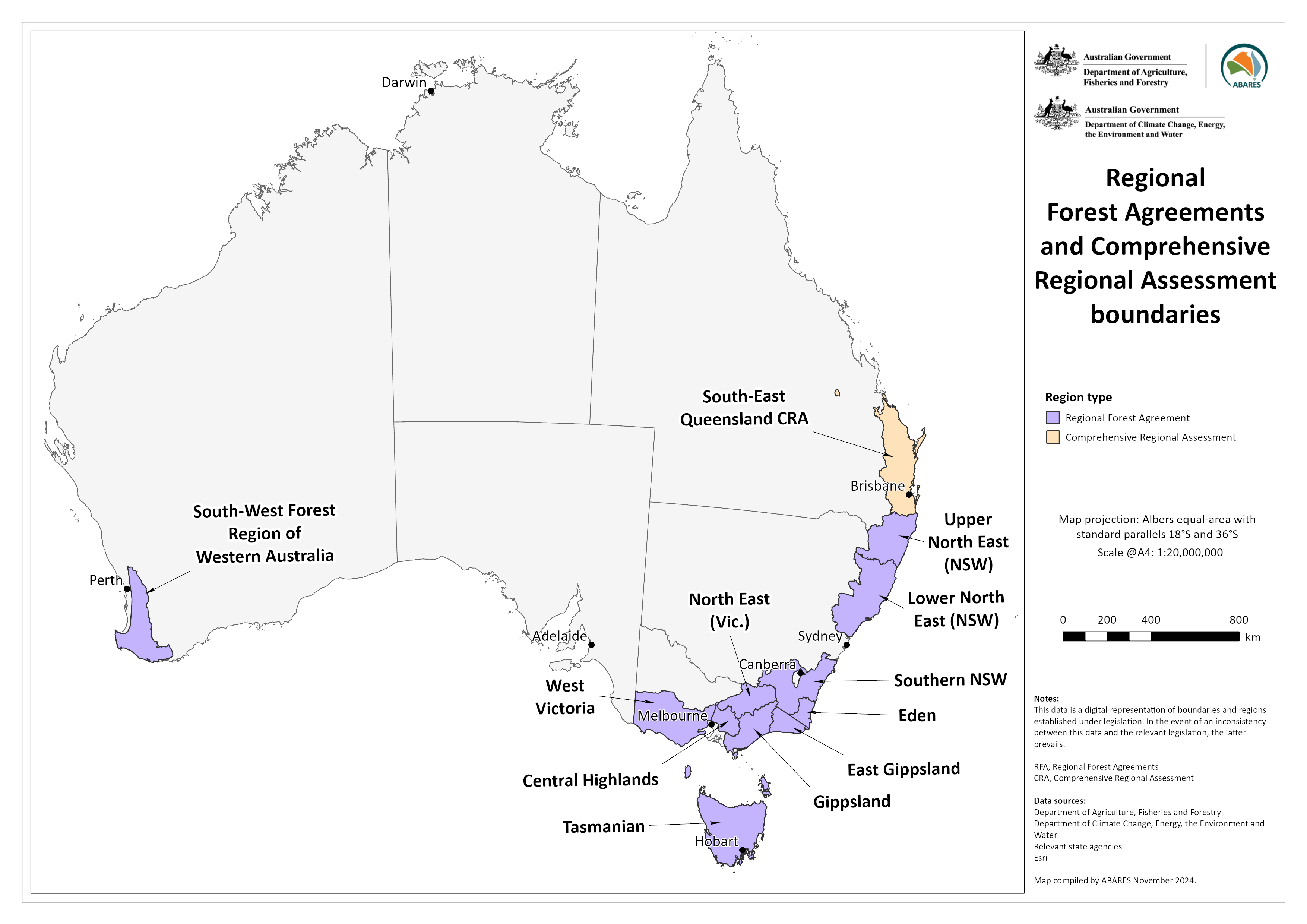
Regional Forest Agreements (RFAs) are long-term Commonwealth–state agreements for the conservation and sustainable management of specific regions of Australia’s native and plantation forests.

This dataset defines the areas that were supplied by states for the Regional Forest Agreements process and includes RFA regions in New South Wales, Tasmania, Victoria and Western Australia, and for Queensland a Comprehensive Regional Assessment region.

This dataset is designed to support and enable Commonwealth reporting specified in the National Forest Policy Statement, the Regional Forest Agreements Act 2002, and to fulfil requirements under the Environment Protection and Biodiversity Conservation Act 1999.

Data

Regional Forest Agreements and Comprehensive Regional Assessment boundaries – Shapefile and metadata (zipped) [5 MB]

Regional Forest Agreements and Comprehensive Regional Assessment boundaries – Metadata – PDF [0.1 MB]

Graphic

Regional Forest Agreements and Comprehensive Regional Assessment boundaries map

Map showing Regional Forest Agreements and Comprehensive Regional Assessment boundaries

Regional Forest Agreements and Comprehensive Regional Assessment boundaries – graphic only – PNG [0.6 MB]


Thanks for your feedback.
Thanks! Your feedback has been submitted.

We aren't able to respond to your individual comments or questions.
To contact us directly phone us or submit an online inquiry

CAPTCHA
This question is for testing whether or not you are a human visitor and to prevent automated spam submissions.

Please verify that you are not a robot.

Skip
Page last updated: 24 February 2025

We acknowledge the continuous connection of First Nations Traditional Owners and Custodians to the lands, seas and waters of Australia. We recognise their care for and cultivation of Country. We pay respect to Elders past and present, and recognise their knowledge and contribution to the productivity, innovation and sustainability of Australia’s agriculture, fisheries and forestry industries.

Artwork: Protecting our Country, Growing our Future
© Amy Allerton, contemporary Aboriginal Artist of the Gumbaynggirr, Bundjalung and Gamilaroi nations.

Footer

  • Contact us
  • Accessibility
  • Disclaimer
  • Privacy
  • FOI

© Department of Agriculture, Fisheries and Forestry

Facebook X LinkedIn Instagram