Skip to main content Skip to main navigation Skip to search
ABARES - Forests Australia

Top navigation abares

  • Department
  • Ministers
  • Media Centre
Main menu

Main navigation Forests Australia

  • Home
    Home
  • Australia’s forests
    Australia’s forests
  • State of the forests reports
    State of the forests reports
  • Product statistics
    Product statistics
  • Plantation statistics
    Plantation statistics
  • Data and maps
    Data and maps
  • Publications
    Publications
Department of Agriculture

Breadcrumb

  1. DAFF Home
  2. ABARES
  3. Forests Australia
  4. Data, maps and tools
  5. Forest spatial data
  6. Regional Forestry Hubs boundaries

Secondary Forests Australia

  • Spatial data
    • Forests of Australia
    • Tenure of Australia's forests
    • Australia's Indigenous land and forest estate
    • Fires in Australia's forests
    • Regional Forestry Hubs boundaries
    • Australia's plantations

Regional Forestry Hubs boundaries (2022)

Publication date: 31 March 2022

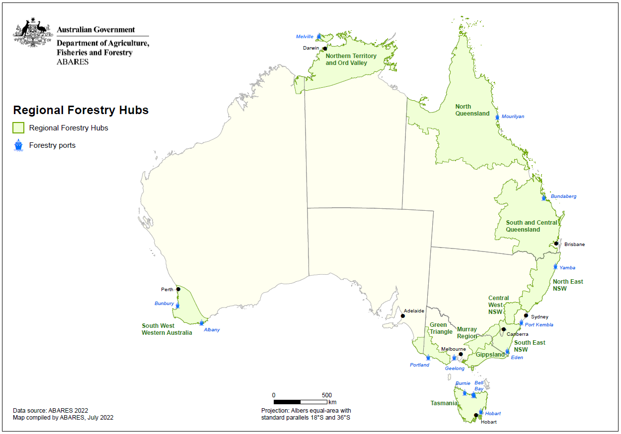
Regional Forestry Hubs boundaries (2022) is a spatial dataset comprising the boundaries created by each of eleven Regional Forestry Hubs established under the National Forest Industries Plan [PDF 3.1 MB].

The Regional Forestry Hubs were created under the National Forest Industries Plan and associated budget measures to identify economic and social opportunities and benefits in regions with existing concentrations of wood supply resources, processing and/or manufacturing operations, established transport links, and strong potential for growth.

The Regional Forestry Hubs boundaries (2022) dataset was assembled by ABARES for the Department of Agriculture, Fisheries and Forestry to support the Regional Forestry Hub committees. Each Regional Forestry Hub is led by a committee which worked with local stakeholders such as the forest industry, community groups, forest consultants and state and local governments, to define its specific region. A mix of different geographic elements were used to inform the development of the hub boundaries including Local Government Areas, Regional Forest Agreement regions, and major roads and rivers. ABARES is the central repository of each of the hub boundary datasets, all of which have been endorsed by their respective committees.

Further information is available on the Regional Forestry Hubs page of the Department of Agriculture, Fisheries and Forestry website.

Data

Regional Forestry Hubs boundaries (2022) – Shapefiles and metadata​ (zipped)​ – [7.7 ​MB]​​​

​Regional Forestry Hubs boundaries (2022) – Metadata – PDF [0.2 MB]​​

Graphics

Regional Forestry Hubs map

Regional Forestry Hubs map of Australia showing the boundaries of each hub and forestry shipping ports

Regional Forestry Hubs map – graphic only – PDF [0.6 MB]


Thanks for your feedback.
Thanks! Your feedback has been submitted.

We aren't able to respond to your individual comments or questions.
To contact us directly phone us or submit an online inquiry

CAPTCHA
This question is for testing whether or not you are a human visitor and to prevent automated spam submissions.

Please verify that you are not a robot.

Skip
Page last updated: 09 August 2022

We acknowledge the continuous connection of First Nations Traditional Owners and Custodians to the lands, seas and waters of Australia. We recognise their care for and cultivation of Country. We pay respect to Elders past and present, and recognise their knowledge and contribution to the productivity, innovation and sustainability of Australia’s agriculture, fisheries and forestry industries.

Artwork: Protecting our Country, Growing our Future
© Amy Allerton, contemporary Aboriginal Artist of the Gumbaynggirr, Bundjalung and Gamilaroi nations.

Footer

  • Contact us
  • Accessibility
  • Disclaimer
  • Privacy
  • FOI

© Department of Agriculture, Fisheries and Forestry

Facebook X LinkedIn Instagram