
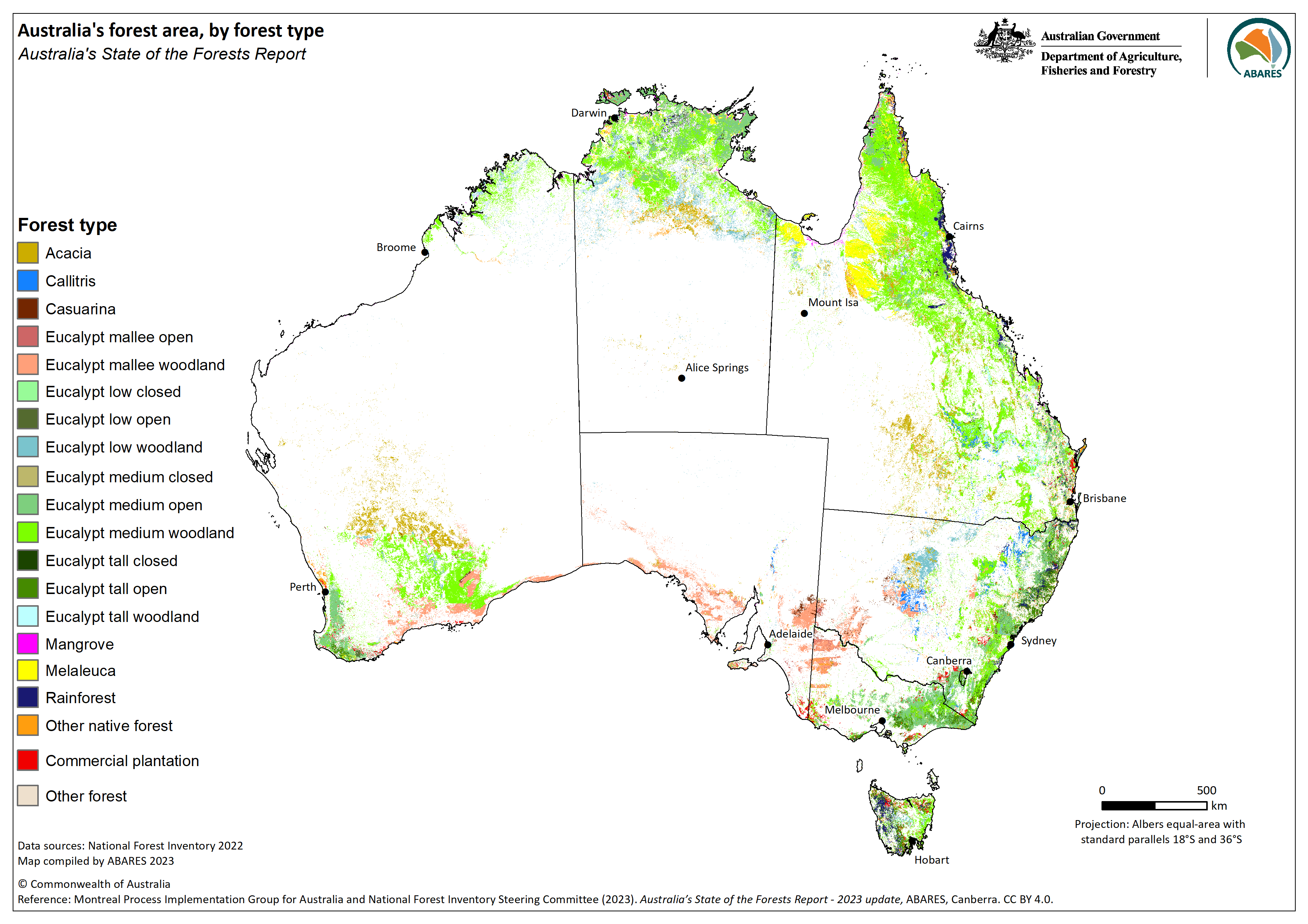
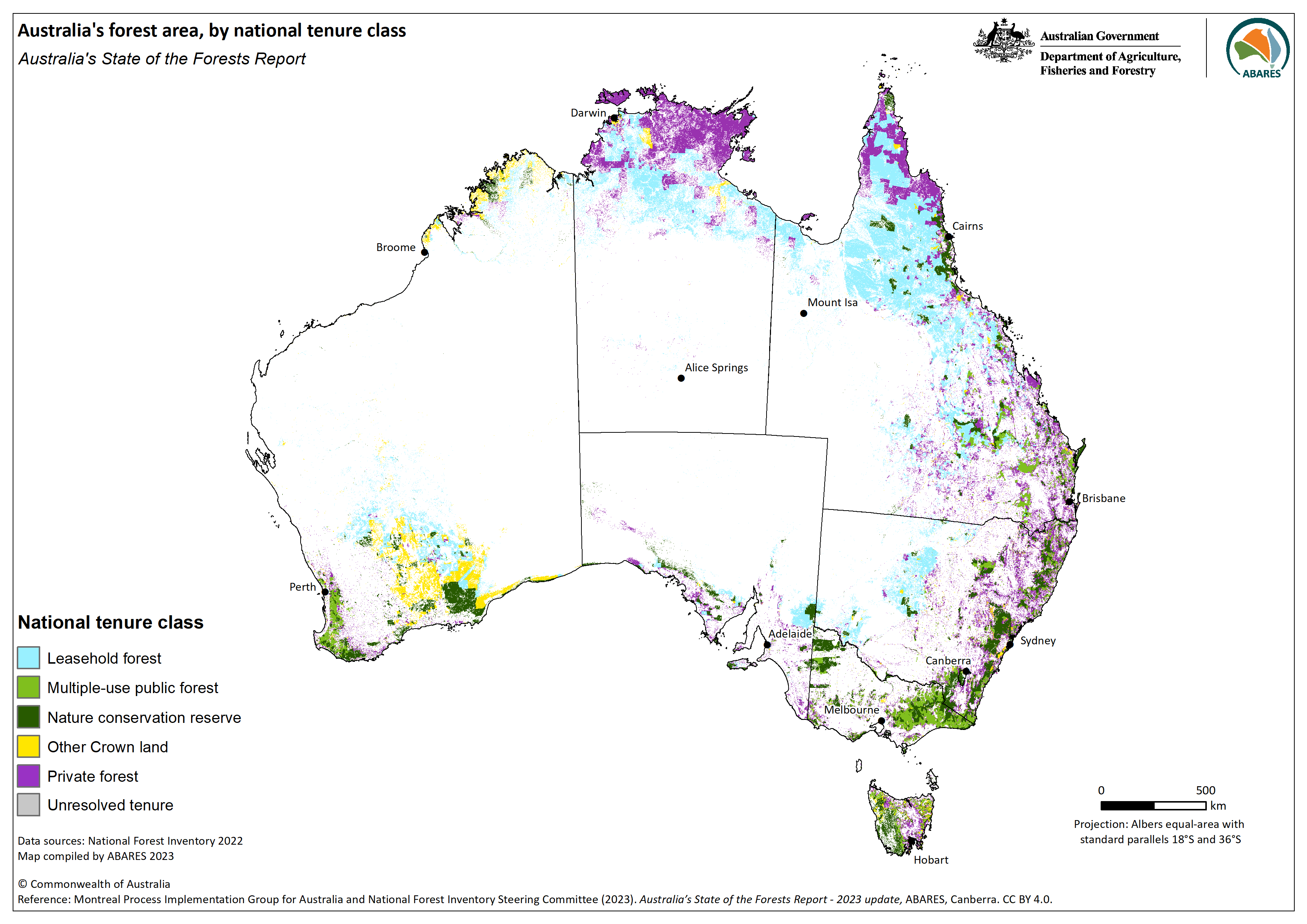
Forests of Australia
National dataset of forest extent, by national forest categories and forest types
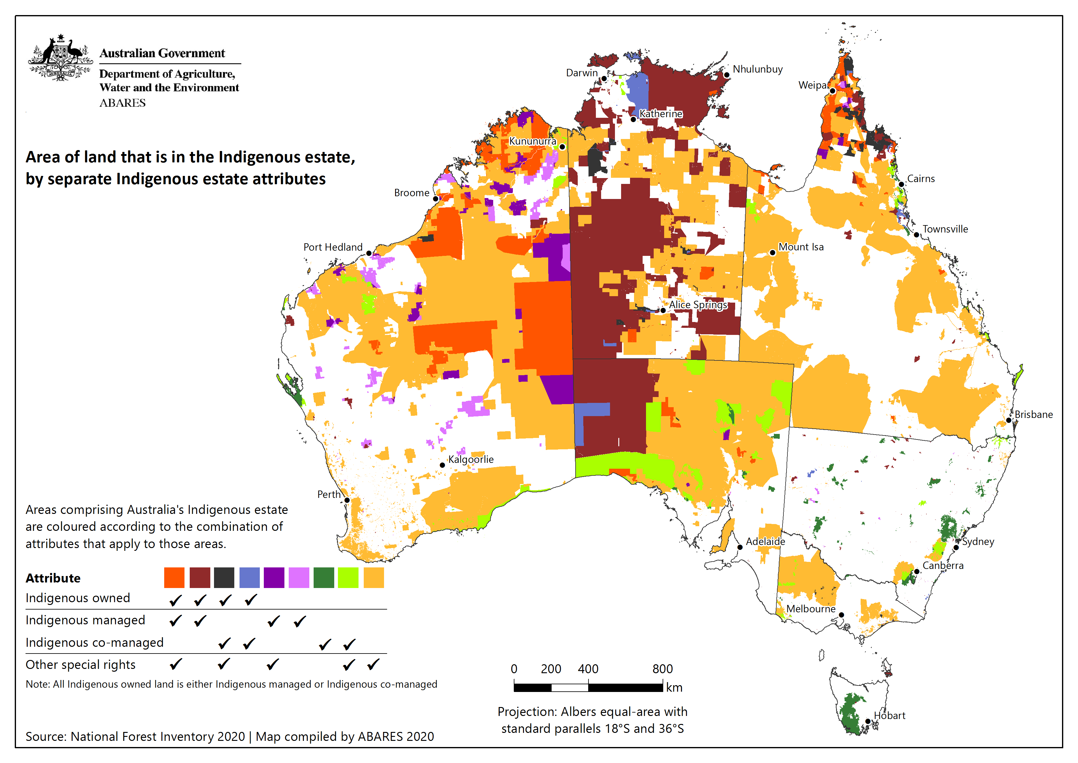
Australia's Indigenous land and forest estate
National dataset of land and forest over which Indigenous peoples have ownership, management, or other special rights
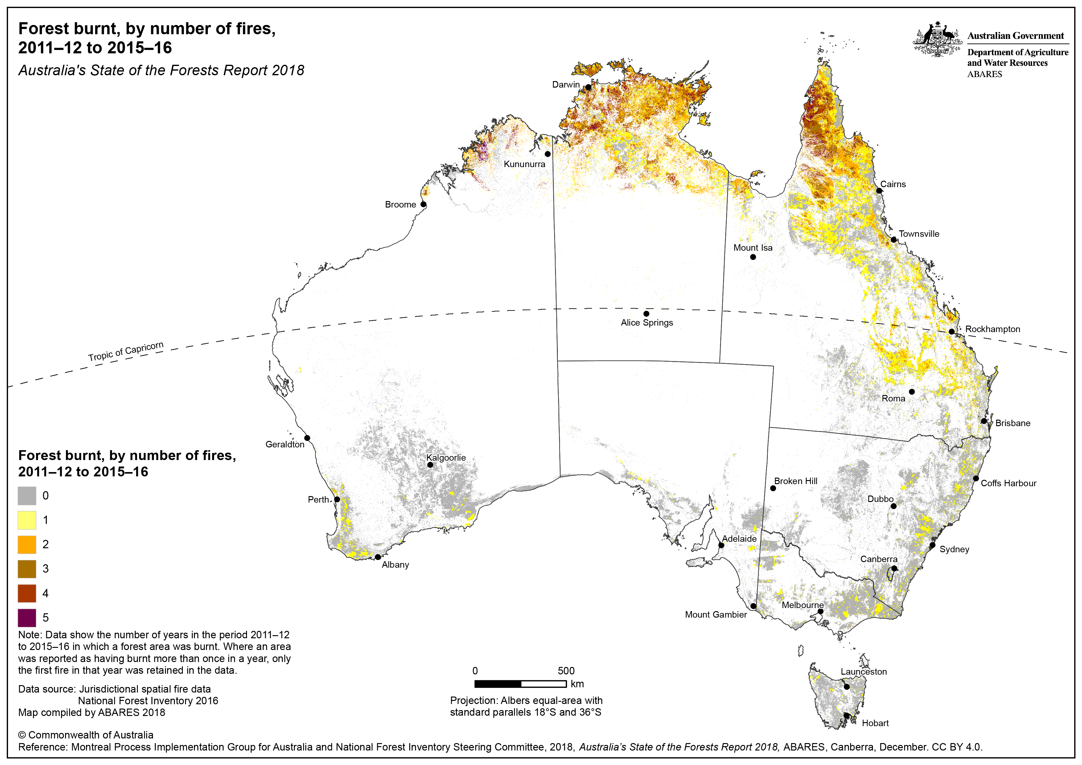
Fires in Australia's forests
National dataset of the extent and frequency of planned and unplanned fires in forests
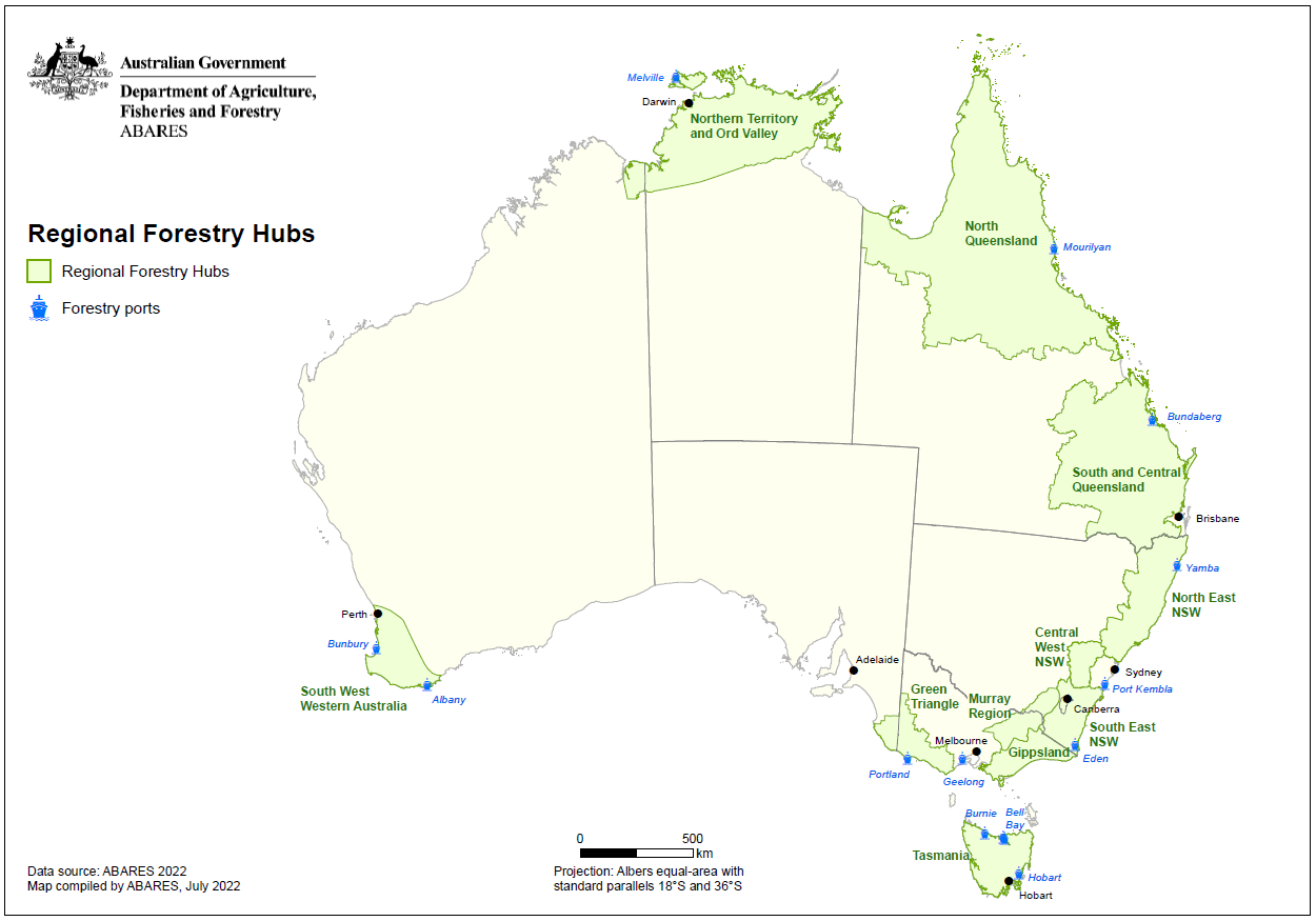
Regional Forestry Hubs boundaries
This dataset delineates boundaries for Regional Forestry Hubs established under the National Forest Industries Plan
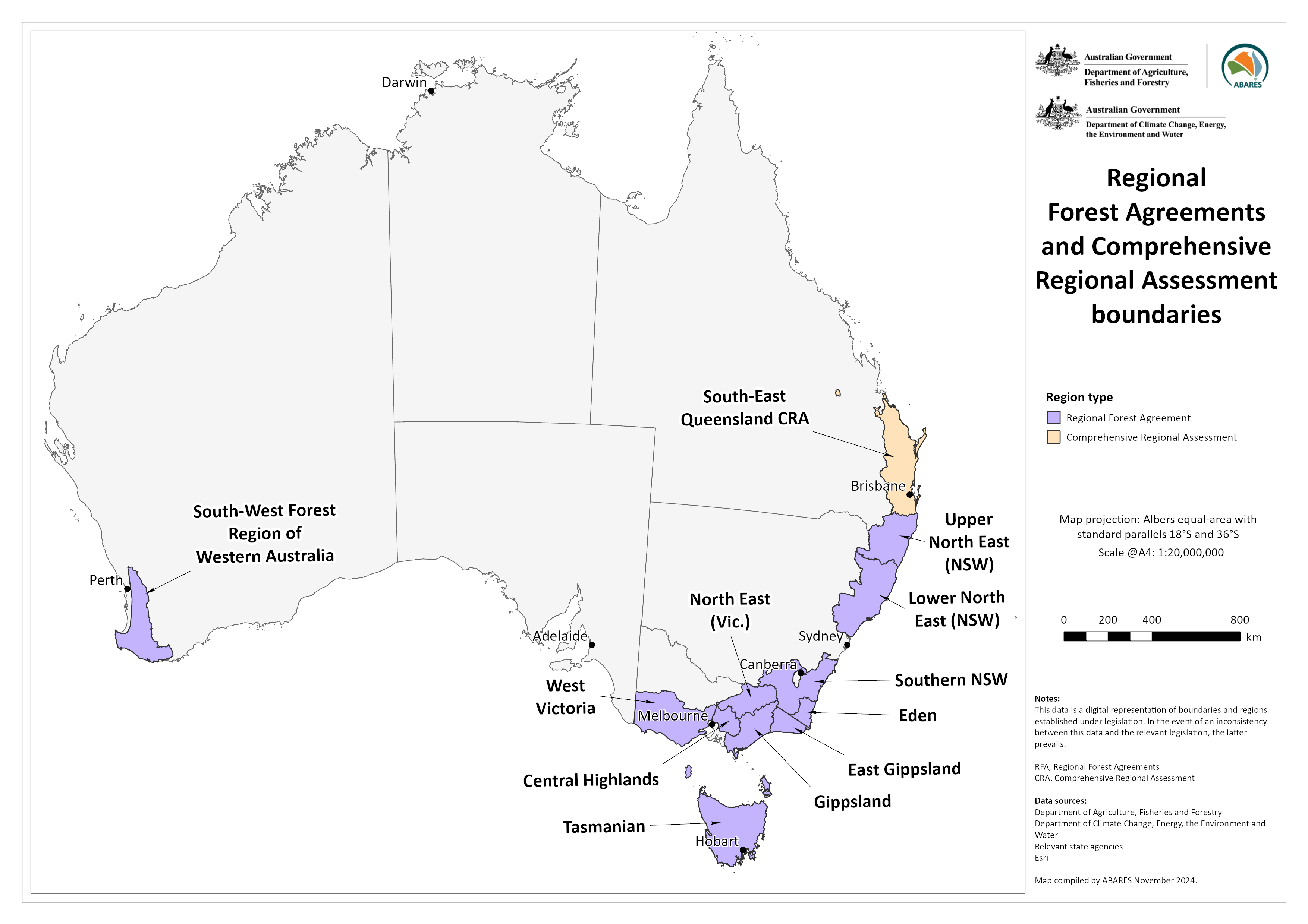
Regional Forest Agreements and Comprehensive Regional Assessment boundaries
This dataset shows the boundaries of Regional Forest Agreements and Comprehensive Regional Assessment boundaries

Australia's plantations
National dataset of commercial plantations derived from spatial data provided by growers and managers
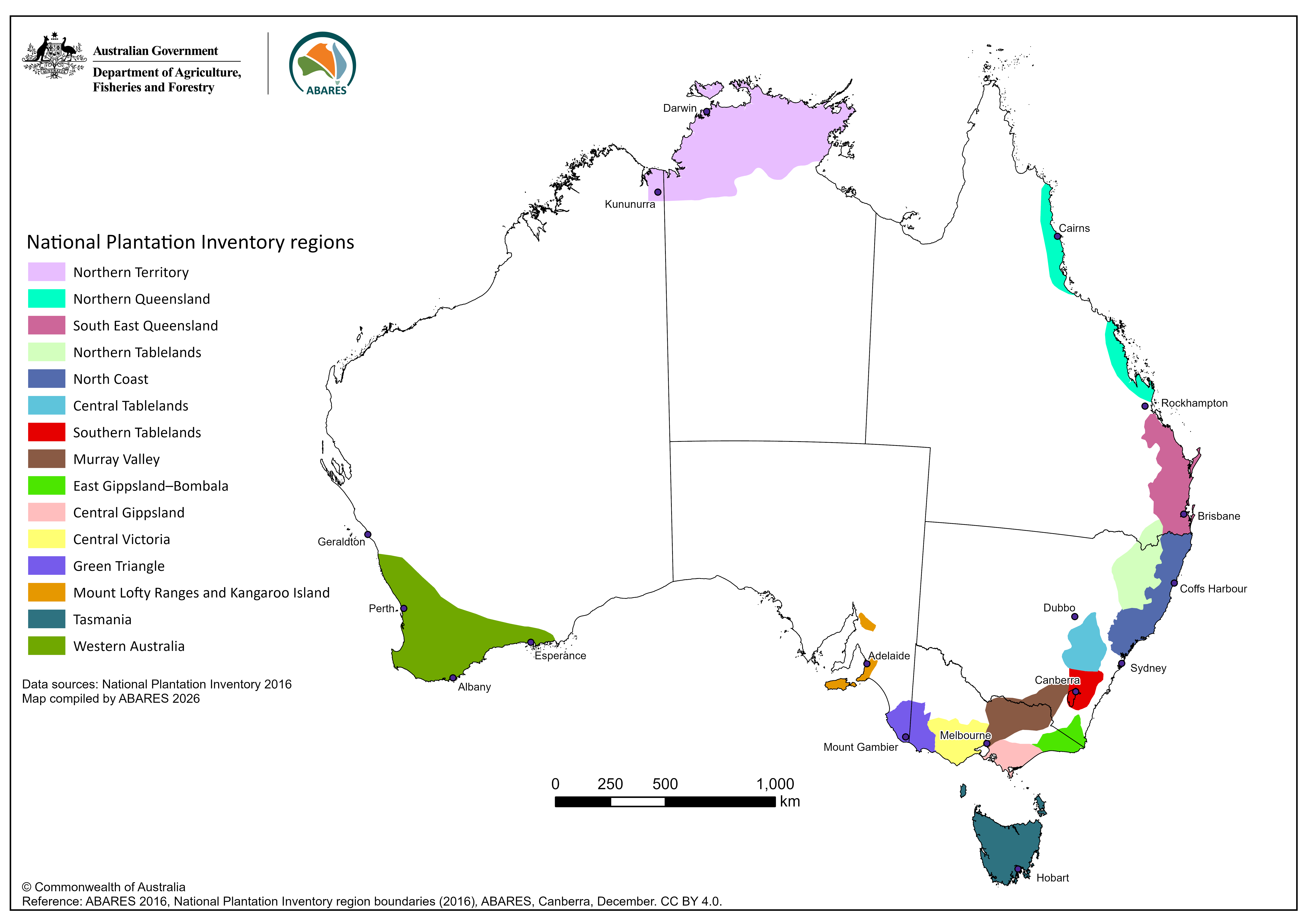
National Plantation Inventory regions boundaries dataset
This dataset delineates boundaries for the National Plantation Inventory regions, a component of the National Forest Inventory