
Note: Revision published as version 2 on 26 November 2019
Publication date: 26 November 2019
Version 2 of the Catchment Scale Land Use of Australia – Commodities – Update December 2018 dataset was released on 26 November 2019. This dataset and map replaces those released on 19 February 2019. Version 2 incorporates the following changes:
- Removal of cattle meat features where it is not clear whether feedlots are cattle or sheep feedlots.
- Removal of broad aquaculture class and consistency applied to aquaculture commodities so that marron and yabbies are now classed as crustaceans and abalone as molluscs.
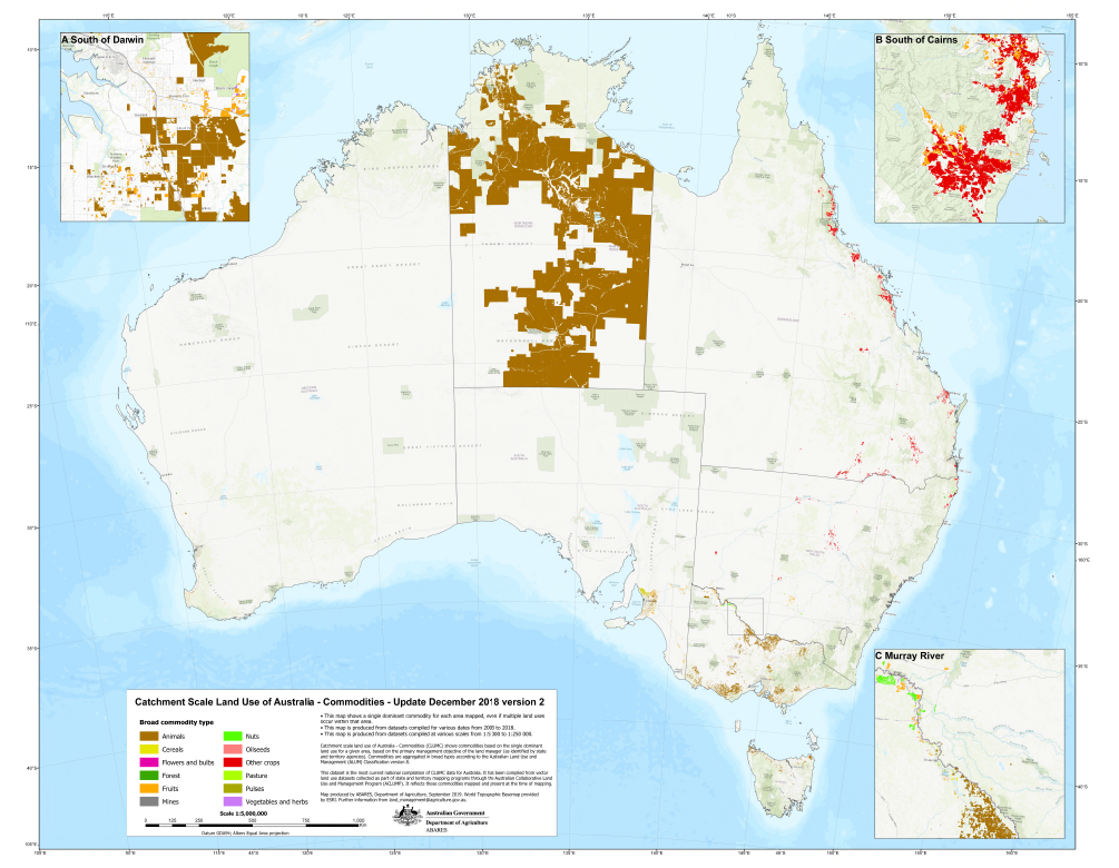
- An increase in the number of polygons in the Australian Capital Territory and Western Australia. Polygons for each commodity in these jurisdictions were combined as multi-part features rather than single part features leading an underestimation of the number of polygons at both the state and national levels.
- Inclusion of extra animal, grapes and olives features based on ALUM and Valuer General codes for South Australia, New South Wales, the Northern Territory and Victoria.
- Inclusion of alkaloid poppies in Tasmania based on ALUM codes.
- Inclusion of missing sugar features in New South Wales based on ALUM codes.
- Inclusion of missing vegetables and herbs features for Western Australia.
- Corrections where commodities have been assigned the wrong broad type (e.g. pistachios assigned to nuts) or commodity names were incorrect (e.g. pecan nuts to pecans).
- Removal of slithers and overlapping polygons.
This dataset is the second national compilation of catchment scale commodity data for Australia (CLUMC), current as at December 2018. It replaces the Catchment Scale Land Use of Australia – Commodities – September 2017. It has been compiled from vector land use datasets collected as part of state and territory mapping programs through the Australian Collaborative Land Use and Management Program (ACLUMP). It complements the Catchment Scale Land Use of Australia – Update December 2018 dataset. Agricultural commodities are assigned to the Australian Land Use and Management (ALUM) Classification version 8 classes based on; perceived intervention to the landscape, growing conditions and management, the intended use of the commodity, consistency with national and international reporting frameworks and standards, industry guidelines and trade codes. A commodity may be applied to one or many land use classes.
Commodities data were produced as part of catchment scale land use mapping and primarily uses fine-scale satellite data and information collected in the field. Field validation was critical for mapping commodities. The date of mapping (2003 to 2018) and scale of mapping (1:5 000 to 1:250 000) vary, reflecting the source data, capture date and scale. It is important to note that the location of a commodity may change on an annual basis, depending on factors such as climate, markets or farming systems.
Jurisdictions captured commodity data (where possible) for those areas most recently mapped in the Catchment scale land use of Australia – Update December 2018 with a focus on horticultural and intensive animal industries. Other commodities which are tertiary classes of the ALUM classification (such as sugar cane, cotton, rice, olives and grapes) have been mapped by jurisdictions for some time and are included in this dataset.
The following areas have been updated since the September 2017 version: Burdekin natural resource management (NRM) region in Queensland; the state of New South Wales; the state of Victoria; and the state of Western Australia.
Downloads
Data
Description of contents of the data package (MS Word) - MS Word [51 KB]
Description of contents of the data package (PDF) - PDF [226 KB]