This series of visualisations is based on the most recent agricultural census data collected by the Australian Bureau of Statistics (ABS) for 2015-16.
The visualisations are designed to showcase the Agricultural Census data in a simple and intuitive way – as maps and charts with a focus on national, state and regional summaries for:
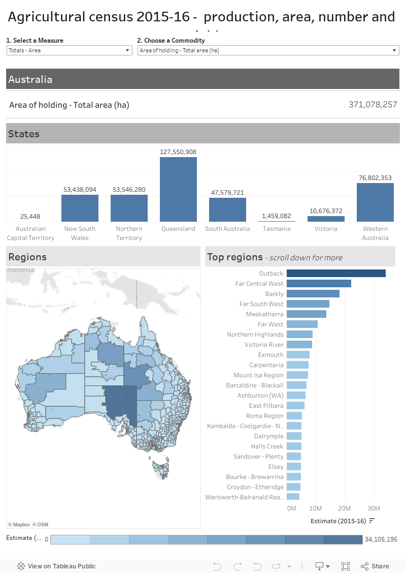
- Production including the area planted or harvested, production and number of livestock or trees
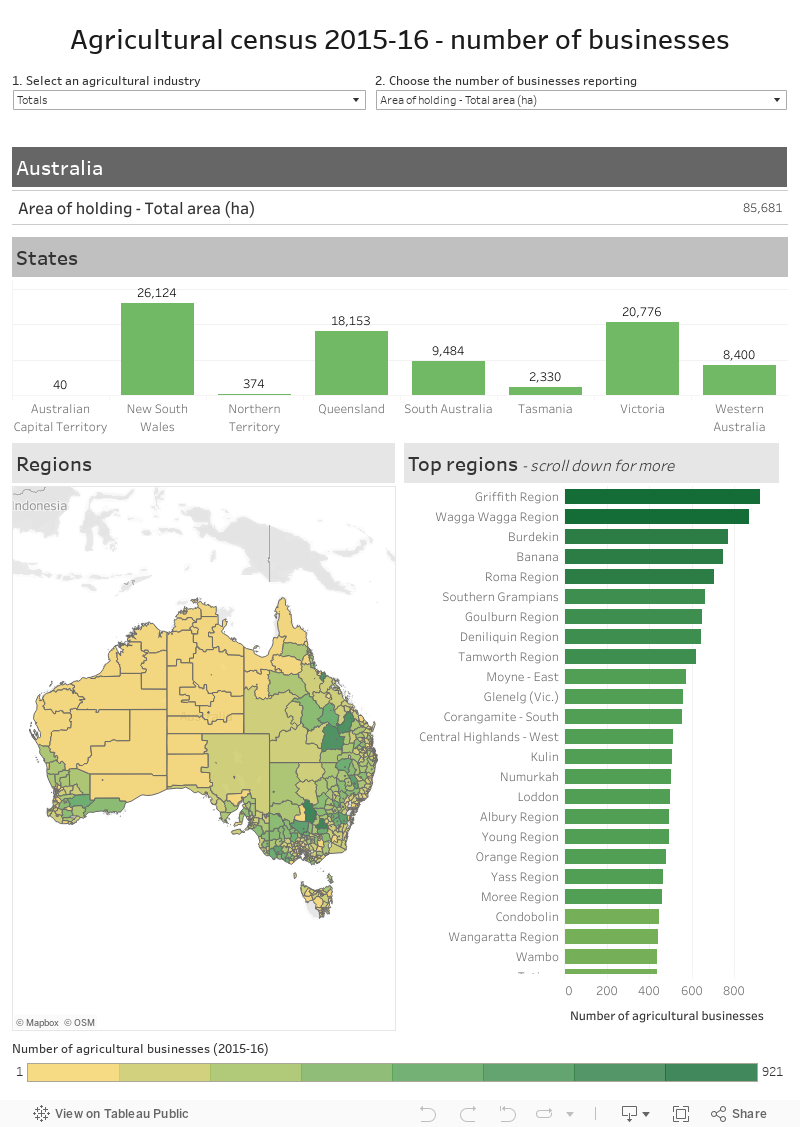
- Number of businesses
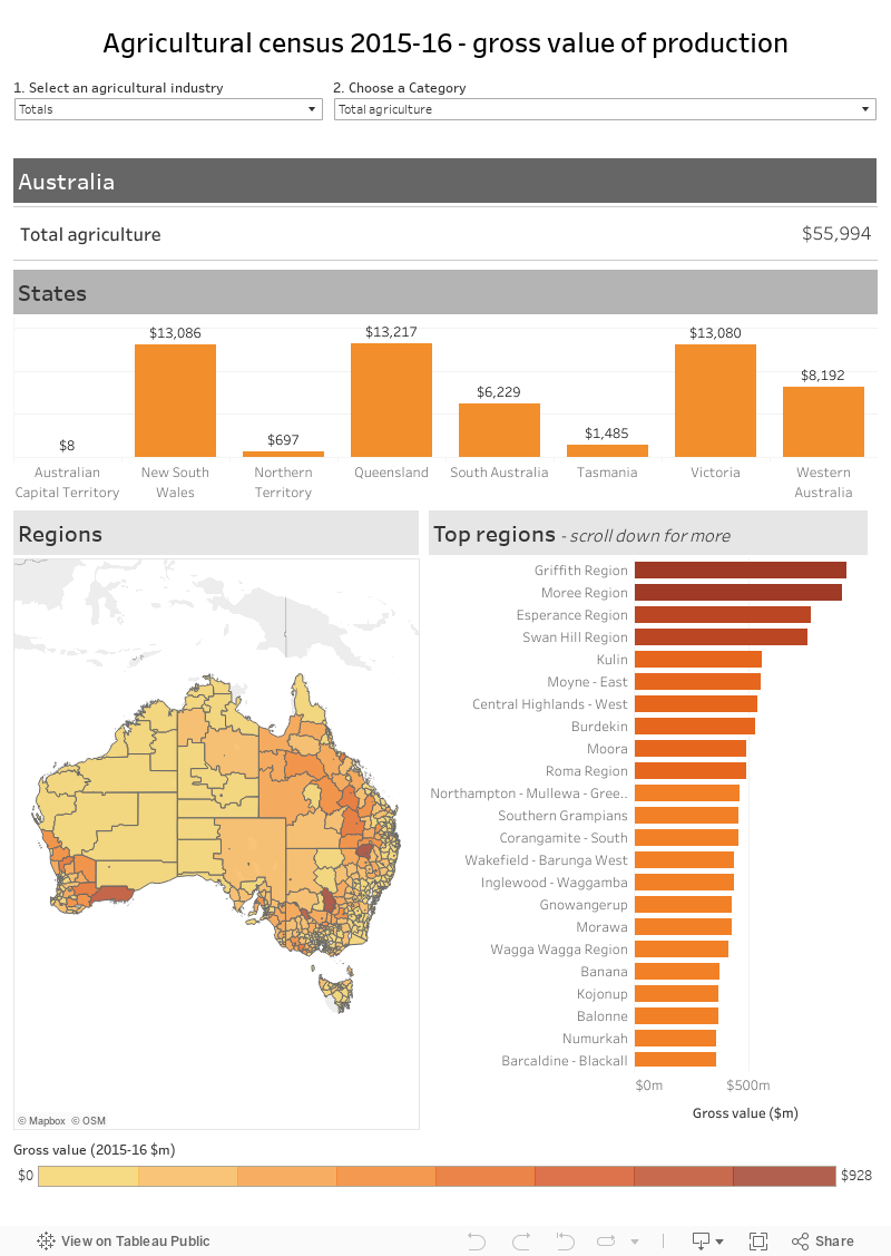
- Gross value of production
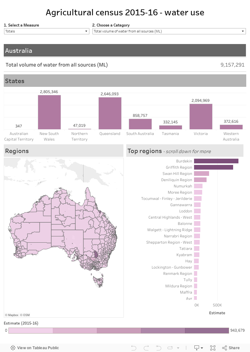
- Water use
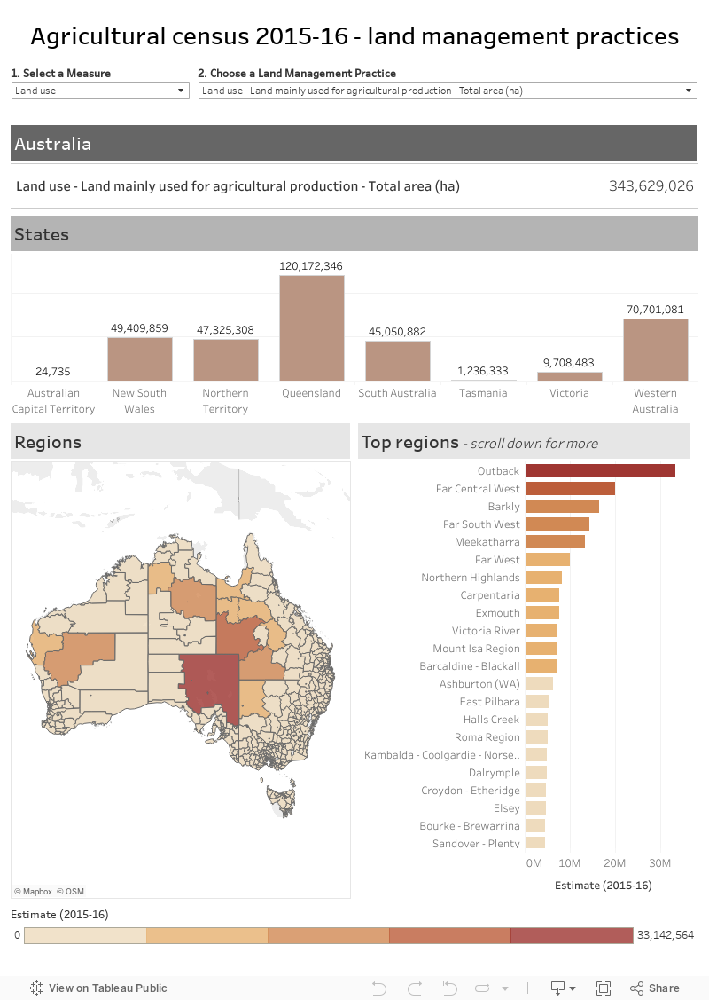
- Land management practices
Using the visualisations
1. Select a dataset:
- Production, area, number and yield
- Number of businesses
- Gross value of production
- Water use
- Land management practices
2. Filter by
- Broad agricultural industry – crops, horticulture or livestock
- Category or commodity description
3. Explore the maps, charts and tables for more information
- Hover over the state bar chart to see the Share of Australia
- Hover over a region in the Regions map to see the region name, and share of Australia
- Hover over a bar in the top regions to see the rank in Australia, relative standard error of the estimate and additional notes
- Click on the Top regions bar to see the location in the Regions map
[expand all]
About the Agricultural census
The main purpose of the Agricultural Census is to provide benchmark information on agricultural industries. The ABS collects agricultural census data every 5 years from agricultural businesses that are recorded in the ABS’ Business Register and have an estimated value of their agricultural operations of $40,000 or greater.
The visualisations used the following ABS data products:
- 7503.0 - Value of Agricultural Commodities Produced, Australia, 2015-16
- 7121.0 - Agricultural Commodities, Australia, 2015-16
- 4618.0 - Water Use on Australian Farms, 2015-16
- Agricultural Census: Land Management Practices - 2015-16 (Custom report, available on request)
The ABS publish the data at a number of levels. The visualisations are reported at:
- Statistical Areas Level 2 (SA2): SA2s are medium-sized general purpose areas built up from whole Statistical Areas Level 1. Their purpose is to represent a community that interacts together socially and economically. There are 2,310 SA2s in Australia of which 1,061 report agriculture.
- State or territories
- Australia
Gross value of production
Production, area, number and yield
Number of businesses
Water use
Land management practices