
ABARES maintains detailed spatial datasets related to Australia’s land and forests. These datasets are also available to use or view via spatial web services (also called web mapping services).
Users can interact with spatial web services using:
- Geographic information systems (GIS) software installed on your computer
- Online mapping applications (via a recently updated web browser)
For information about ABARES other data holdings see ABARES latest data releases and the ABARES data catalogue.
[expand all]
About web services
ABARES spatial data, available as web services, are listed below. Web services allow public access to current ABARES spatial datasets without users needing to store the datasets locally. The services are available as ESRI Web Map Services.
Using web services
To use the following Web Services directly you need software which can communicate with the web services, such as ArcGIS or QGIS Geographic Information System software or Google Earth. See the online mapping application section below to use the services without GIS software.
Terms of use
By accessing ABARES Web Services you acknowledge acceptance of Web Services Terms and conditions. Data accessed through ABARES Web Services are subject to a Creative Commons Attribution By 4.0 Licence.
![]()
Service notifications
- 17/9/25 4pm to 18/9/25 9am - Scheduled outage to DAFF ESRI enterprise which will affect Land use of Australia services.
- Restored 30 July 2025 - Issue with ABARES services hosted on Digital Atlas Australia has been fixed.
- ABARES Web service addresses have changed. ABARES web services are available from the Digital Atlas of Australia and from ABARES as at 1 July 2025. No services will be available on gis.environment. Please update your applications accordingly.
Web services list
You will need GIS software or a web app to access web services using these links
Land use
- 2010-11 to 2015-16 - Primary, Secondary, 18 class, 9 class, Agricultural Industries, Agriculture. Note that this dataset is superseded. New web services will be available for Land use of Australia 2010-11 to 2020-21 later in 2025.
Catchment Scale Land Use of Australia – Update December 2023 version 2
- Simplified classification - Digital Atlas of Australia
- Secondary Classification - Digital Atlas of Australia
- Agricultural Industries - Digital Atlas of Australia
- Image Service https://di-daa.img.arcgis.com/arcgis/rest/services/Land_and_vegetation/Catchment_Scale_Land_Use_Agricultural_Industries/ImageServer
- WMS https://di-daa.img.arcgis.com/arcgis/services/Land_and_vegetation/Catchment_Scale_Land_Use_Agricultural_Industries/ImageServer/WMSServer?request=GetCapabilities&service=WMS
- Date of mapping - Digital Atlas of Australia
- Scale of mapping - Digital Atlas of Australia
Forests
- Forest type - Digital Atlas of Australia
Tenure of Australia's Forests (2023)
- Forest tenure - Digital Atlas of Australia
Fires in Australia's forests 2016–21 (2024)
- Forest burn frequency - Digital Atlas of Australia
- Forest burn type - Digital Atlas of Australia
Australia’s Indigenous land and forest estate (2024)
- Indigenous Forest Estate - Digital Atlas of Australia
- Indigenous land estate – Digital Atlas of Australia
- Land and forest in the total Indigenous estate – Digital Atlas of Australia
- Image Service https://di-daa.img.arcgis.com/arcgis/rest/services/Land_and_vegetation/Total_Area_Land_Forest_Indigenous_Estate/ImageServer
- WMS https://di-daa.img.arcgis.com/arcgis/services/Land_and_vegetation/Total_Area_Land_Forest_Indigenous_Estate/ImageServer/WMSServer?request=GetCapabilities&service=WMS
- Indigenous owned land and forest – Digital Atlas of Australia
- Indigenous managed or co-managed land and forest – Digital Atlas of Australia
- Land and forest with other special rights – Digital Atlas of Australia
Land Tenure
Land tenure of Australia 2010-11 to 2020-21
- Land tenure of Australia 2020-21, Tenure Level 3 - Digital Atlas of Australia
- Land tenure of Australia 2015-16, Tenure Level 3 - Digital Atlas of Australia
- Land tenure of Australia 2010-11, Tenure Level 3 - Digital Atlas of Australia
- Land tenure of Australia, Tenure change 2010–11 to 2020–21, Level 3 - Digital Atlas of Australia
- Image Service https://di-daa.img.arcgis.com/arcgis/rest/services/Land_and_vegetation/Land_Tenure_v2_250m_Change_2010_11_2020_21_Level_3/ImageServer
- WMS https://di-daa.img.arcgis.com/arcgis/services/Land_and_vegetation/Land_Tenure_v2_250m_Change_2010_11_2020_21_Level_3/ImageServer/WMSServer?request=GetCapabilities&service=WMS
- Land tenure of Australia 2020-21, Tenure data caveat - Digital Atlas of Australia
- Land tenure of Australia 2015-16, Tenure data caveat - Digital Atlas of Australia
- Land tenure of Australia 2010-11, Tenure data caveat - Digital Atlas of Australia
Online mapping applications
View ABARES spatial data using these online mapping applications.
| Application | Type |
|---|---|
| Land use of Australia | Web map |
| Catchment scale land use profiles | Web map |
| Catchment scale land use profiles | Dashboards |
Digital Atlas of Australia
The Digital Atlas of Australia brings together trusted national data in a central platform.
Using the Digital Atlas, you can explore, analyse, and visualise data on Australia's geography, people, economy, and environment.
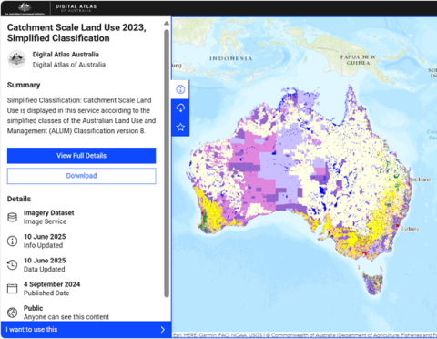
This image shows Catchment Scale Land Use of Australia – Update December 2023 version 2 as a web service visualised by simplified land use classes on the Digital Atlas of Australia.