
The selection of data which will be used as input in this guide is derived from the criteria chosen in the introduction section.
Inputting Data
Inputting data required to build the Proximity to Water criterion:
- Click on Primary Input Data. This will display the "Data" folder in your project directory inside MCAS-S.
- Navigate to the "Water" folder.
- Drag and drop "dist_privers" onto the workspace. This map shows distance from perennial rivers.
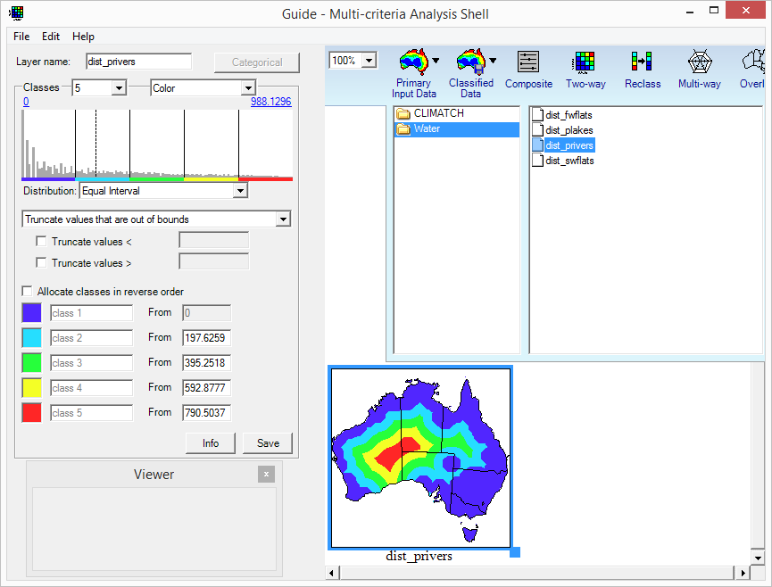
Since our goal is to highlight which regions in Australia are closest in proximity to water bodies, we will need to reverse the order of our classes. The fidelity of the map can be increased by adding more classes to our map layer. We will keep the class distribution set to "Equal Interval" as this provides nice distance bands from water sources.
- Tick the "Allocate classes in reverse order" box.
- Select 10 classes from the "Classes" drop-down selection.
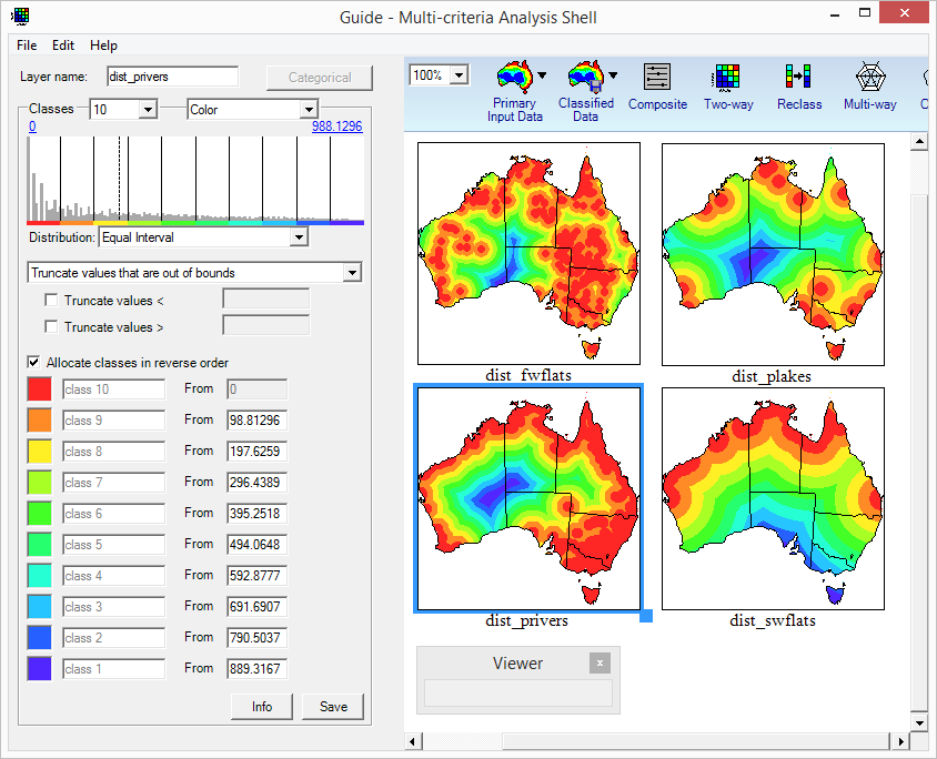
- Repeat this input process for "dist_plakes", "dist_swflats" and "dist_fwflats", selecting 10 classes and allocating the classes in reverse order. These maps represent distance from perennial lakes, distance from saline wetlands and distance from freshwater wetlands respectively.
When you have finished inputting and classifying your data, the workspace should resemble the figure below with red areas being those closest to water bodies and dark blue areas being those furthest from water bodies.
Climate Suitability
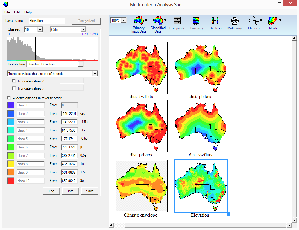
The climate suitability of the example species can be found through a composition of the climate envelope of the species with elevation data (we know from our assumed knowledge that the species cannot survive in higher altitudes). Climate suitability can be modelled using tools such as ABARES Climatch, or the Biodiversity Climate Change Virtual Laboratory (BCCVL).
- To input the climate suitability data for the species, click on "Primary Input Data" and navigate to the "CLIMATCH" folder.
- Click and Drag "aqua_invasive" to the workspace.
- When prompted, import the data as continuous.
- Rename it to "Climate envelope" by editing the "Layer name".
- Select 10 classes from the "Classes" drop down list.
- To input the elevation data, click on "Primary Data" and click on the "Land" folder.
- Drag and drop "Elevation" onto the workspace.
- Since we would like to highlight areas of high elevation, select "standard deviation" from the "Distribution" drop down menu.
← Previous Section: Set Up | Next Section: Composition and Comparison →