
MCAS-S Data Pack – Update 2022 released
The MCAS-S data pack – update 2022 supports the Multi-Criteria Analysis Shell for Spatial Decision Support (MCAS-S) software tool.
- This package of nationally consistent Australian spatial layers at one-kilometre resolution contains publicly available national data for use with MCAS-S up until December 2022.
- It replaces the 2014, 2011 and 2009 MCAS-S data packs.
- The downloadable zip file (1GB unzips to 4GB) contains a sample MCAS-S project alongside a data folder.
- Within the data folder are more than 290 layers in four sub-folders.
Improvements in MCAS-S version 4 (2022):
- Better performance: faster display of list of available primary data layers using a cached display
- Easier to view and share: more zoom and pan options, view simple projects in a web browser
- Sort categorical data classes alphabetically, use data fields for labels and numerical ranks
- Mask using primary data layers (no need to duplicate in primary folder)
- Save linked data projects
MCAS-S training through ecoEd (2018):
![]()
- MCAS-S training material is available through ecoEd.
- ecoEd is an innovative training program developed to enhance accessibility to Australia's digital research infrastructure by educating and upskilling environmental scientists and managers in the use of ecological models in online tools.
- More information is available at www.ecoed.org.au
- The Multi-Criteria Analysis training package featuring MCAS-S includes:
- a lecture (with datapack - where to live in Australia),
- a self paced exercise (handout in word or PDF with datapack - Lantana), and
- teachers notes.
Improvements in MCAS-S 3.2 (2018):

- A 64 bit installer for improved performance on 64-bit operating systems. This allows more layers with greater resolution. The 32-bit version is still maintained.
- Live links to detailed metadata for each layer. You can add live hyperlinks in the .tip files for more descriptive information about each data layer.
- More options for processing and analysing time series data.
- Improved labeling and ranking from fields in your categorical data.
Improvements in MCAS-S 3.1:
- An improved workspace with new toolbars and zoom and pan options, multiple layers can be added, resized, aligned, exported and deleted at once, and new colour ramps have been added.
- More options for classifying data layers include standard deviation, natural breaks and a 'reclass' classification for values or classes of interest which don't fall at one end of an existing scale.
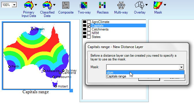
- Overlays can be included in analysis by creating distance from points and lines turning overlays into primary layers.
- Editing composite functions is now possible through the function calculator.
- Multi-ways now show a 'coincidence count' of how many input criteria are met.
- Users can report on values at points and find the correlation between two layers through a 'correlation report'.
- Time stamped versions of MCAS-S projects are saved in the History folder helping to keep track of decisions and allowing users to revert to a previous option.
Improvements in MCAS-S 3:
- accommodation of map layers with different grid resolutions in single MCAS-S projects
- 'sensitivity analysis' to test change in weighting of input map layers
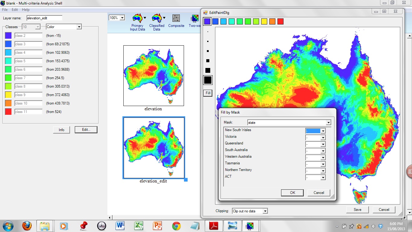
- the creation of new user map layers using paint and fill functionality
- the display of point data overlays such as cities
- faster processing through improved computational performance.