
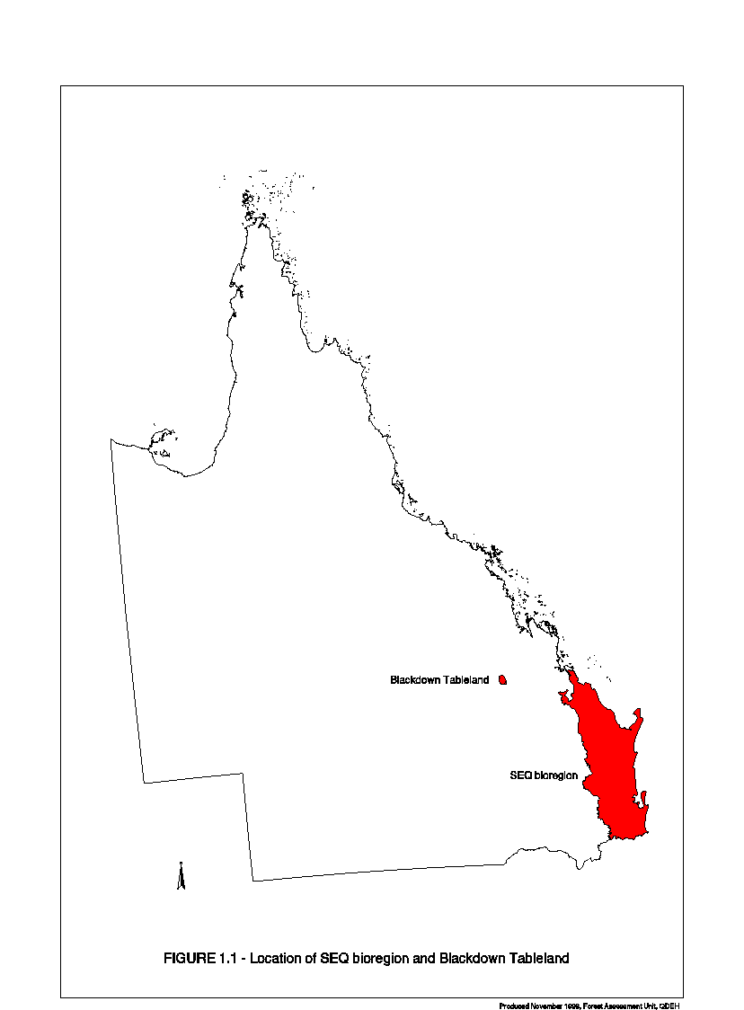
Note: The Commonwealth and Queensland Governments completed a Comprehensive Regional Assessment for South-East Queensland, but did not sign a Regional Forest Agreement.
[expand all]
Comprehenasive Regional Assessment
| Document | Pages | File size |
|---|---|---|
Contents PDF
 | 6 | 78 KB |
| Executive Summary PDF
| 14 | 44 KB |
| Chapter 1: Background to the RFA Process PDF
| 1 | 9 KB |
| Chapter 2: The South-East Queensland Region PDF
| 5 | 279 KB |
| Chapter 3: Environment and Heritage Project Summaries PDF
| 46 | 189 KB |
| Chapter 4: Social and Economic Project Summaries PDF
| 78 | 2.23 MB |
| Bibliography PDF
| 5 | 27 KB |
| Appendix PDF
| 11 | 30 KB |
If you have difficulty accessing these files, please visit web accessibility.
Cultural and Heritage Reports
Forest Industry Heritage Places Study: Sawmills and Tramways, South East Queensland (25 May 1999)
If you have difficulty accessing these files, please visit web accessibility.
Compilation and Assessment of places of Geoheritage Significance EH 5.1.1 (March 1999)
If you have difficulty accessing these files, please visit web accessibility.
Identification and Assessment of Places of Natural History Significance EH 5.1.6 (March 1999)
If you have difficulty accessing these files, please visit web accessibility.
Protecting cultural Heritage Values and Places in South East Queensland (March 1999)
If you have difficulty accessing these files, please visit web accessibility.
Travel Routes, Forest Towns and Settlements (March 1999)
| Document | Pages | File size |
|---|---|---|
| Travel Routes, Forest Towns and Settlements PDF | 297 | 6.0 MB |
Travel Routes, Forest Towns and Settlements ZIP  | 5.45 MB |
If you have difficulty accessing these files, please visit web accessibility.
Indigenous Cultural Heritage Management Guidelines for South-East Queensland Forests (December 1999)
If you have difficulty accessing these files, please visit web accessibility.
South-East Queensland Regional Forest Agreement Indigenous Cultural Heritage Data Audit (December 1999)
If you have difficulty accessing these files, please visit web accessibility.
Directions or Options Reports
If you have difficulty accessing these files, please visit web accessibility.
Ecologically Sustainable Forest Management Reports
| Document | Pages | File size |
|---|---|---|
| Ecologically Sustainable Forest Management (ESFM) report PDF | 87 | 738 KB |
Ecologically Sustainable Forest Management (ESFM) report DOC  | 87 | 1.3 MB |
If you have difficulty accessing these files, please visit web accessibility.
Environment Reports
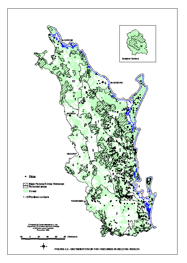
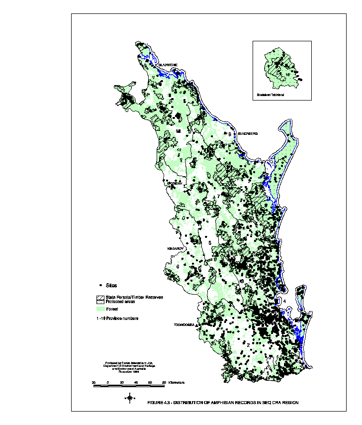
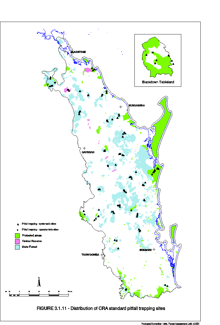
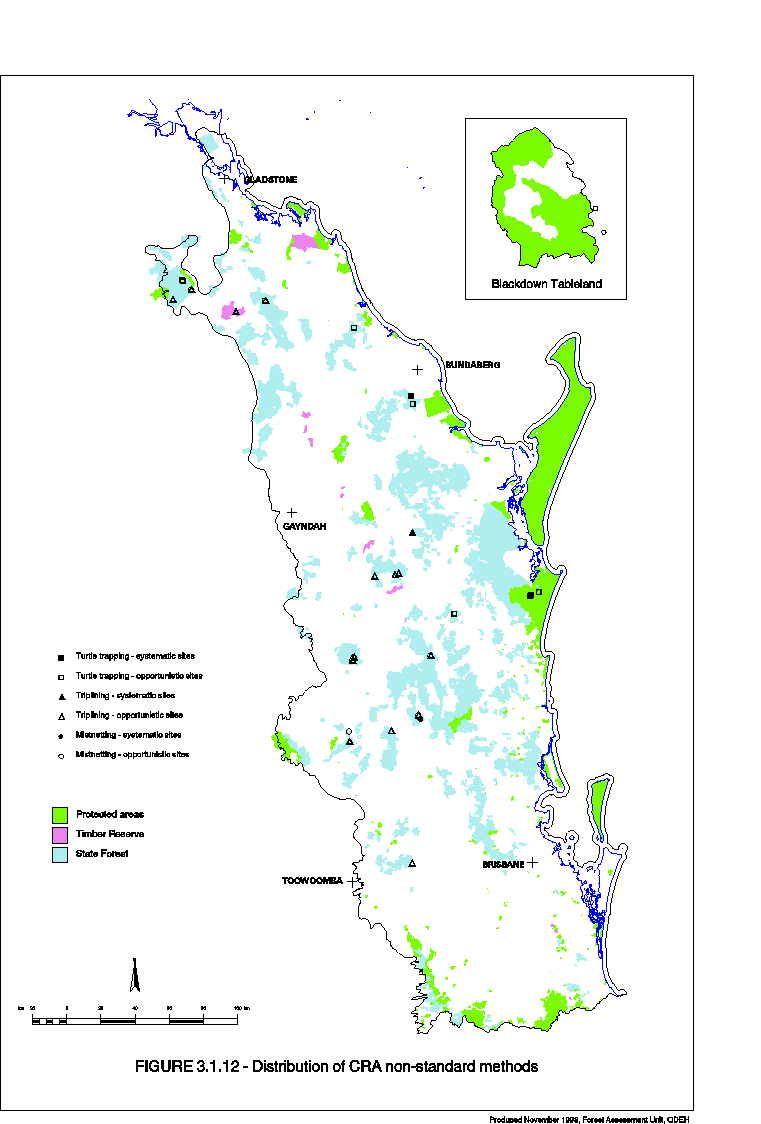
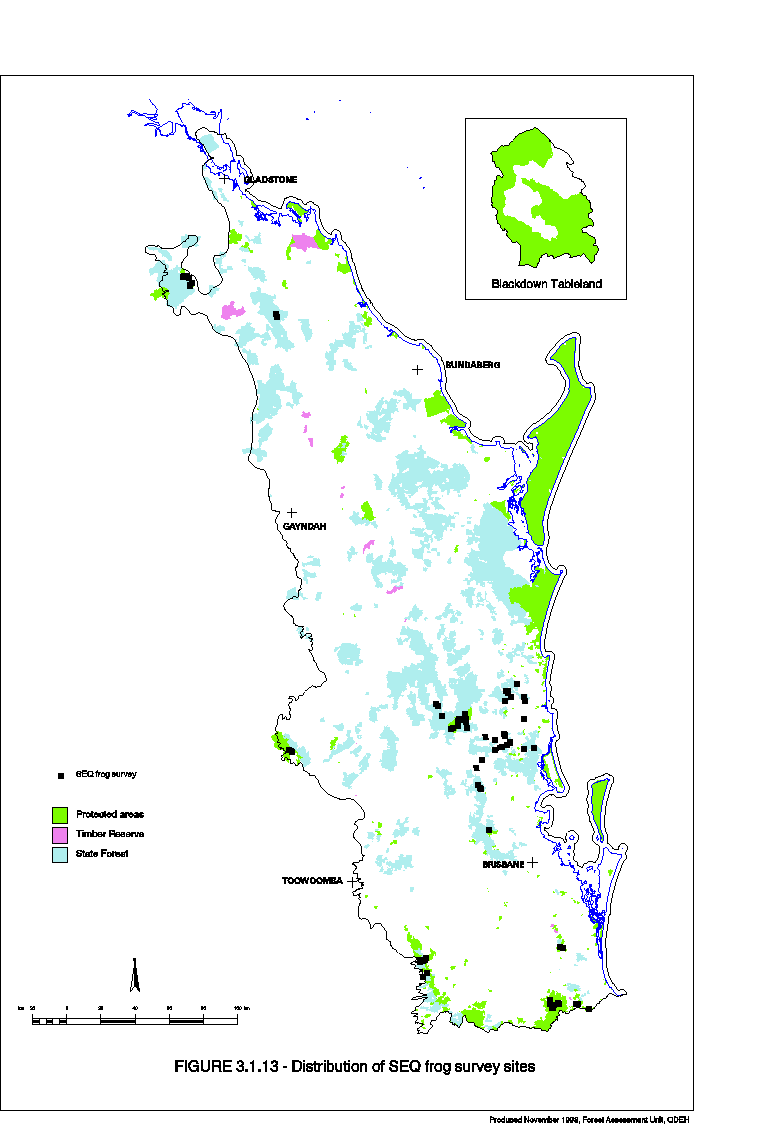
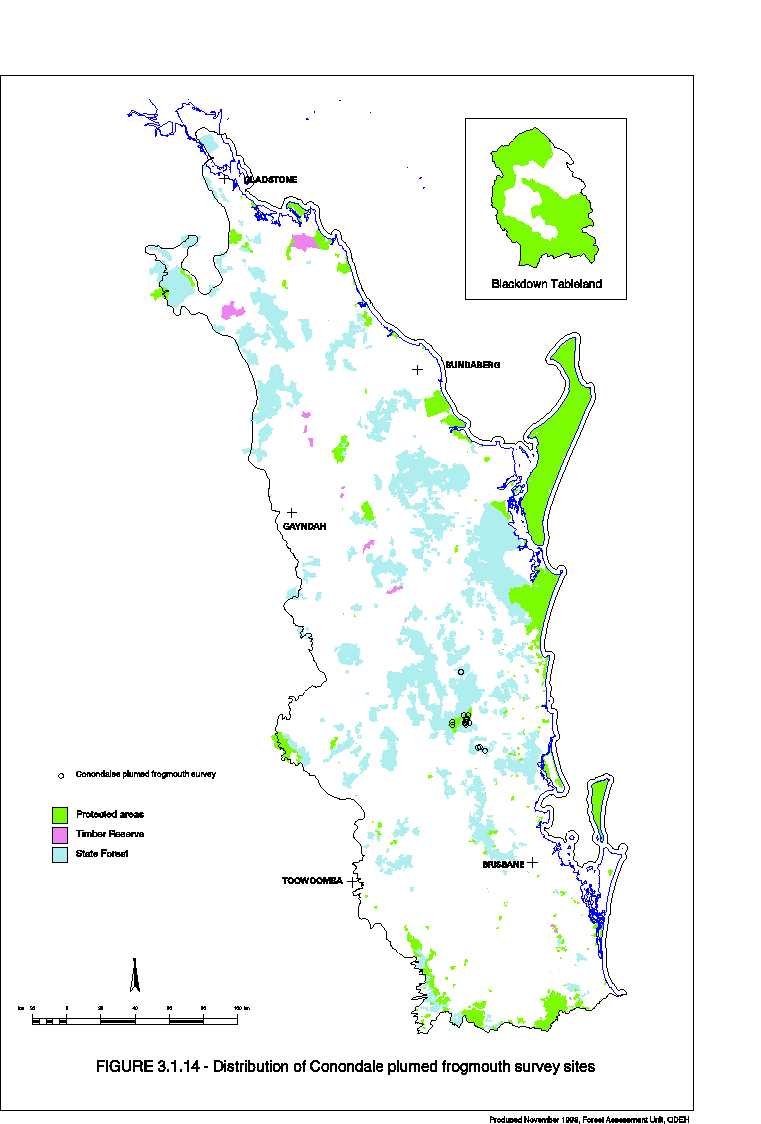
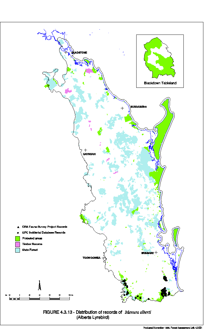
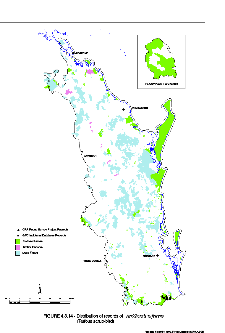
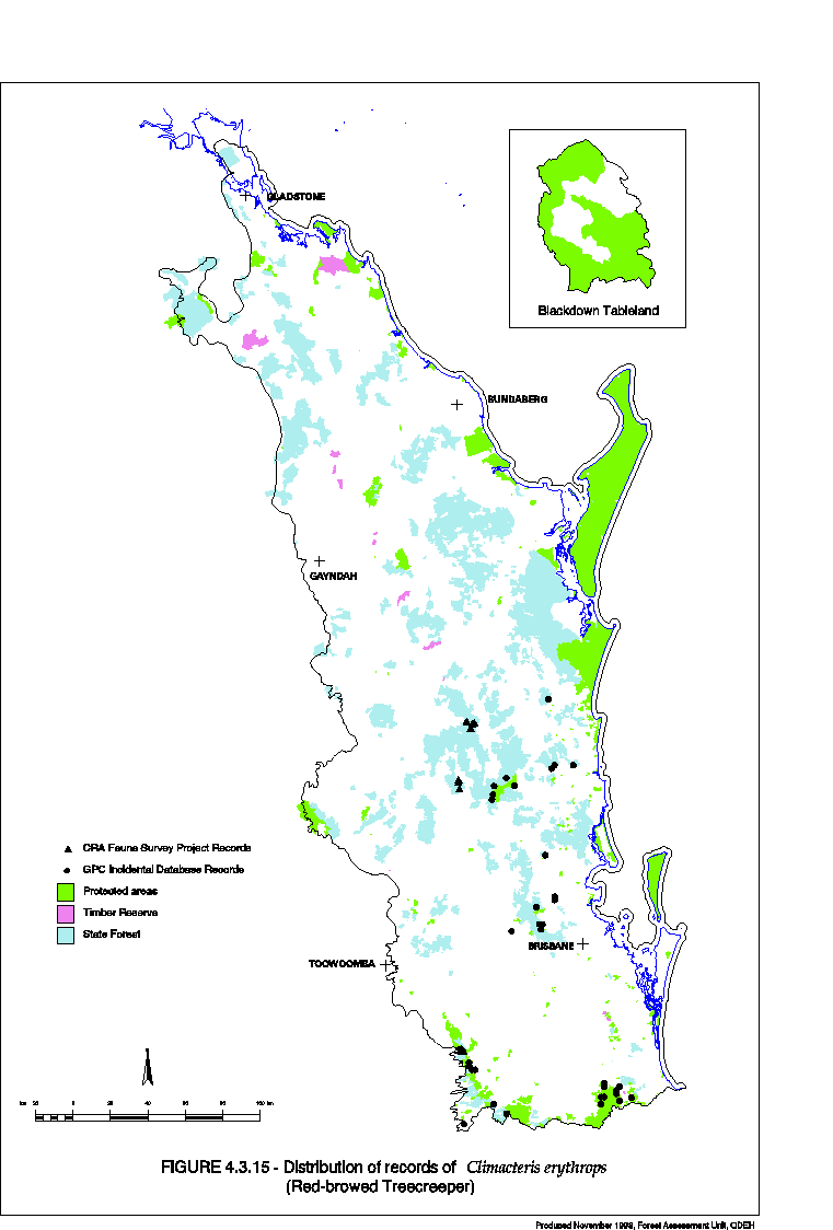
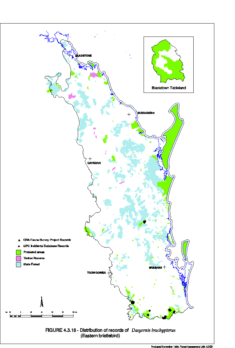
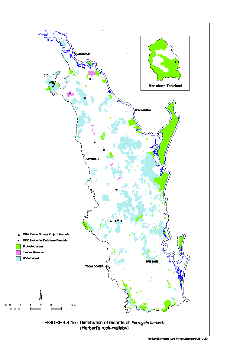
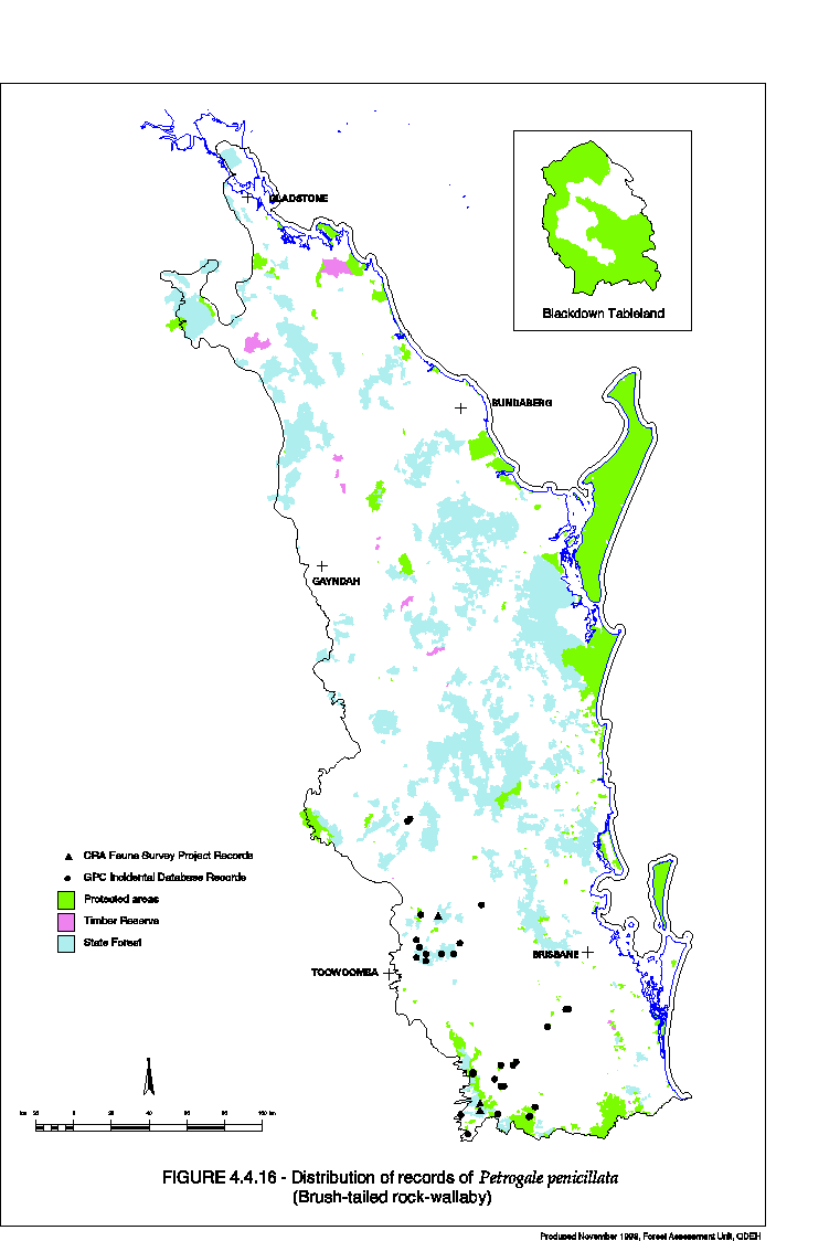
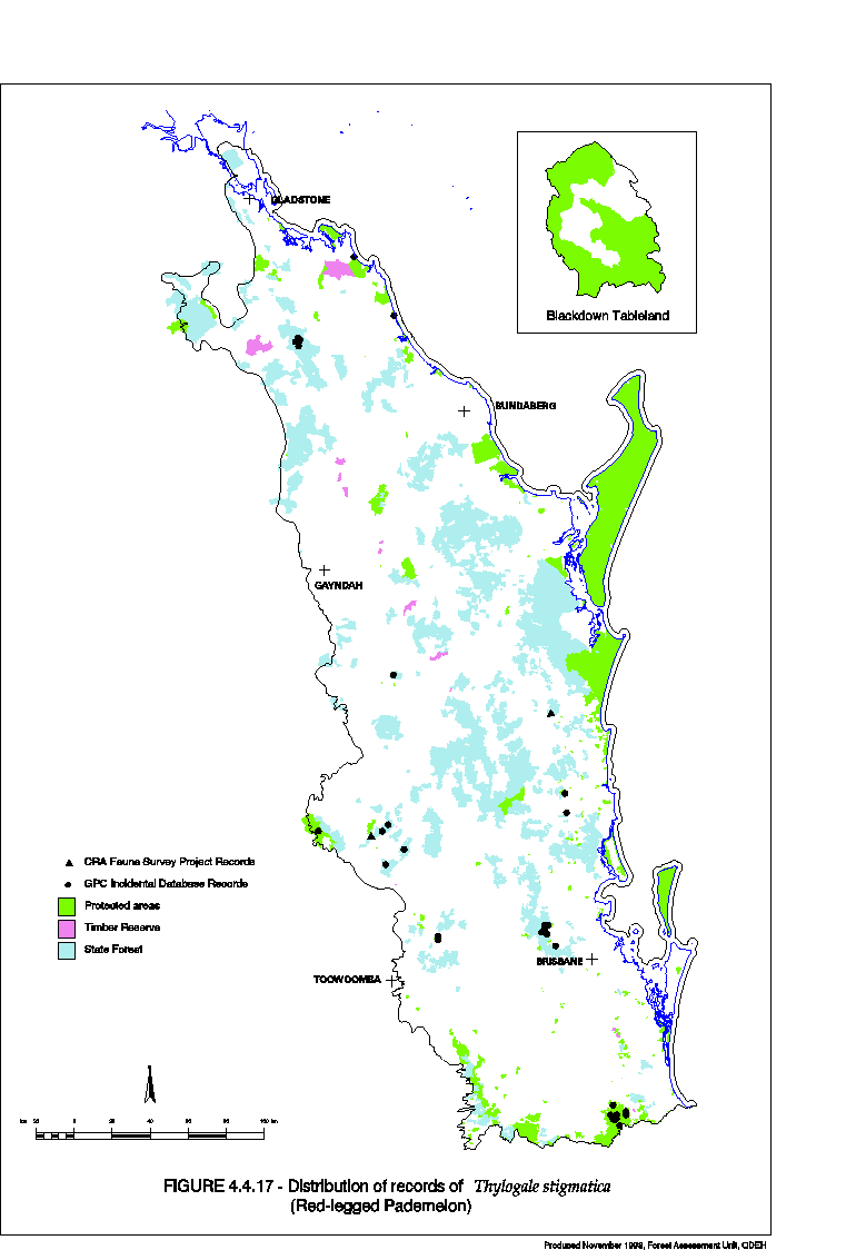
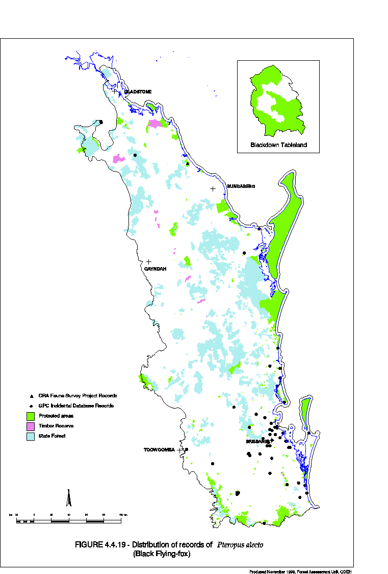
Systematic Forest Vertebrate Fauna Study Stage 1A: Audit and Gap Assessment EH 1.1.1 Part A (March 1999)
If you have difficulty accessing these files, please visit web accessibility.
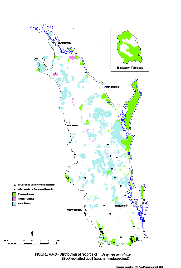
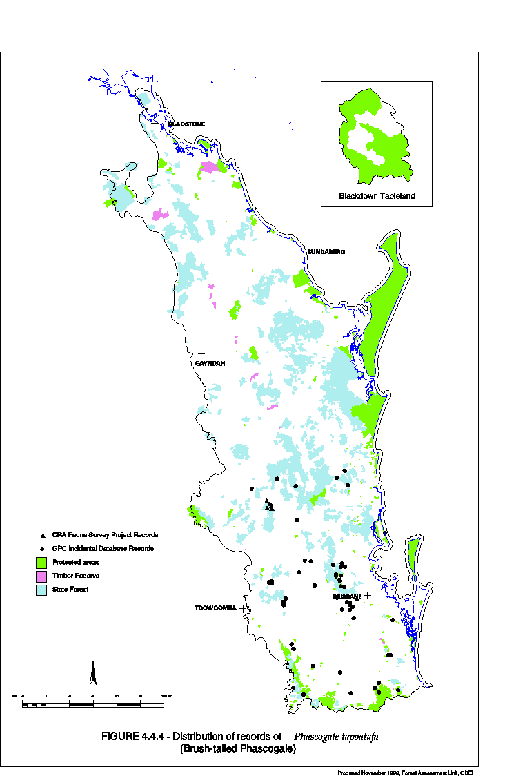
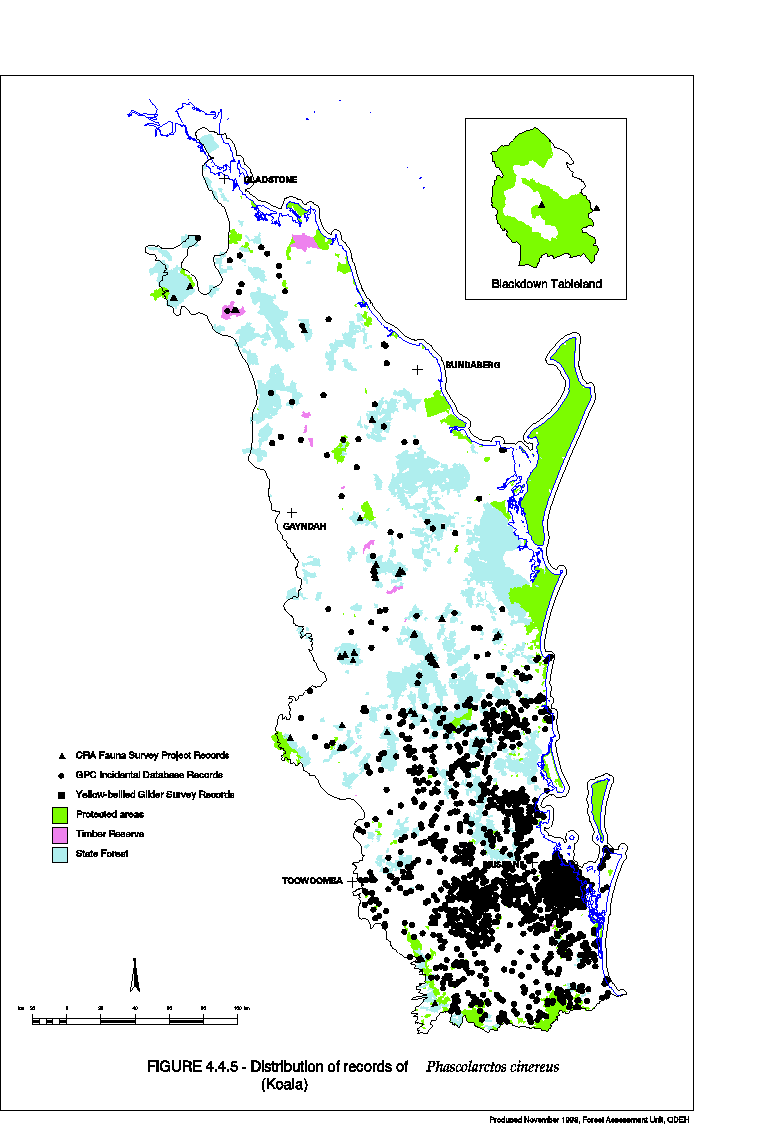
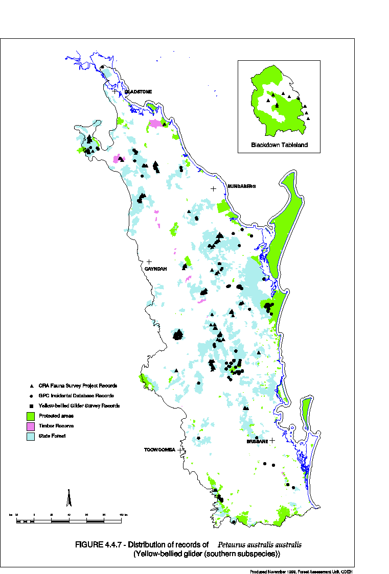
Systematic Vertebrate Fauna Survey Stage 1A: Vertebrate Fauna Survey in the SEQ Bioregion EH 1.1.1 Part B(March 1999)
If you have difficulty accessing these files, please visit web accessibility.
Systematic Forest Vertebrate Fauna Study Stage 11A: Analysis and Reserve Option Example EH 1.1.2 Part A (March 1999)
If you have difficulty accessing these files, please visit web accessibility.
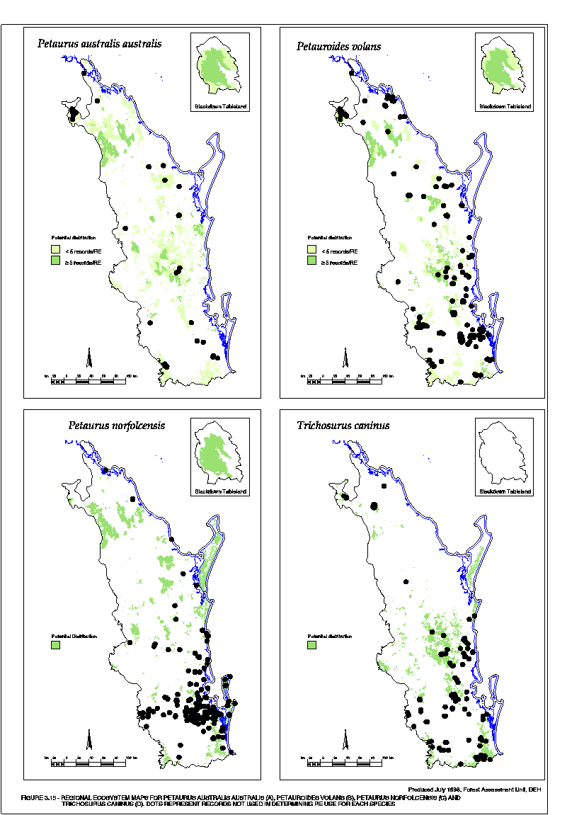
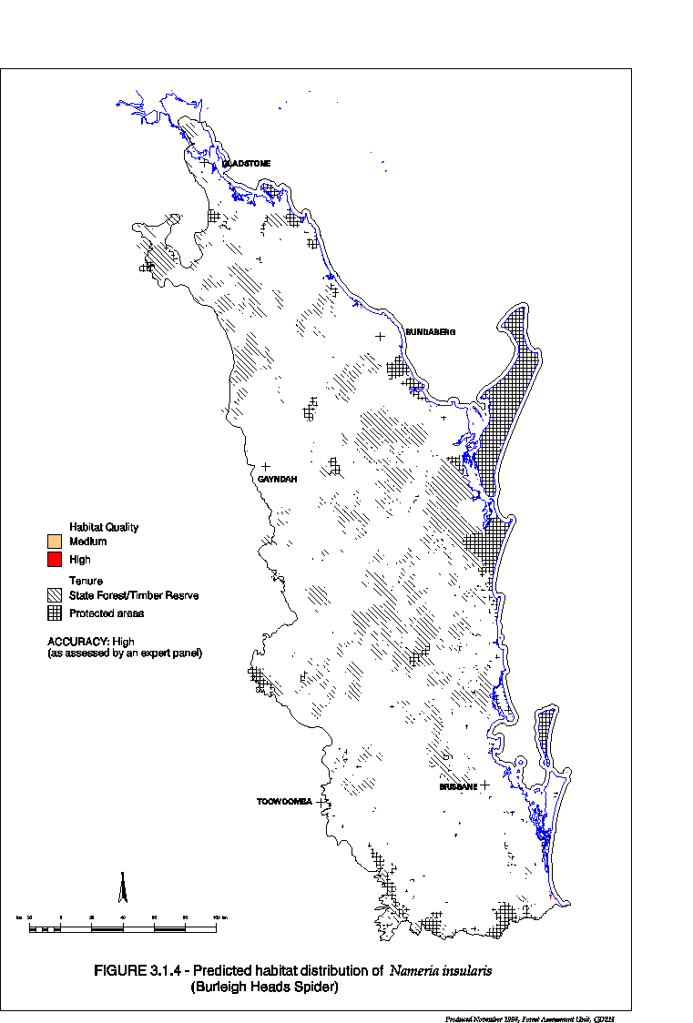
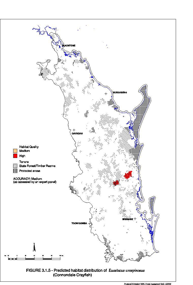
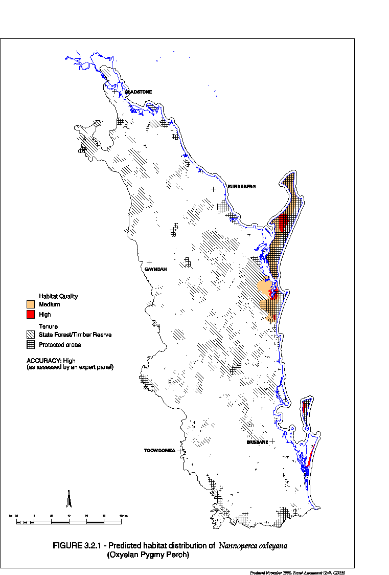
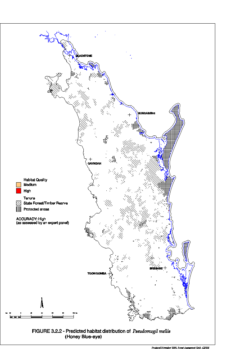
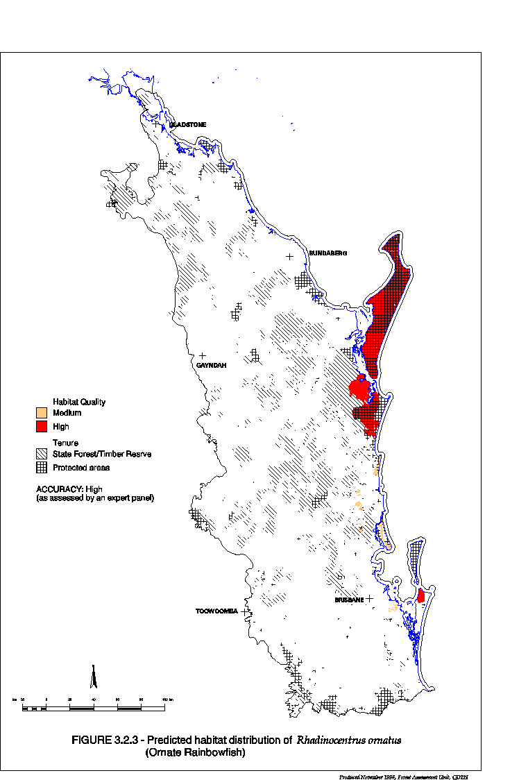
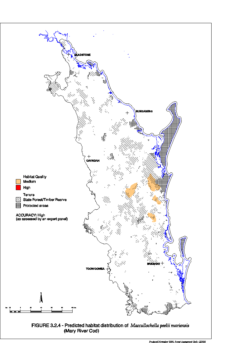
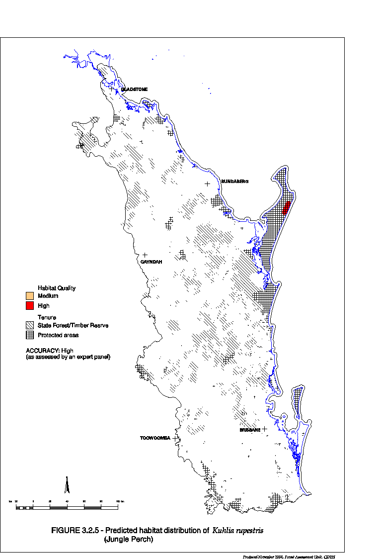
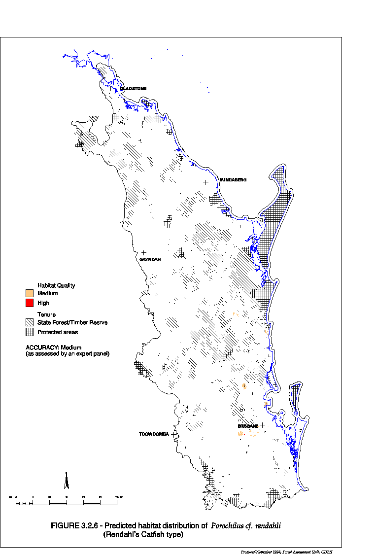
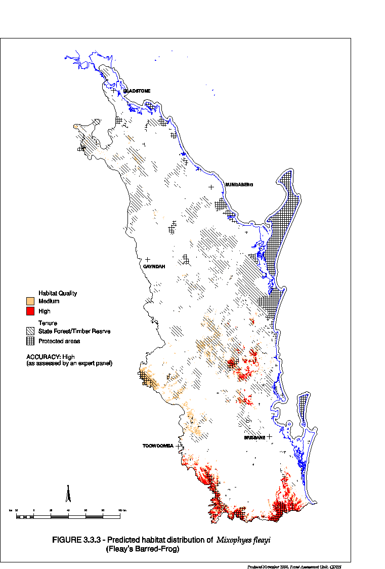
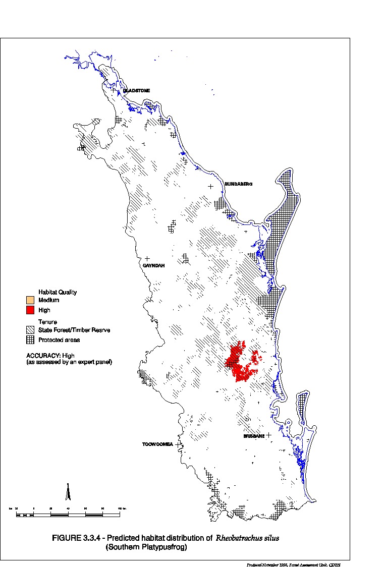
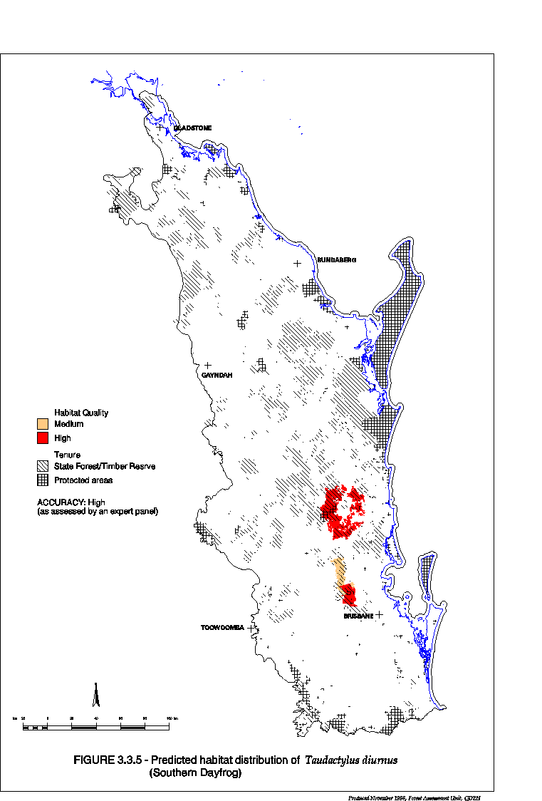
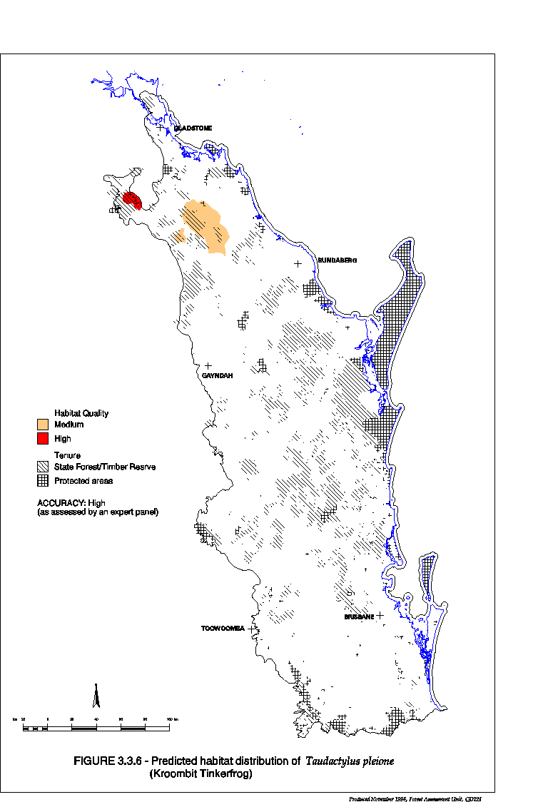
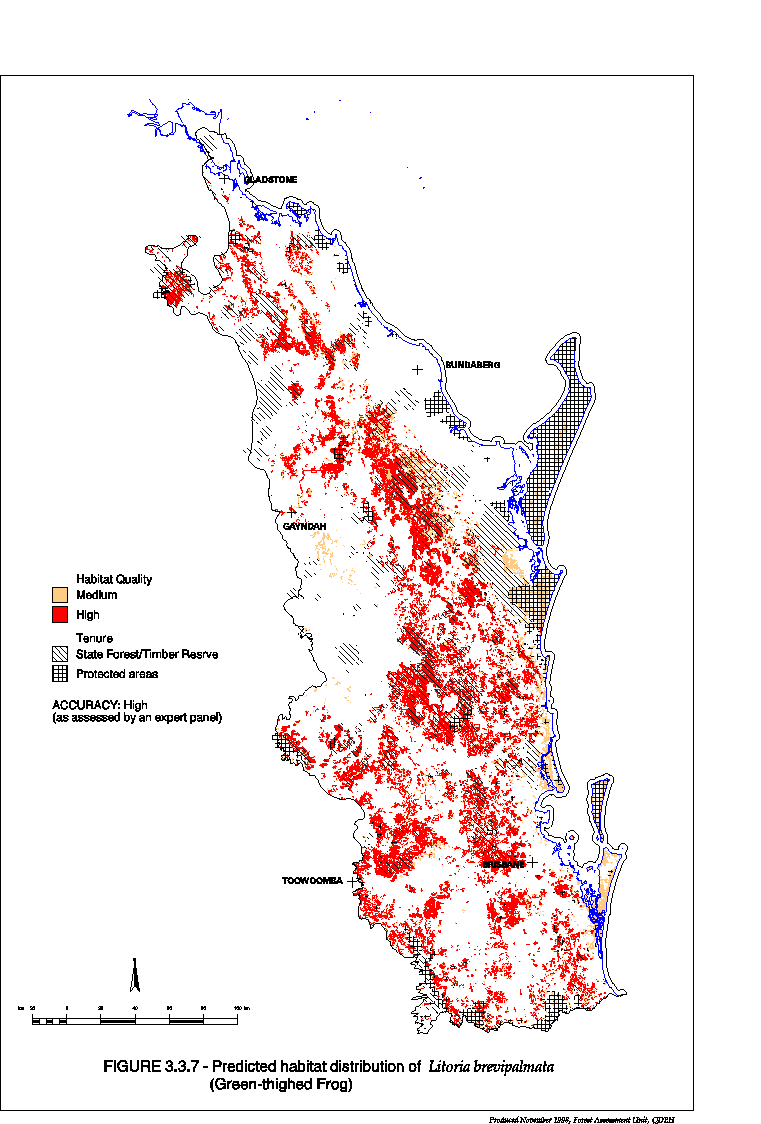
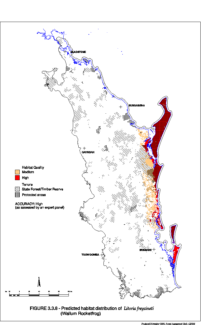
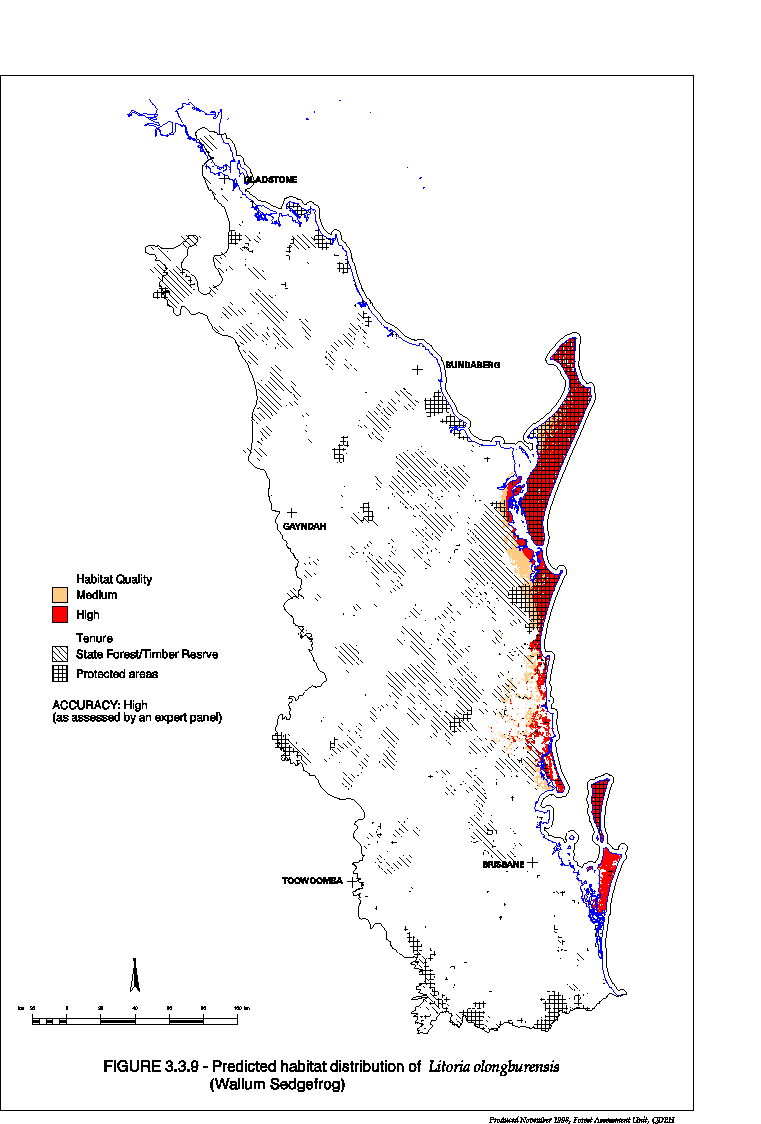
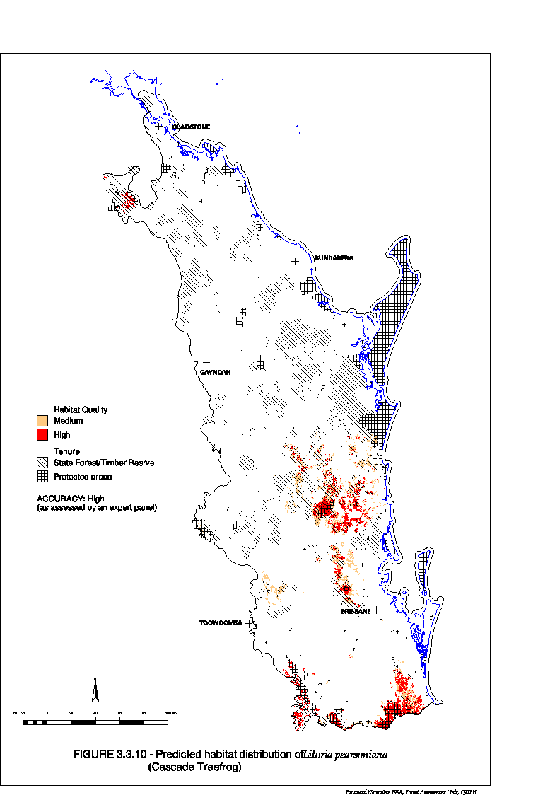
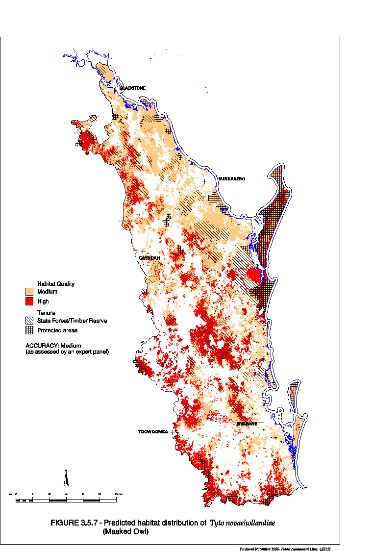
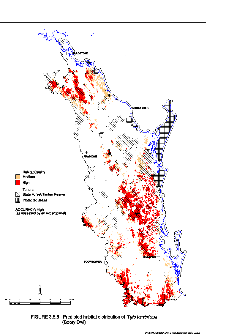
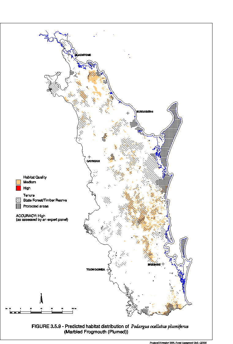
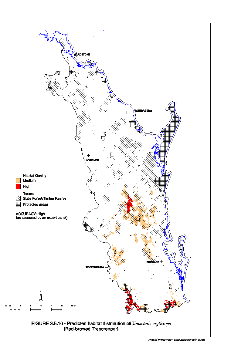
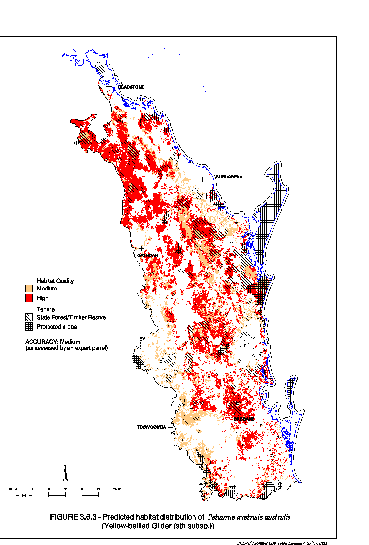
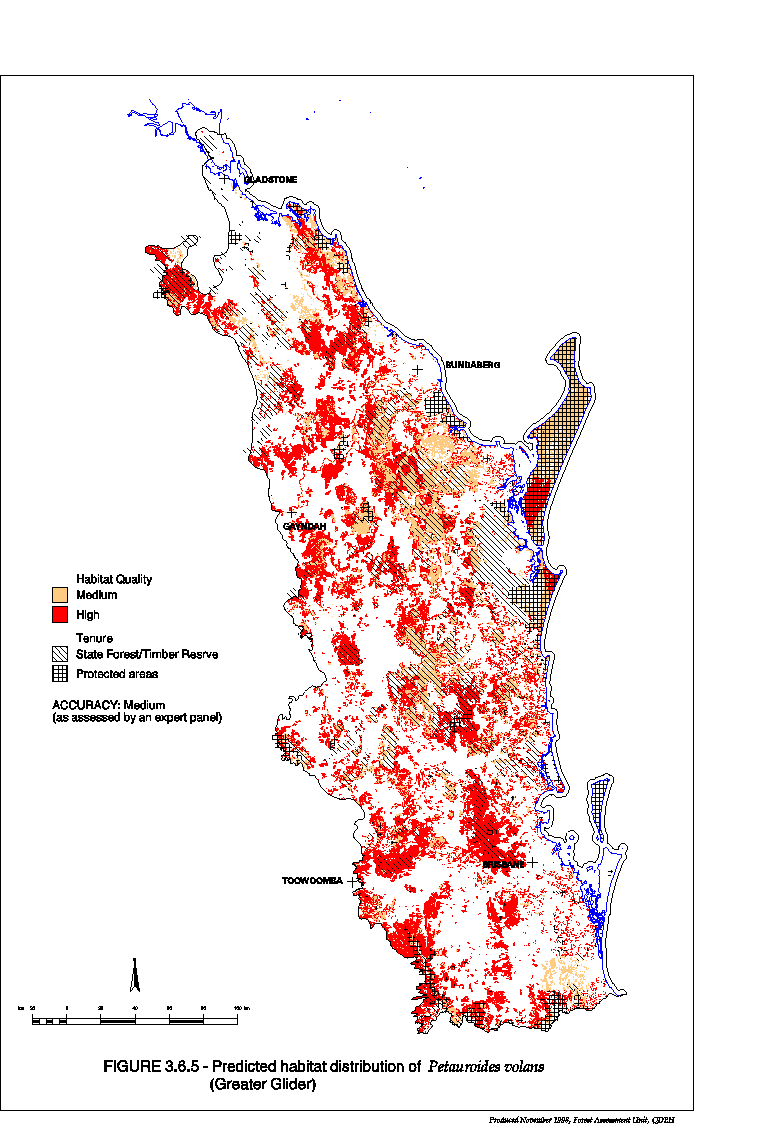
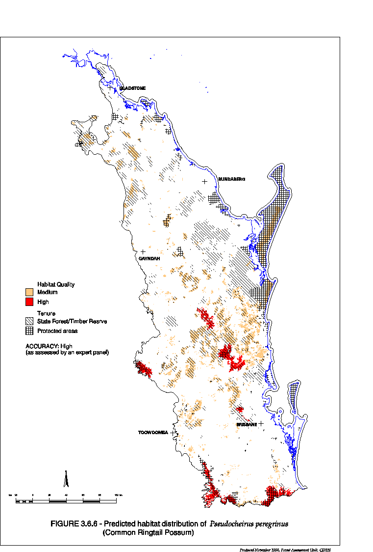
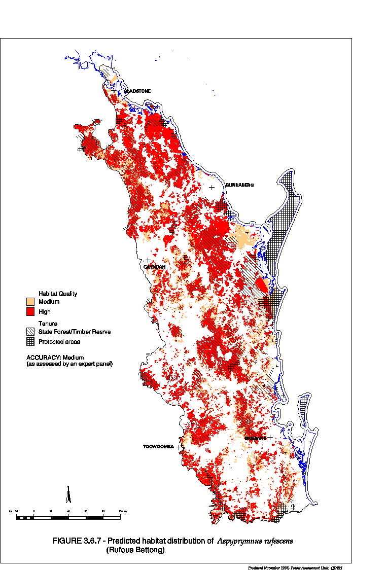
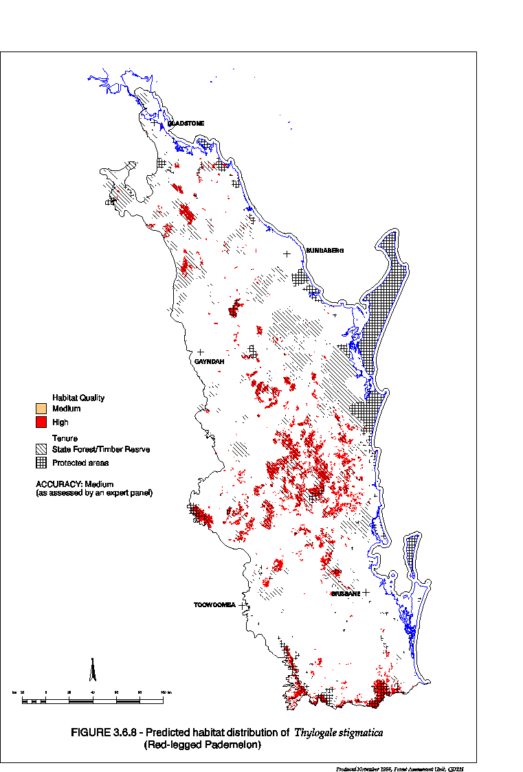
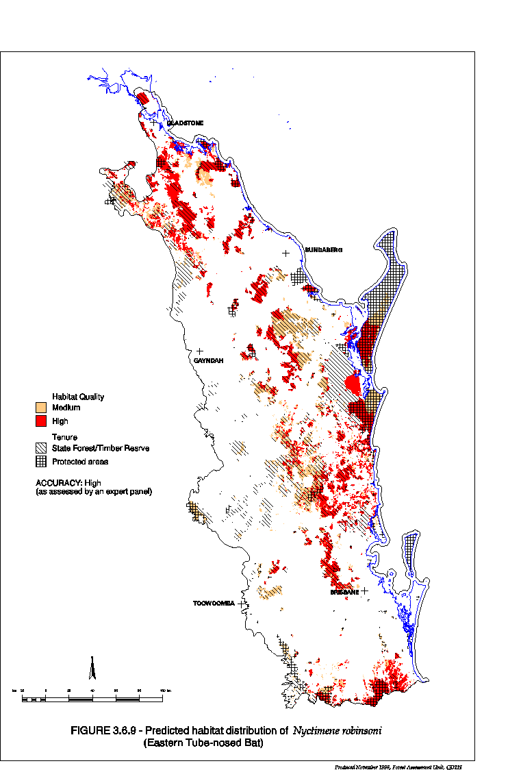
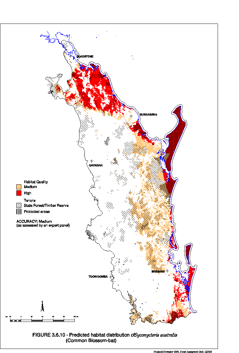
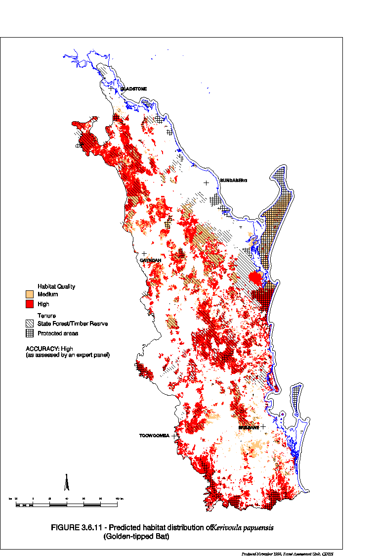
Systematic Vertebrate Fauna Survey Project Stage 11A: Assessment of Habitat Quality for Priority Species EH 1.1.2 Part B (March 1999)
If you have difficulty accessing these files, please visit web accessibility.
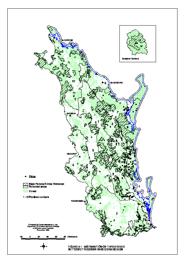
Survey of threatened plant species in South East Queensland biogeographical region EH 1.1.3
If you have difficulty accessing these files, please visit web accessibility.
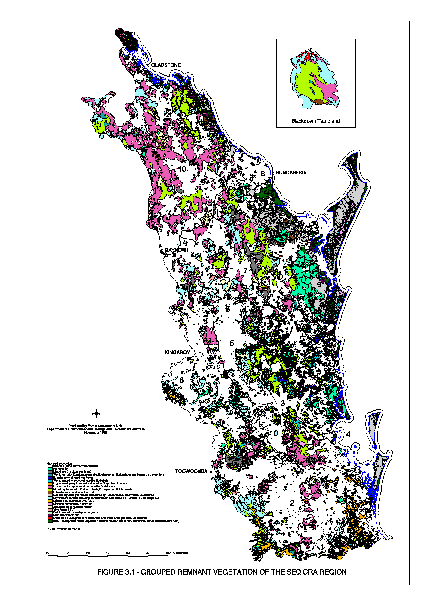
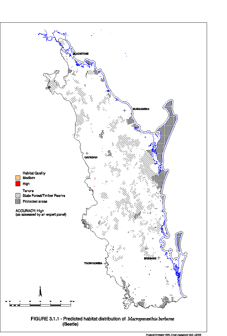
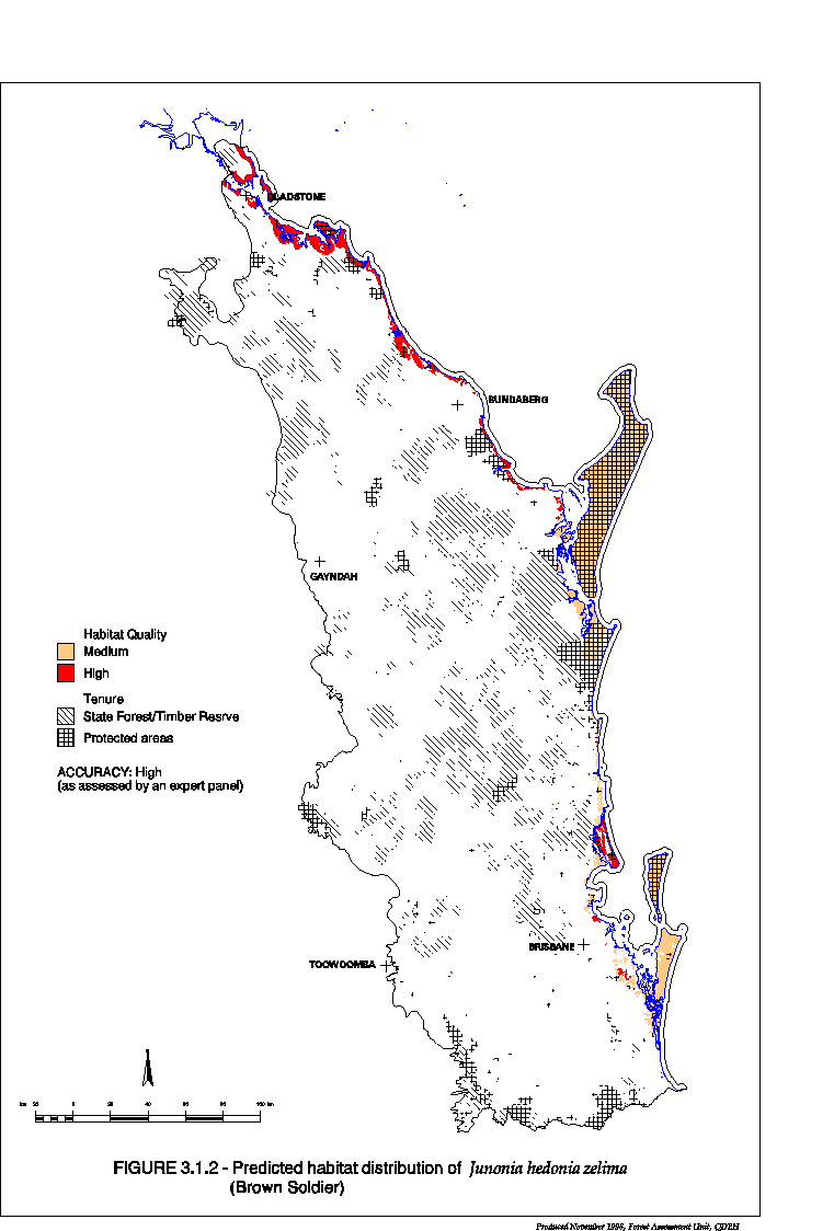
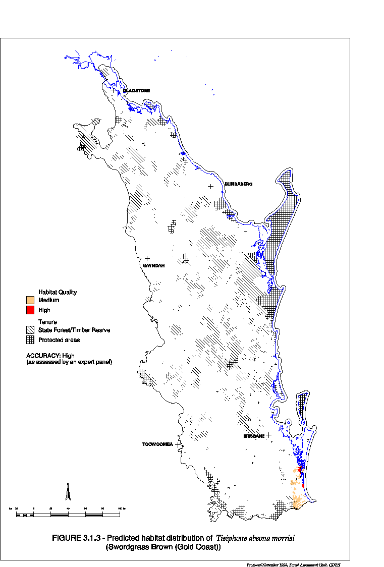
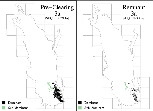
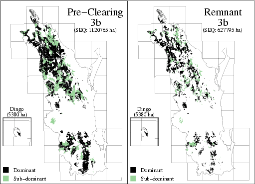
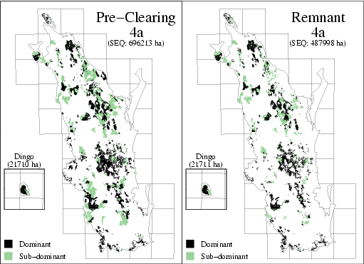
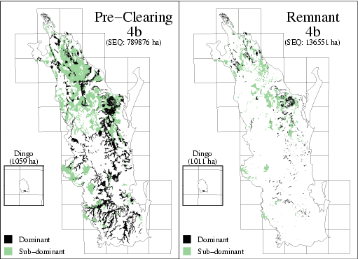
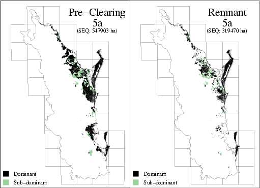
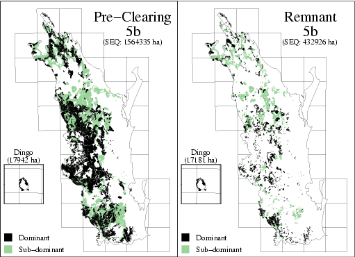
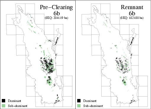
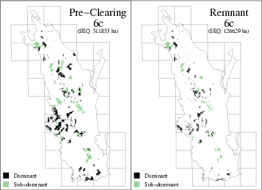
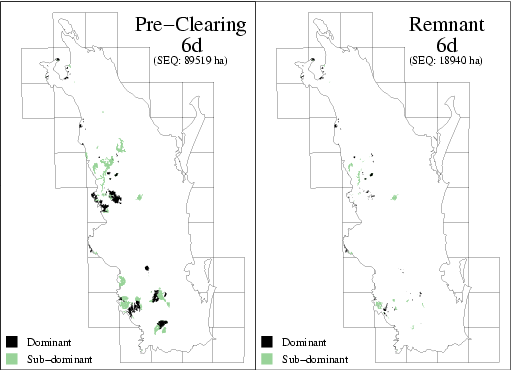
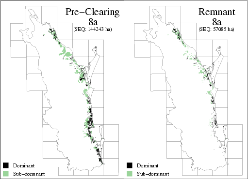
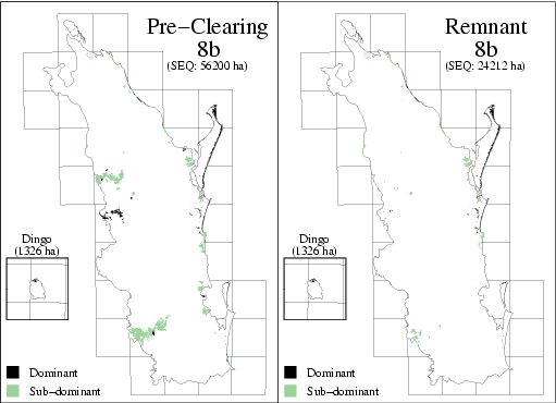
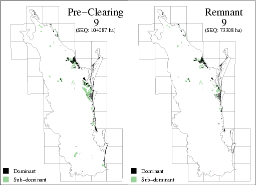
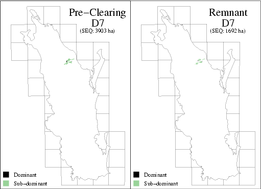
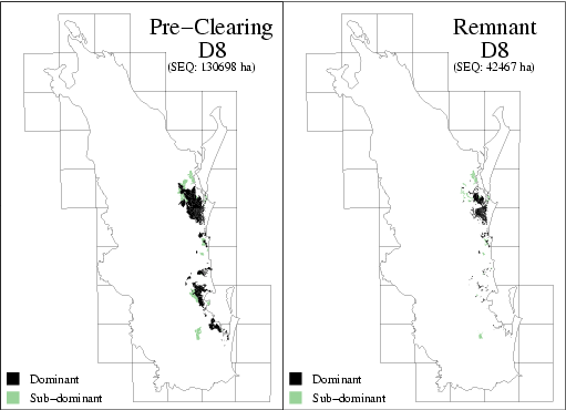
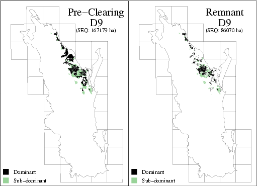
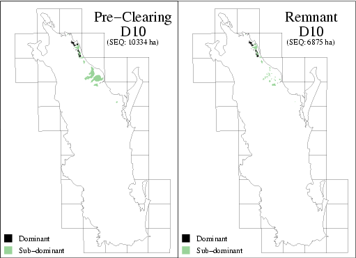
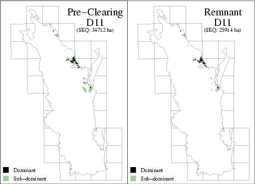
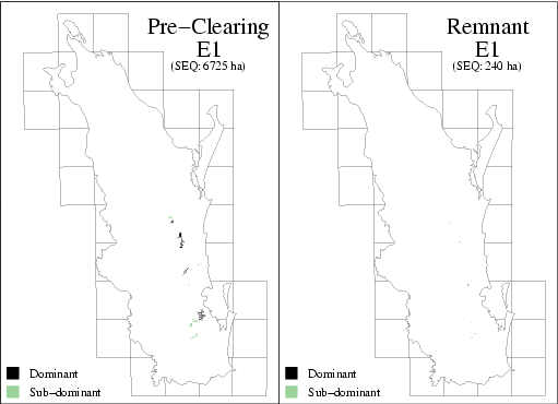
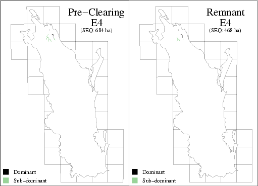
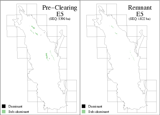
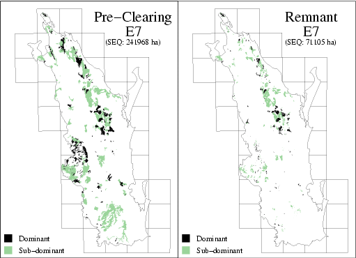
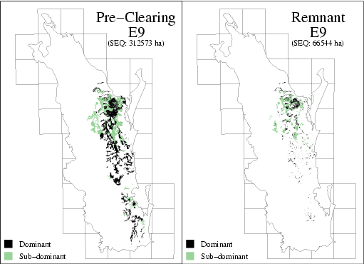
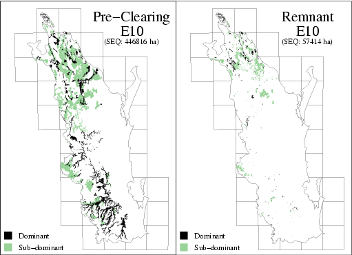
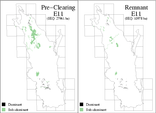
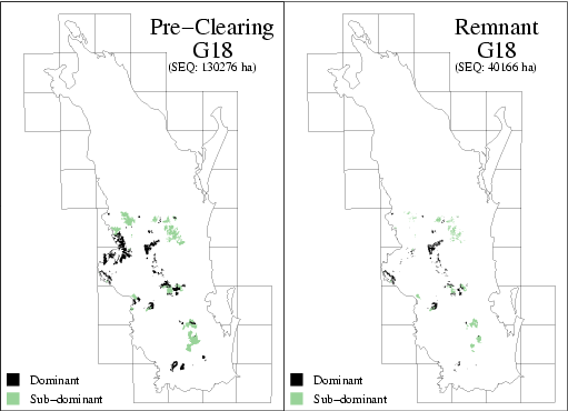
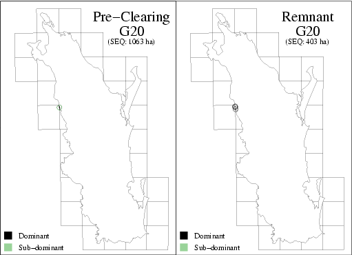
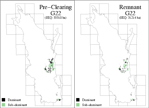
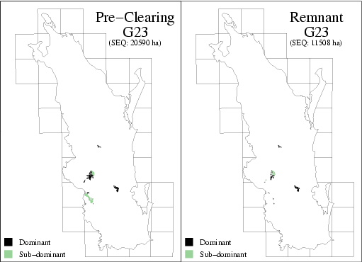
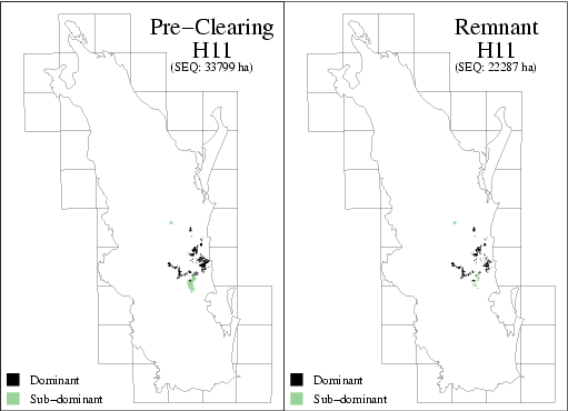
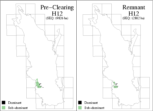
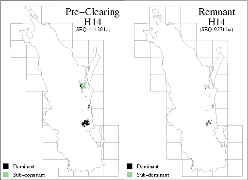
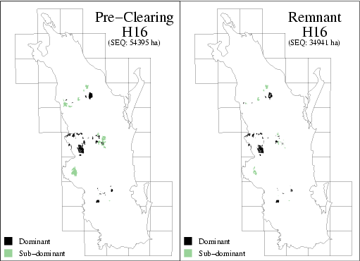
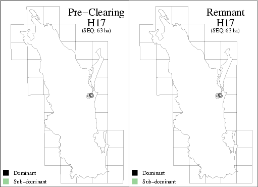
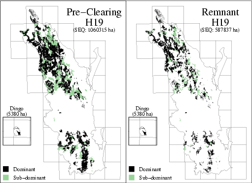
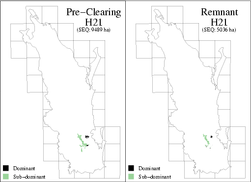
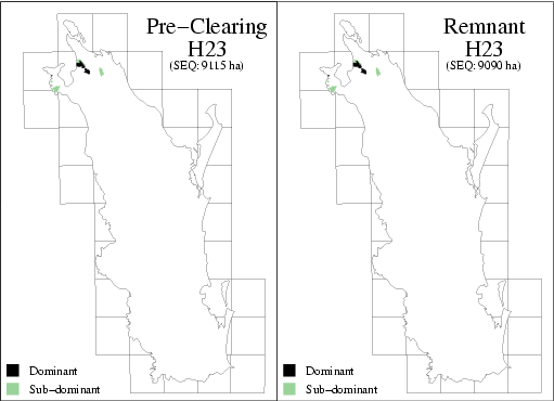
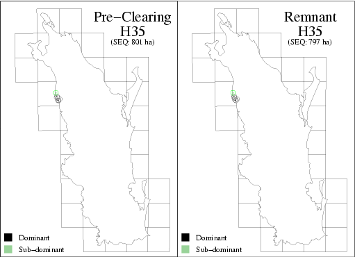
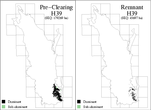
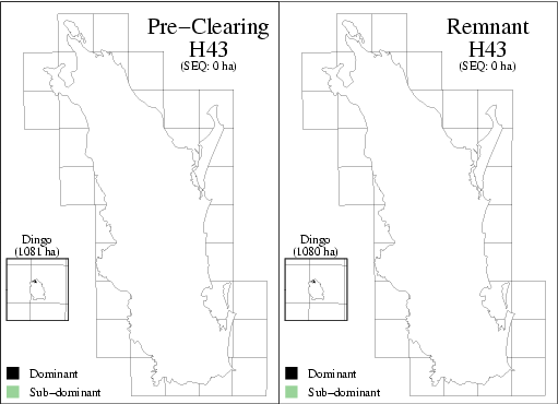
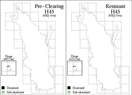
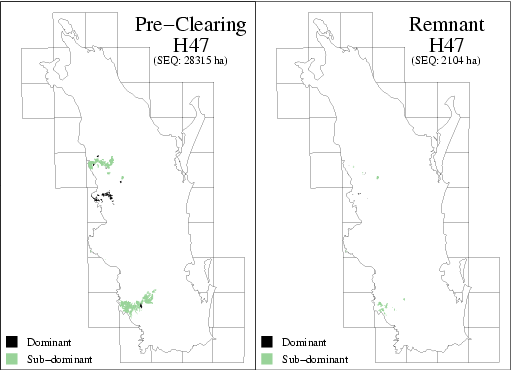
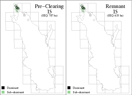
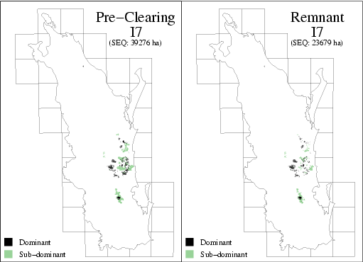
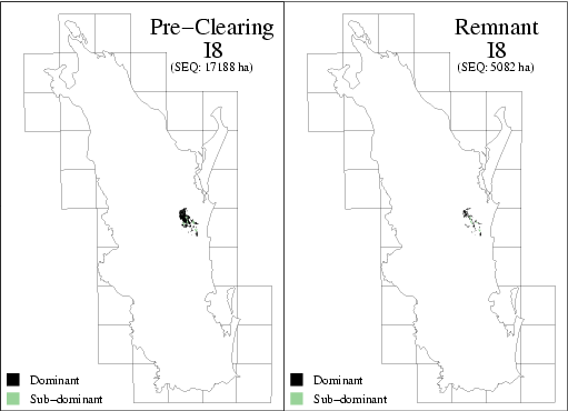
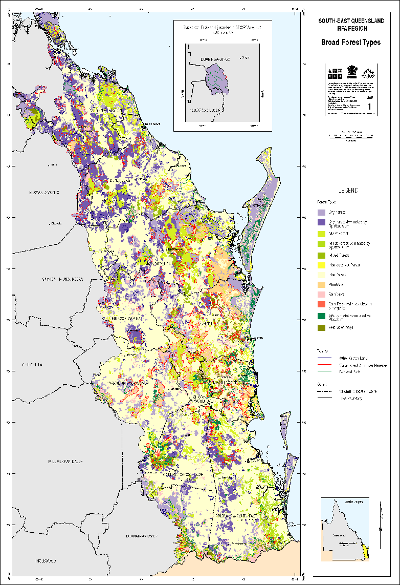
Forest Ecosystem Mapping and Analysis of South-Eastern Queensland Biogeographic Region A. Vegetation Survey and Mapping Version 2 EH 1.2 Part A (March 1999)
If you have difficulty accessing these files, please visit web accessibility.
Forest Ecosystem Mapping and Analysis of South-Eastern Queensland Biogeographic Region B. Regional Ecosystems EH 1.2 Part B (March 1999)
| Document | Pages | File size |
|---|---|---|
| Forest Ecosystem Mapping and Analysis B. Regional Ecosystems (EH 1.2 Part B) PDF | 79 | 280 KB |
| Forest Ecosystem Mapping and Analysis B. Regional Ecosystems (EH 1.2 Part B) ZIP | 82 KB |
If you have difficulty accessing these files, please visit web accessibility.
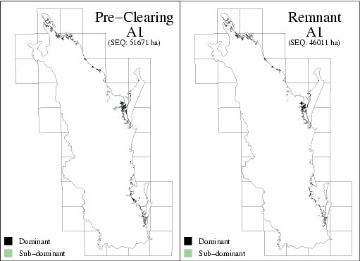
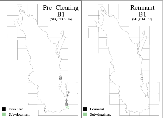
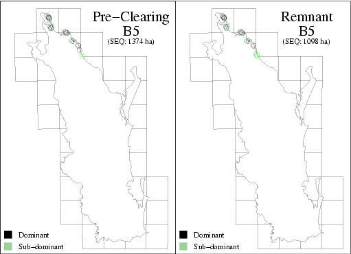
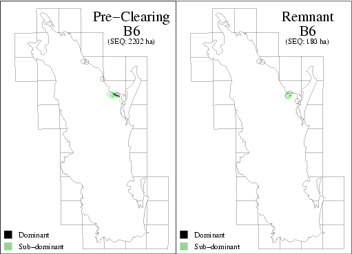
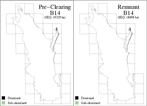
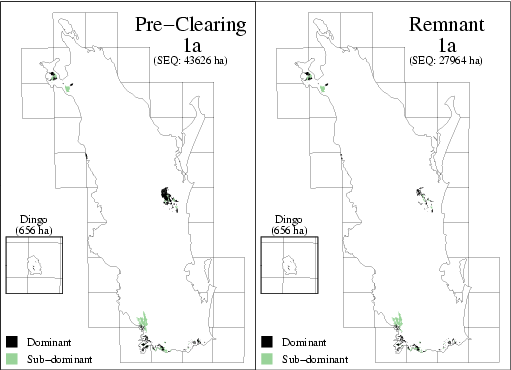
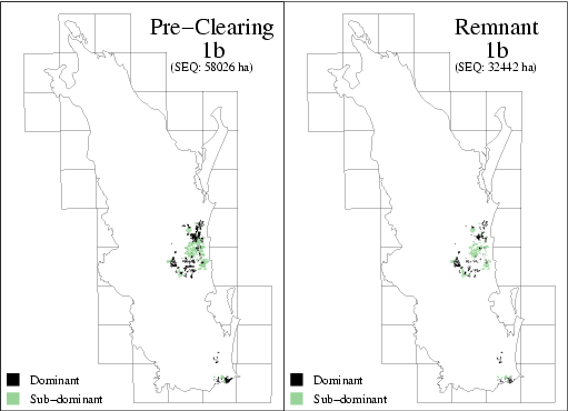
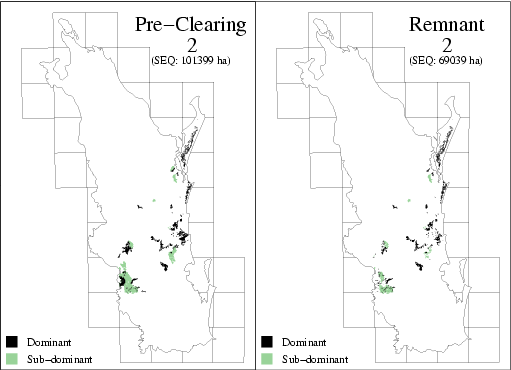
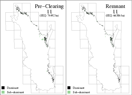
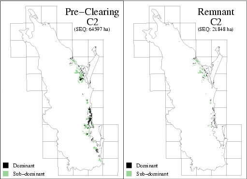
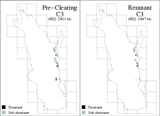
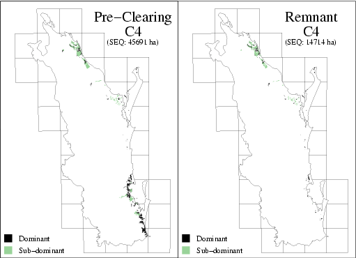
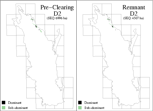
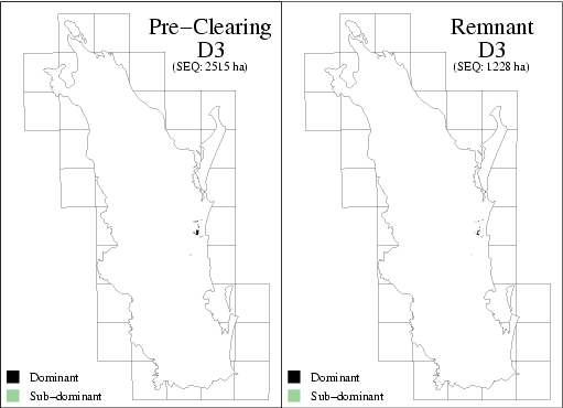
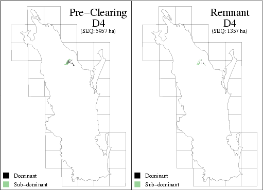
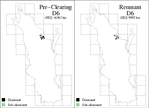
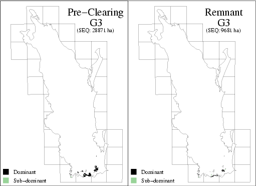
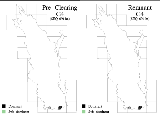
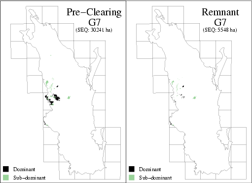
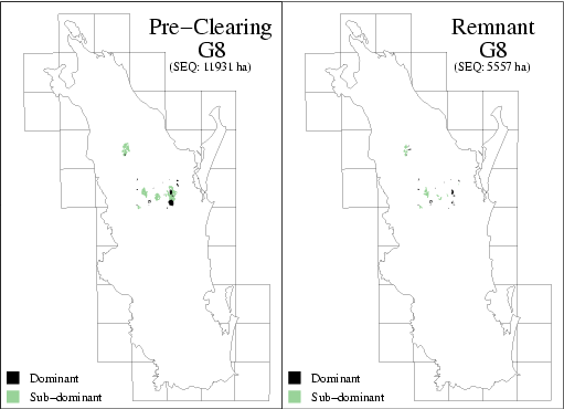
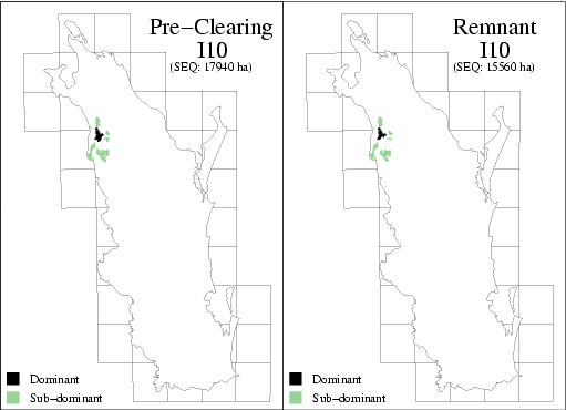
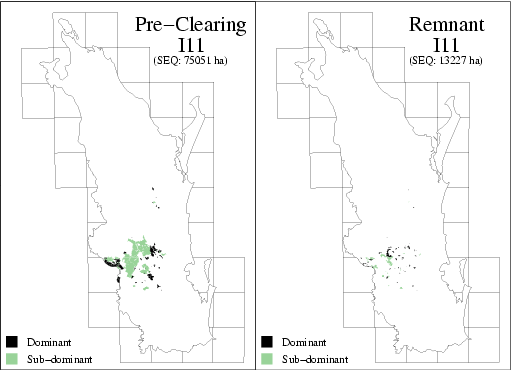
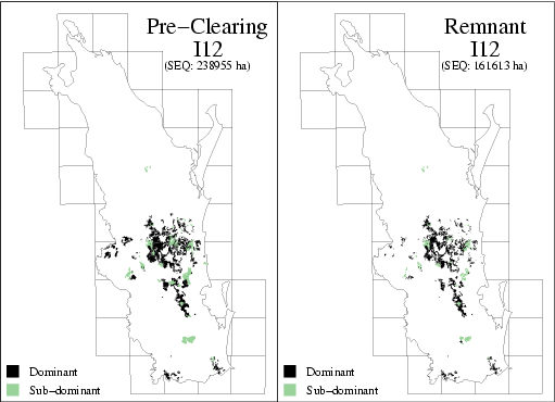
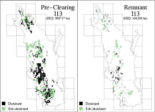
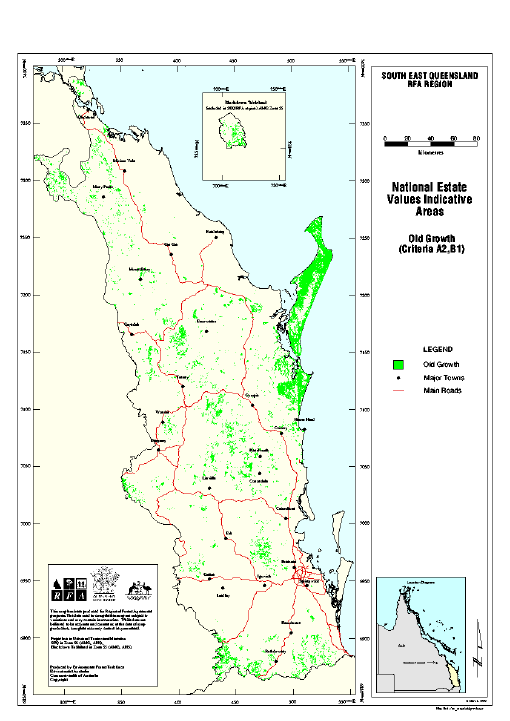
Old Growth Forest in South-East Queensland EH 2.1 (April 1999)
| Document | Pages | File size |
|---|---|---|
| Old Growth Forest in South-East Queensland (EH 2.1) PDF | 122 | 838 KB |
| Map 1 GIF | 1 | 60 KB |
| Map 2: Old growth forests status Cooloola National Park subset map GIF | 1 | 124 KB |
If you have difficulty accessing these files, please visit web accessibility.
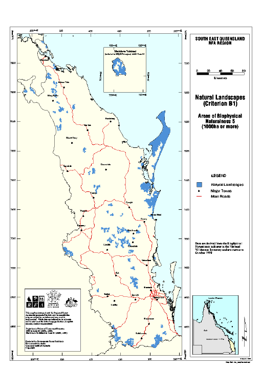
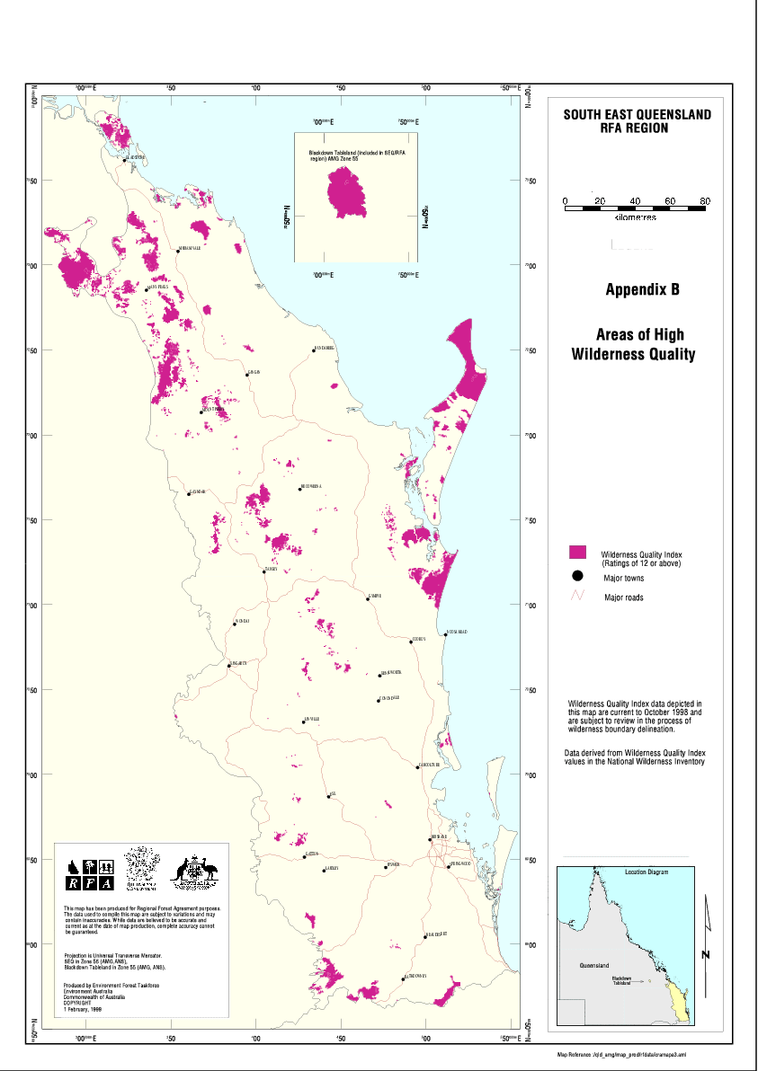
Wilderness and Extensive Natural Values EH 3.1 (March 1999)
| Document | Pages | File size |
|---|---|---|
| Wilderness and Extensive Natural Values (Project 3.1) PDF | 24 | 562 KB |
| Wilderness and Extensive Natural Values (Project 3.1) ZIP | 46 KB | |
| Map: Areas of high wilderness quality GIF | 1 | 1.08 MB |
If you have difficulty accessing these files, please visit web accessibility.
Integration of data for National Estate Aesthetic Values Studies
| Document | Pages | File size |
|---|---|---|
| Integration of data for National Estate Aesthetic Values Studies PDF | 194 | 918 KB |
If you have difficulty accessing this file, please visit web accessibility.
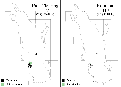
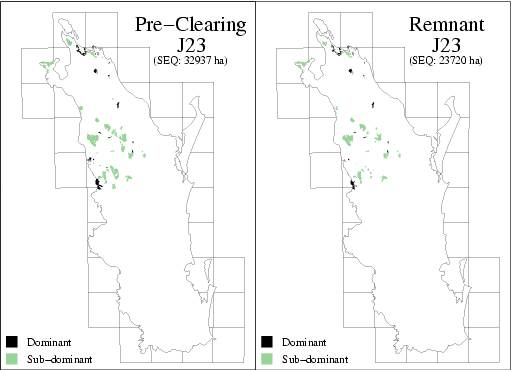
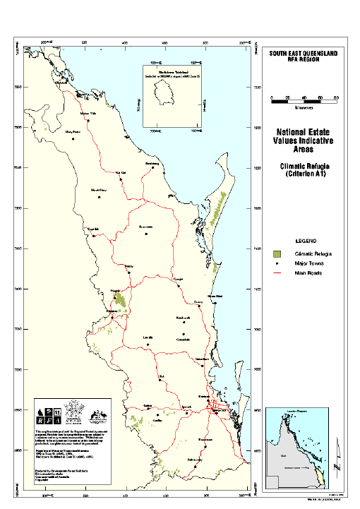
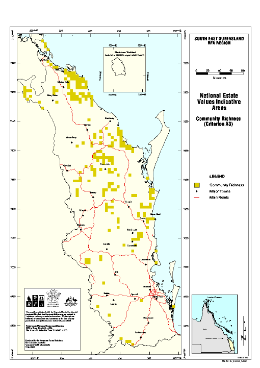
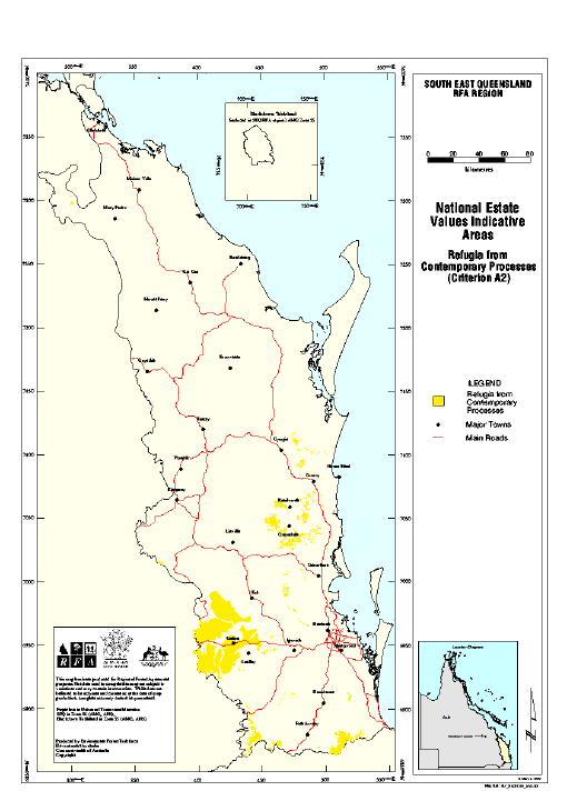
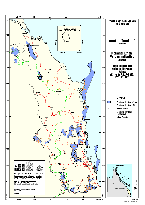
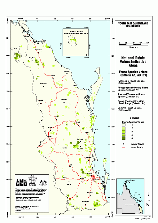
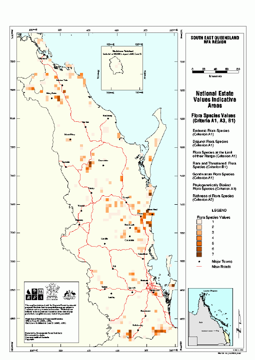
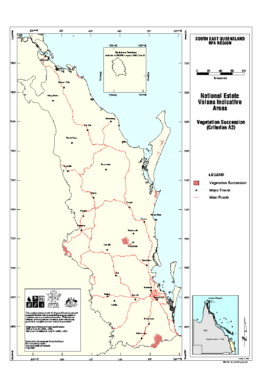
National Estate Values: Indicative Areas
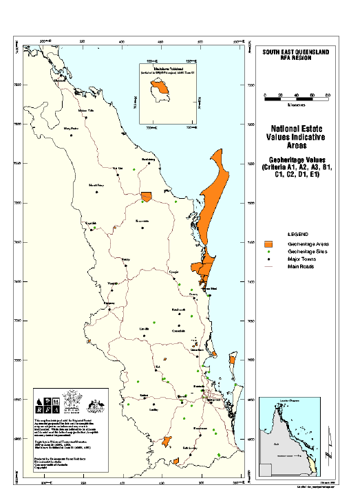
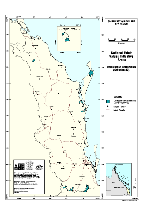
If you have difficulty accessing these files, please visit web accessibility.
National Estate: Historic Values
| Document | Pages | File size |
|---|---|---|
| National Estate: Historic Values PDF | 138 | 1.01 MB |
| National Estate: Historic Values ZIP | 1.05 MB |
If you have difficulty accessing these files, please visit web accessibility.
National Estate: Social Values
| Document | Pages | File size |
|---|---|---|
| National Estate: Social Values PDF | 242 | 1.41 MB |
| National Estate: Social Values ZIP | 1.43 MB |
If you have difficulty accessing these files, please visit web accessibility.
Information Kits / Factsheets
Forests and People - the Social Assessment
| Document | Pages | File size |
|---|---|---|
| South East Queensland - RFA News PDF | 8 | 304 KB |
If you have difficulty accessing this file, please visit web accessibility.
Media Releases
Note: The Commonwealth and Queensland Governments completed a Comprehensive Regional Assessment for South-East Queensland, but did not sign a Regional Forest Agreement.
The following media releases were issued by the then Australian Government Minister for Forestry and Conservation:
- 18 March 1999 - Assessment Spotlights People and Forests
- 14 May 1999 - Regional Forest Agreement Directions Report (joint Ministerial Statement)
Resource Reports
An appraisal of methods and data used by QDPI Forestry to estimate wood resource yields as a part of the Resource Assessment for South-East Queensland SE 1.1
If you have difficulty accessing these files, please visit web accessibility.
Public Forest Resource Description and Inventory SE 1.2 Part A (April 1999)
If you have difficulty accessing these files, please visit web accessibility.
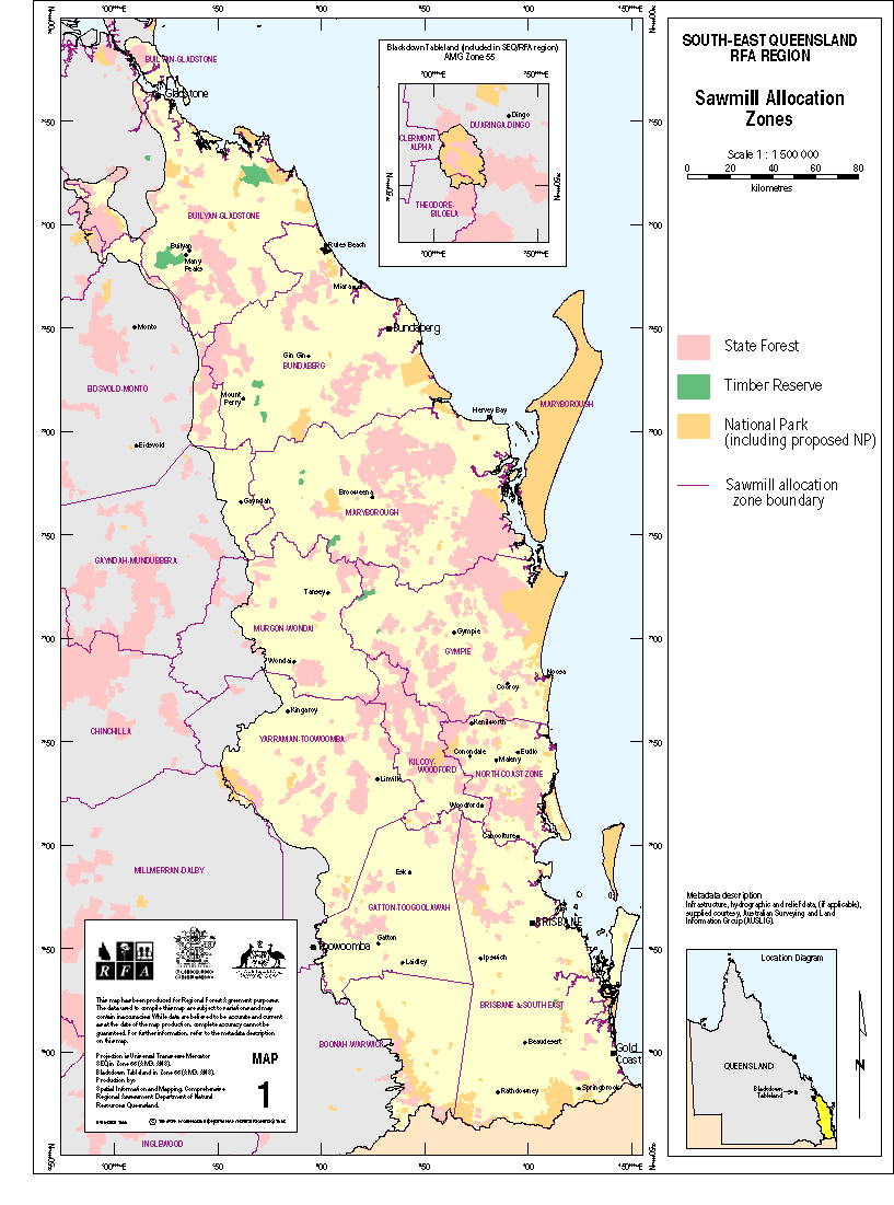
Public Forest Resource Description and Inventory SE 1.2 Part B - Other Wood Products (April 1999)
| Document | Pages | File size |
|---|---|---|
| Public Forest Resource Description and Inventory (SE 1.2 Part B) PDF | 39 | 101 KB |
| Map 1: Sawmill Allocation Zones GIF | 1 | 63 KB |
If you have difficulty accessing these files, please visit web accessibility.
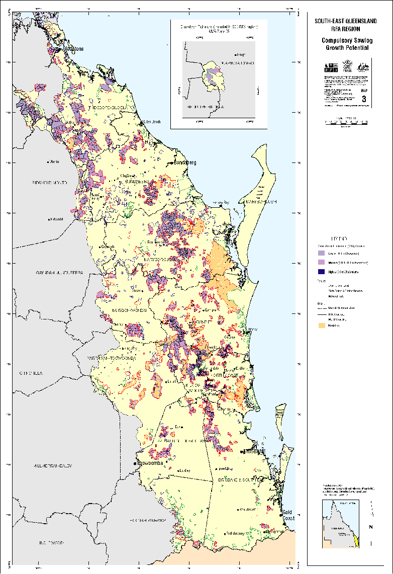
Forest Resource Enhancement Opportunities for South-East Queensland SE 1.3
| Document | Pages | File size |
|---|---|---|
| Forest Resource Enhancement Opportunities for South-East Queensland (SE 1.3) PDF | 68 | 221 KB |
| Forest Resource Enhancement Opportunities for South-East Queensland (SE 1.3) ZIP | 174 KB |
If you have difficulty accessing these files, please visit web accessibility.
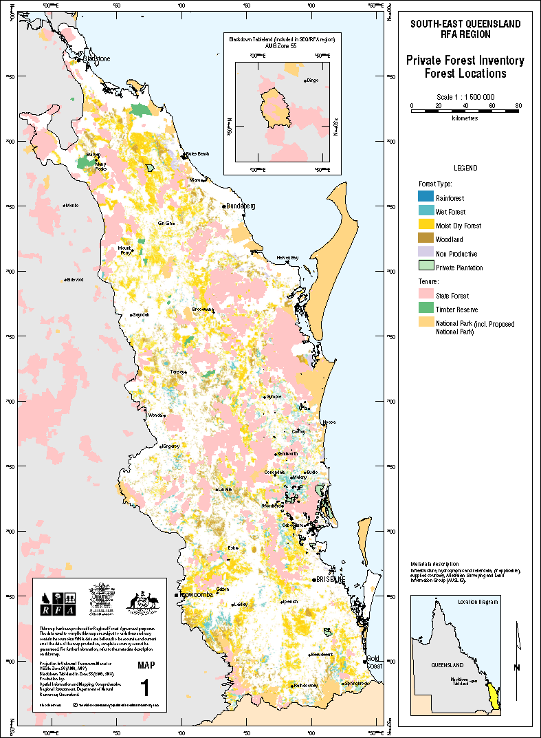
An Inventory of Private Forests of SEQ SE 1.4 (April 1999)
| Document | Pages | File size |
|---|---|---|
| An Inventory of Private Forests of South-East Queensland (SE 1.4) PDF | 52 | 507 KB |
| Map 1: Private Forest Inventory Forest Locations GIF | 1 | 163 KB |
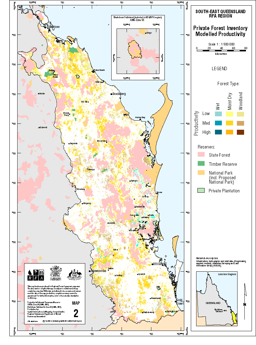
| Map 2: Private Forest Inventory Modelled Productivity GIF | 1 | 142 KB |
If you have difficulty accessing these files, please visit web accessibility.
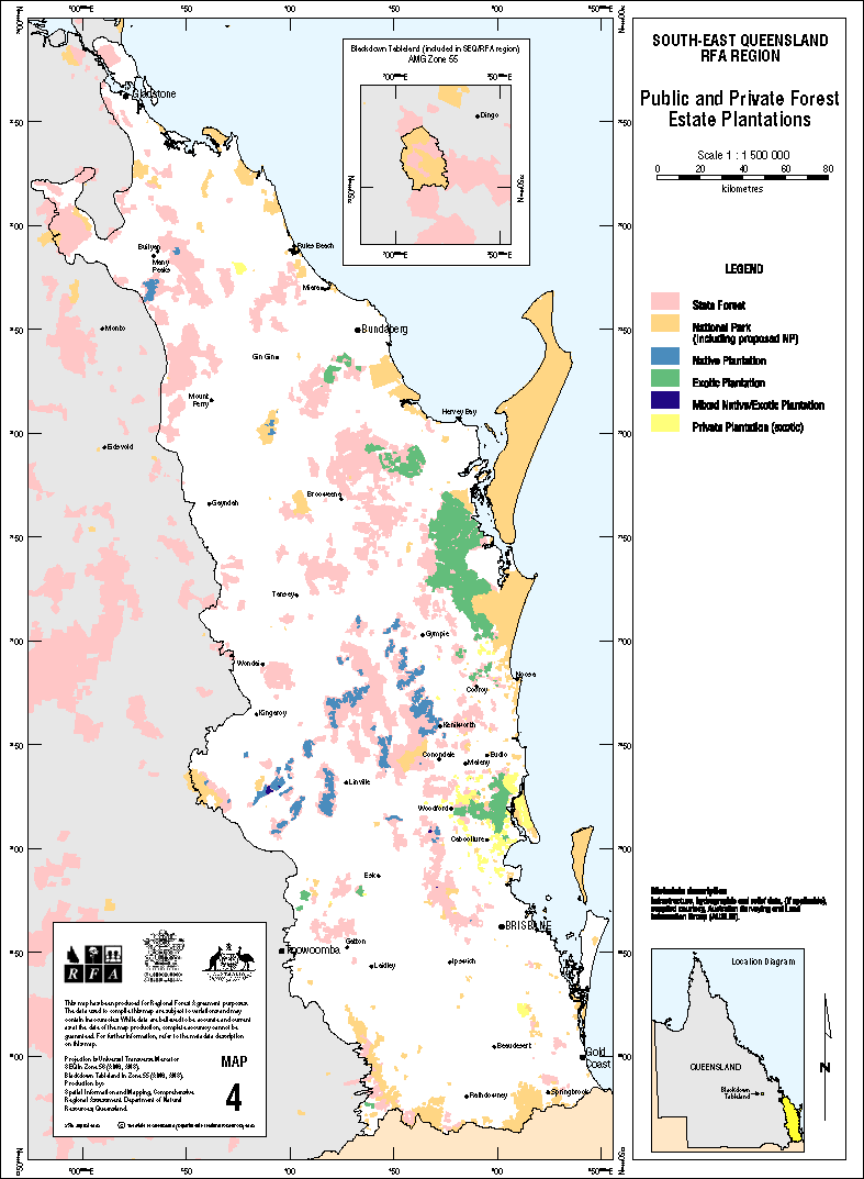
Wood and Wood Products Industry Background and Situation Analysis SE 2.5 Final Report (April 1999)
| Document | Pages | File size |
|---|---|---|
| Wood and Wood Products Industry Background and Situation Analysis (SE 2.5 Final Report) PDF | 51 | 418 KB |
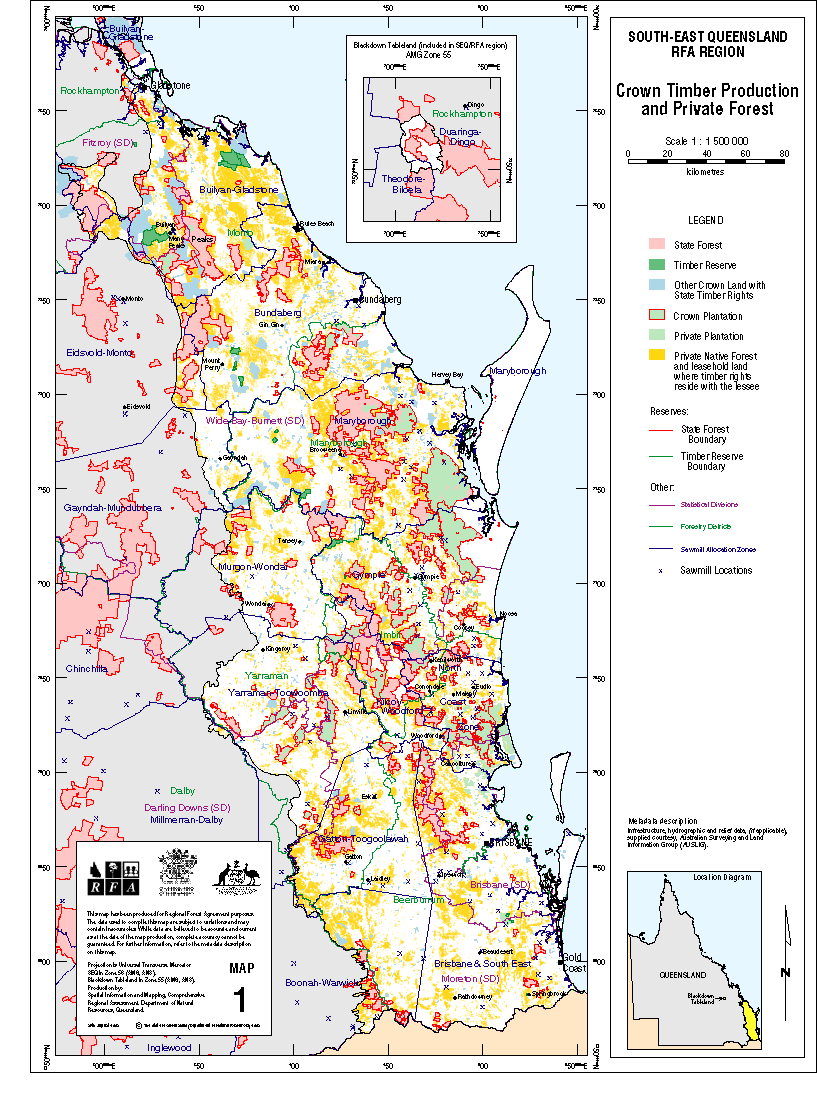
| Map 1: Crown Timber Production and Private Forest GIF | 1 | 156 KB |
If you have difficulty accessing these files, please visit web accessibility.
Review of Value-adding/Transformation Opportunities for the South-East Queensland Wood and Wood Products Industry (SE 2.6) (April 1999)
| Document | Pages | File size |
|---|---|---|
| Review of Value-adding/Transformation Opportunities for the South East Queensland Wood and Wood Products Industry (SE 2.6) PDF | 111 | 1.89 MB |
If you have difficulty accessing this file, please visit web accessibility.
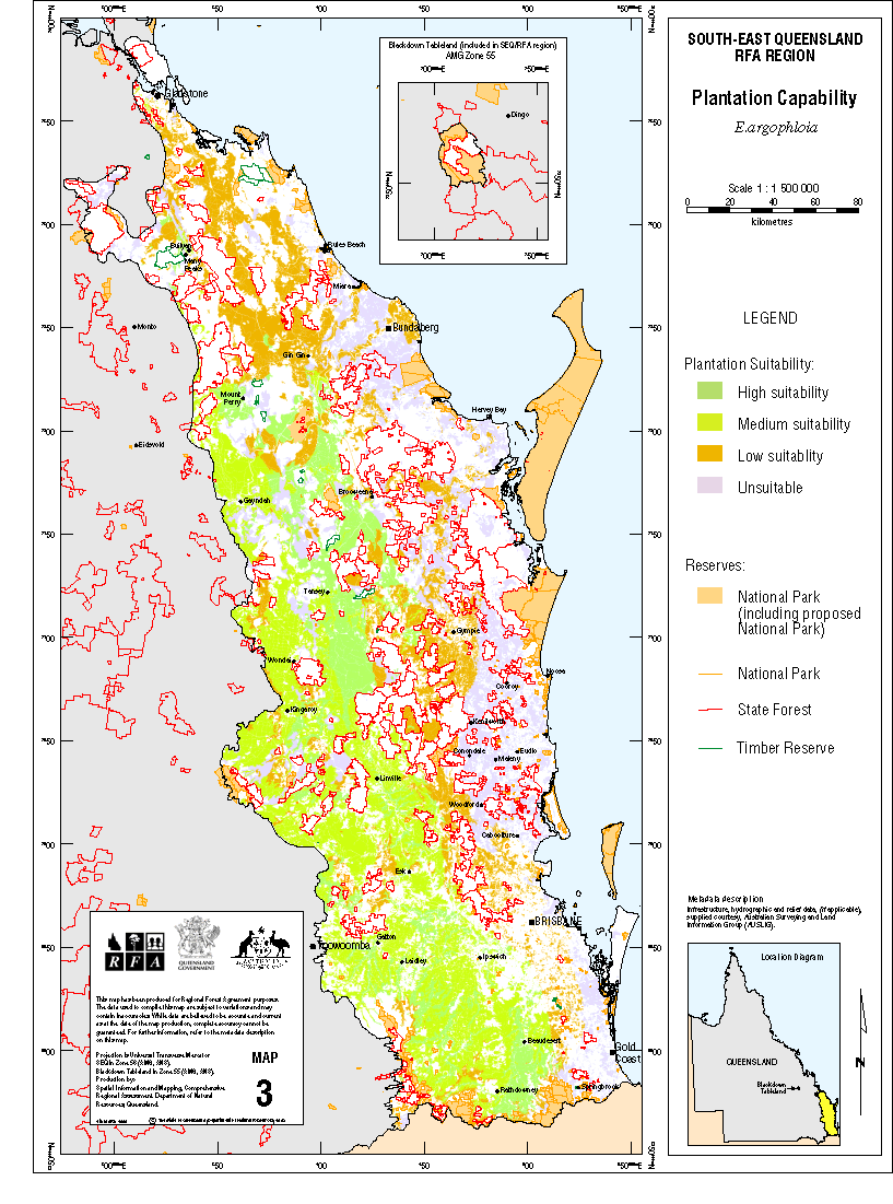
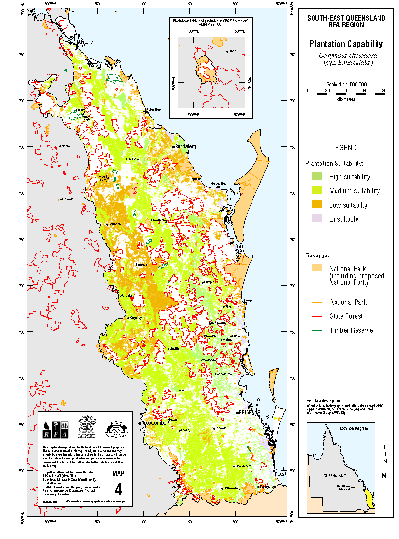
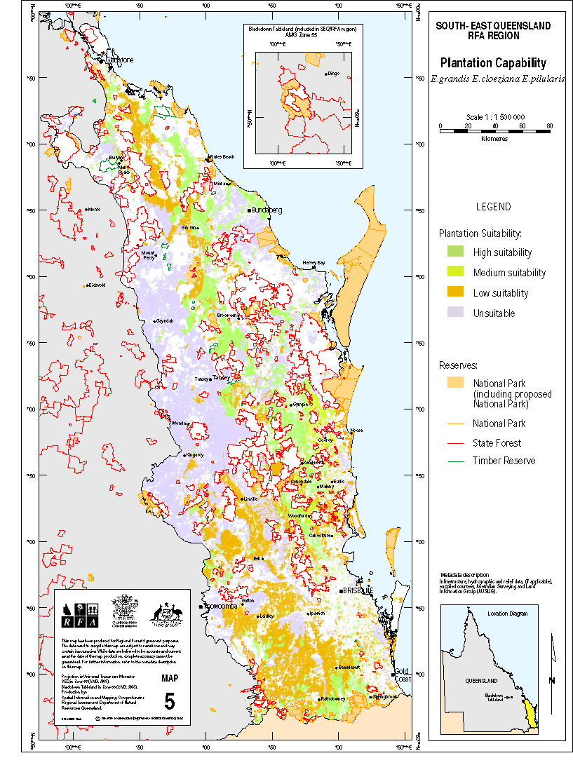
Commercial Plantation Land Capability Analysis (SE 1.5) (April 1999)
| Document | Pages | File size |
|---|---|---|
| Commercial Plantation Land Capability Analysis (SE 1.5) PDF | 45 | 129 KB |
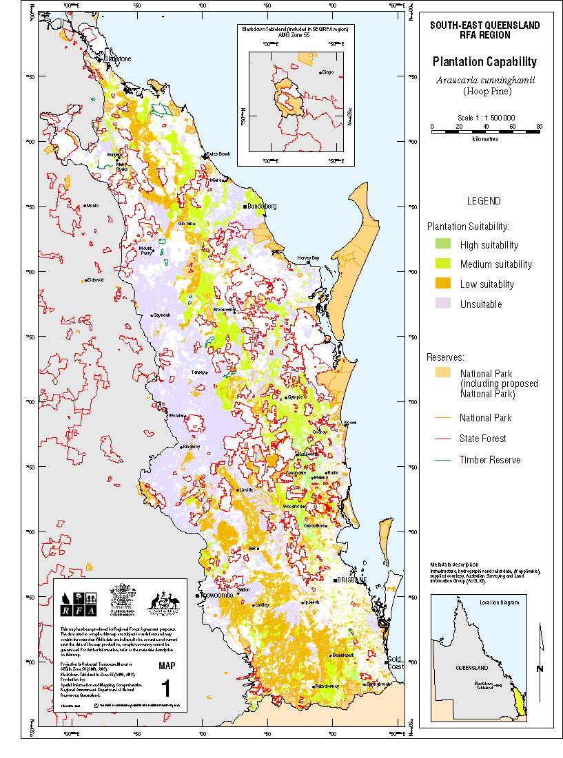
| Map 1: Plantation Capability GIF | 1 | 159 KB |
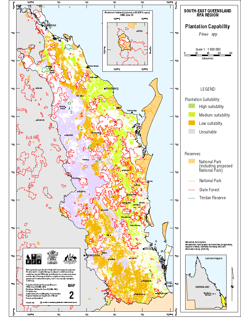
| Map 2: Plantation Capability GIF | 1 | 166 KB |
| Map 3: Plantation Capability GIF | 1 | 171 KB |
| Map 4: Plantation Capability GIF | 1 | 177 KB |
| Map 5: Plantation Capability GIF | 1 | 189 KB |
If you have difficulty accessing these files, please visit web accessibility.
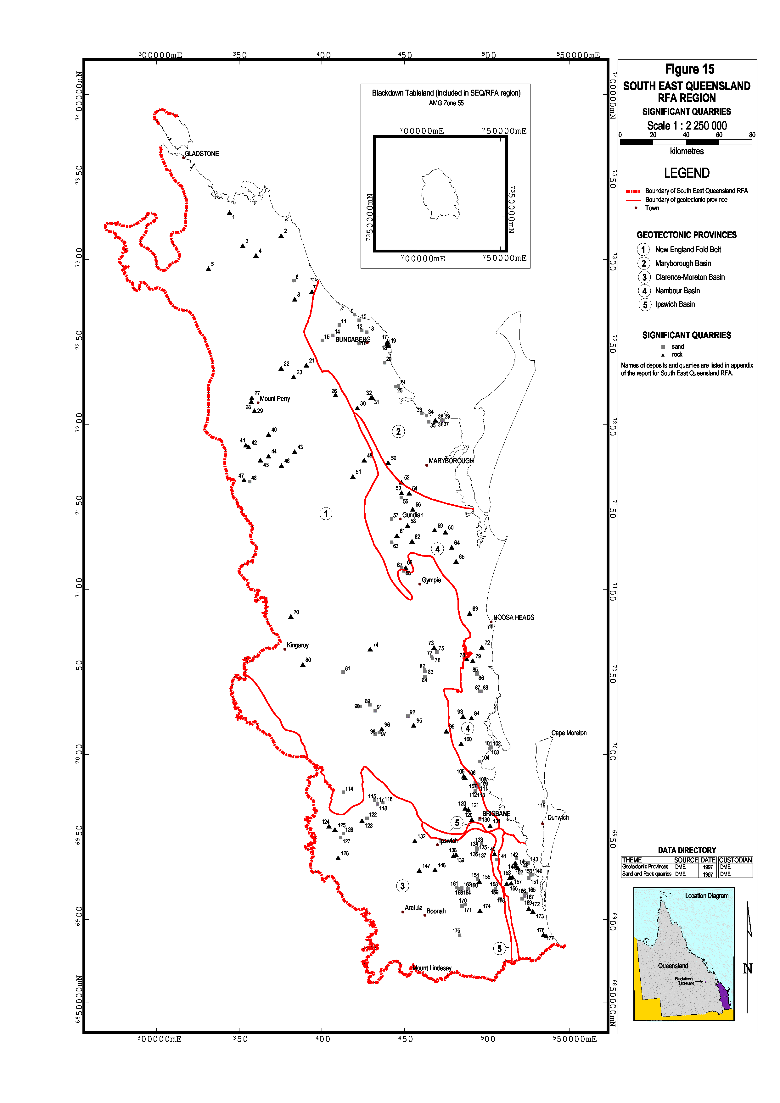
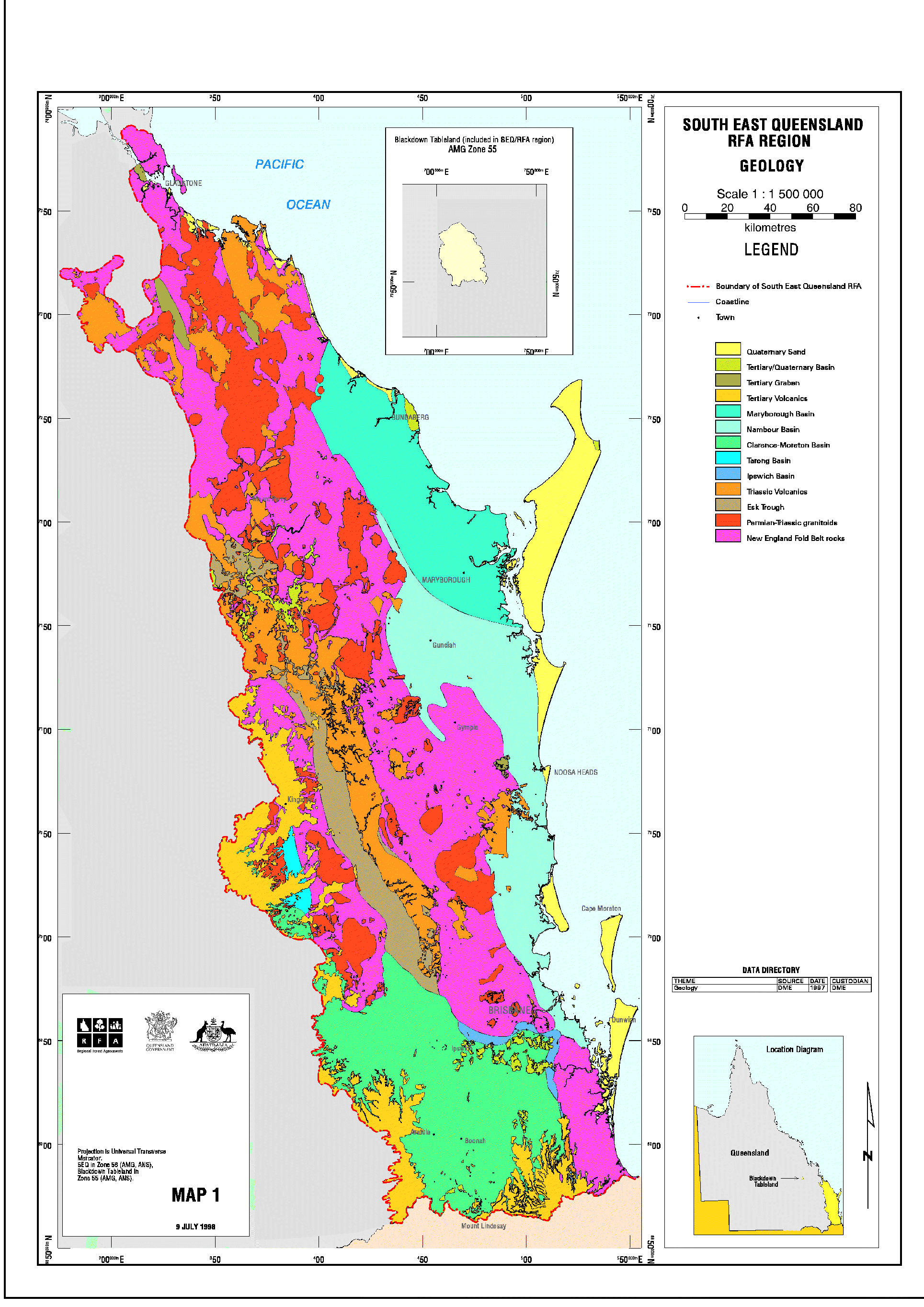
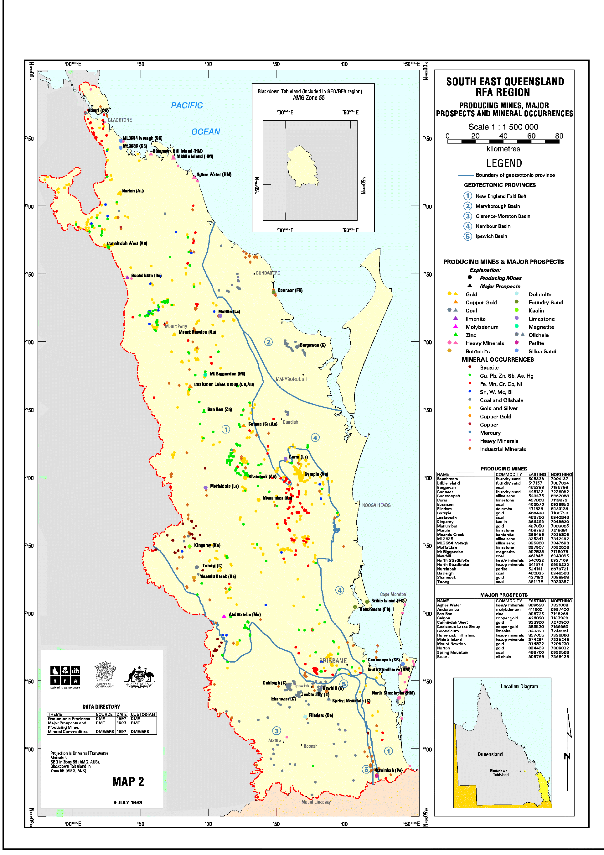
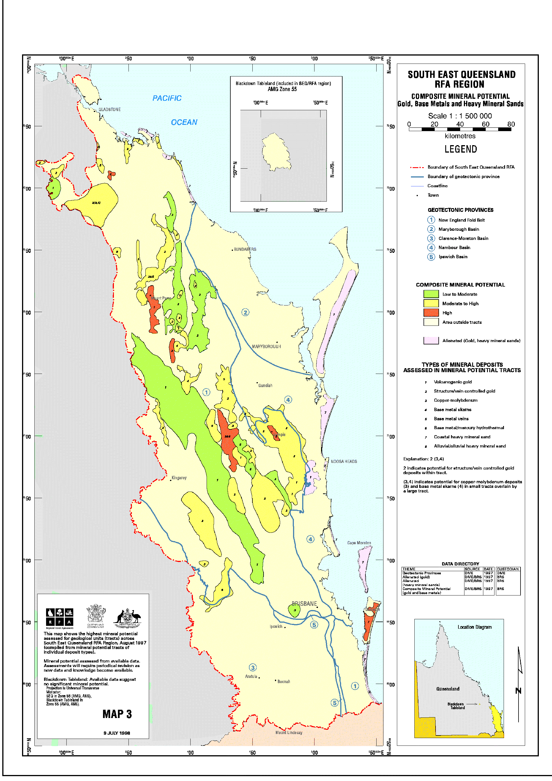
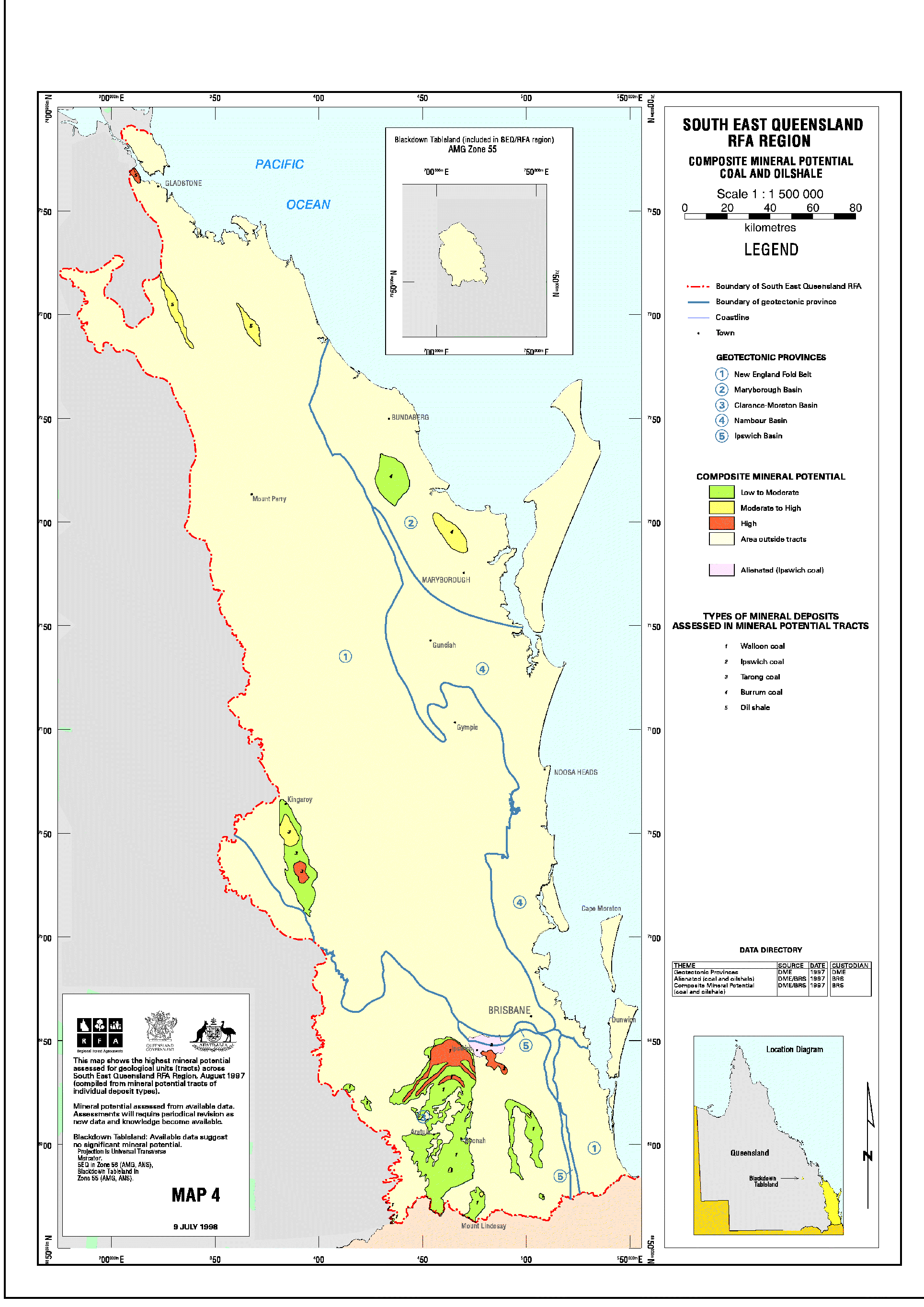
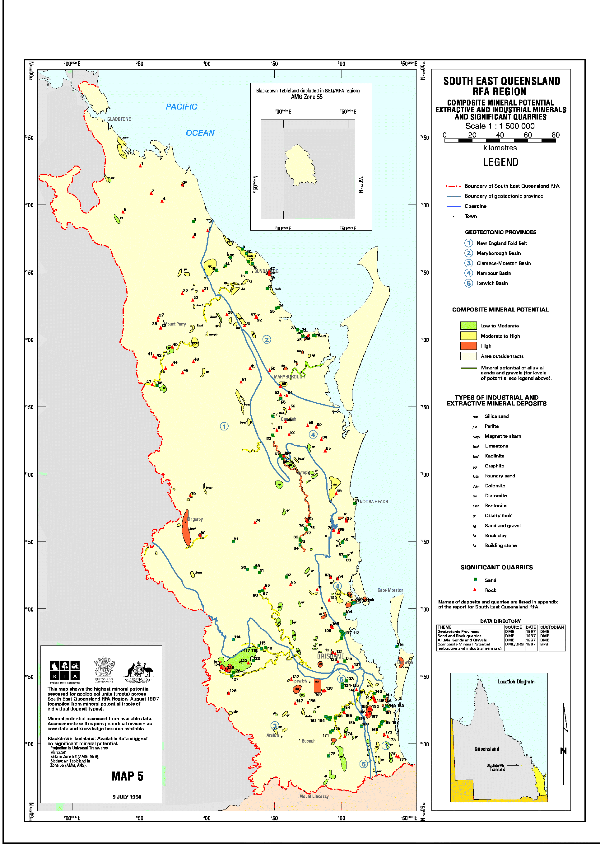
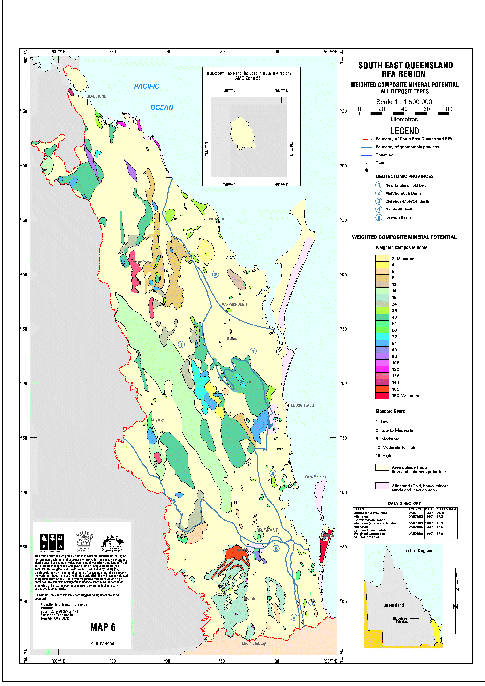
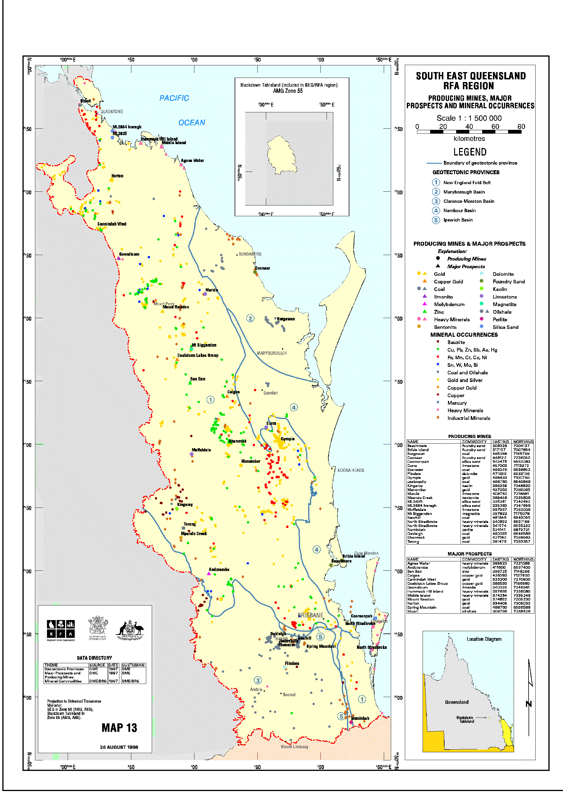
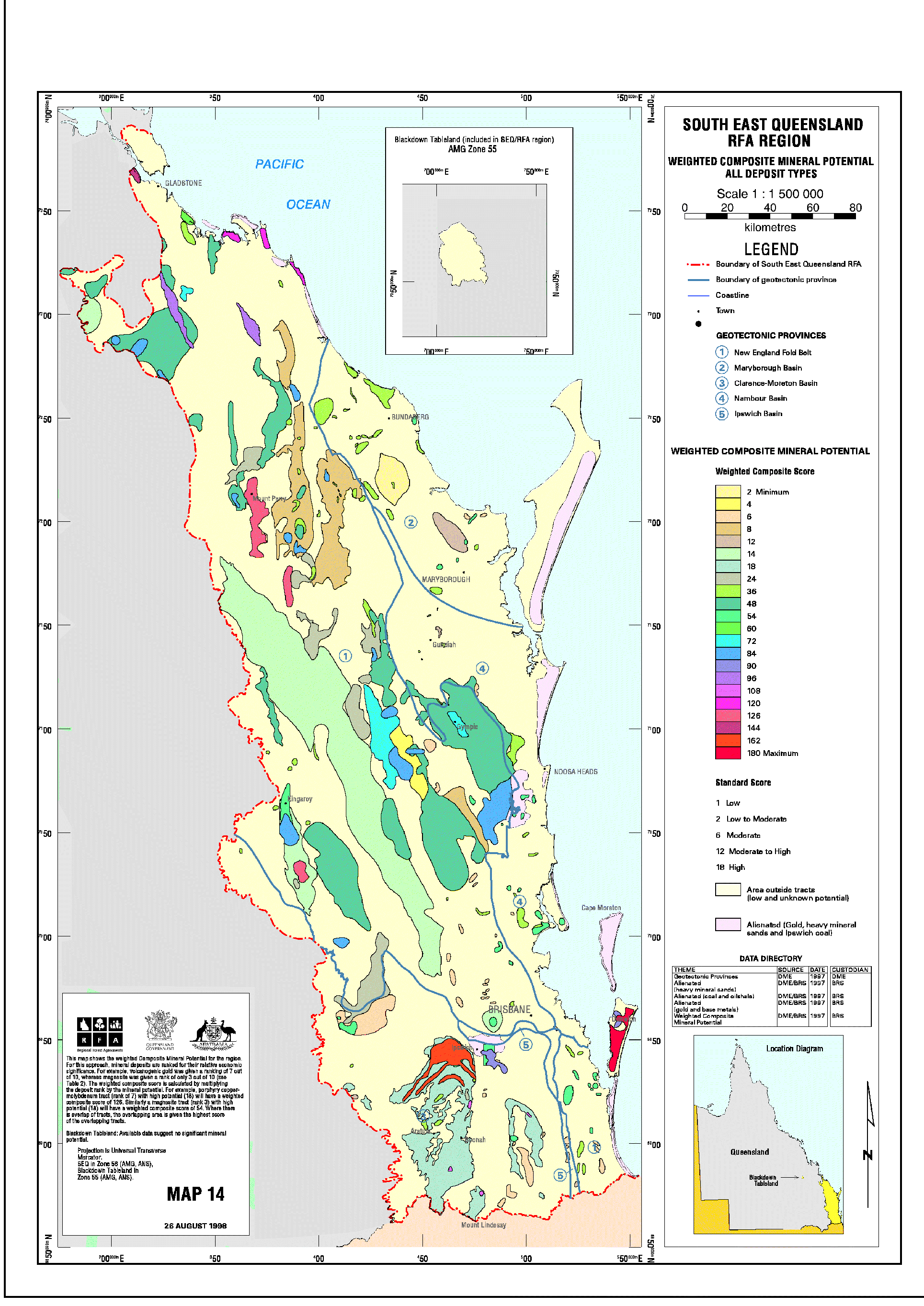
Assessment of Mineral and Extractive Material Resources (SE 3.1) (March 1999)
If you have difficulty accessing these files, please visit web accessibility.
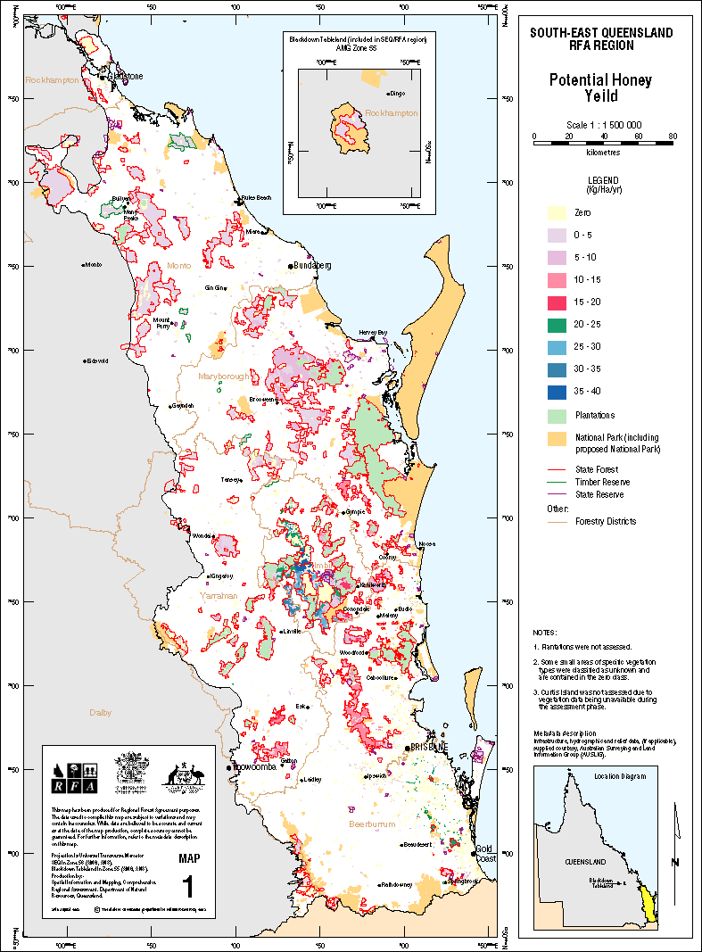
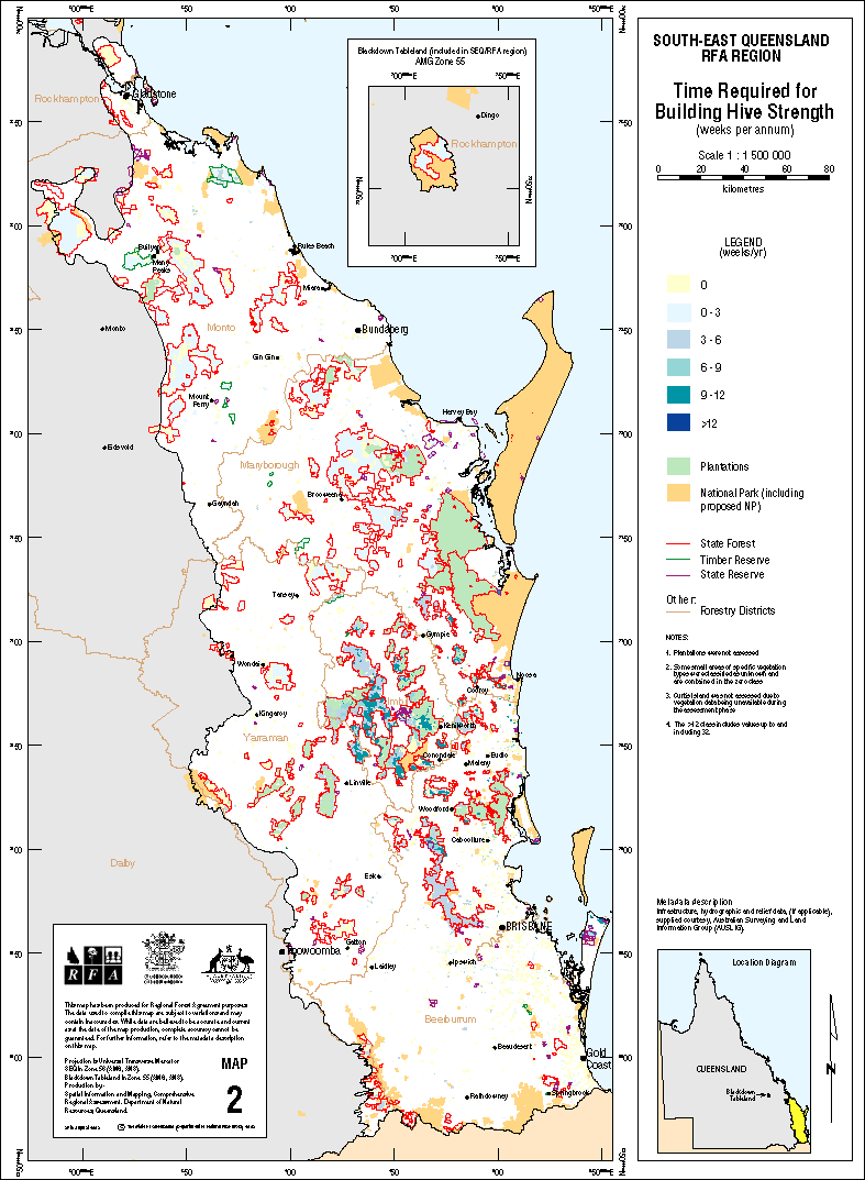
Apiculture (SE 4.2 Final Report) (April 1999)
| Document | Pages | File size |
|---|---|---|
| Apiculture SE 4.2 Final Report PDF | 93 | 244 KB |
| Map 1: Potential Honey Yield GIF | 1 | 722 KB |
| Map 2: Time Required for Building Hive Strength GIF | 1 | 71 KB |
If you have difficulty accessing these files, please visit web accessibility.
Flora Collection (SE 4.2) (April 1999)
| Document | Pages | File size |
|---|---|---|
| Flora Collection (SE 4.2) PDF | 43 | 149 KB |
If you have difficulty accessing this file, please visit web accessibility.
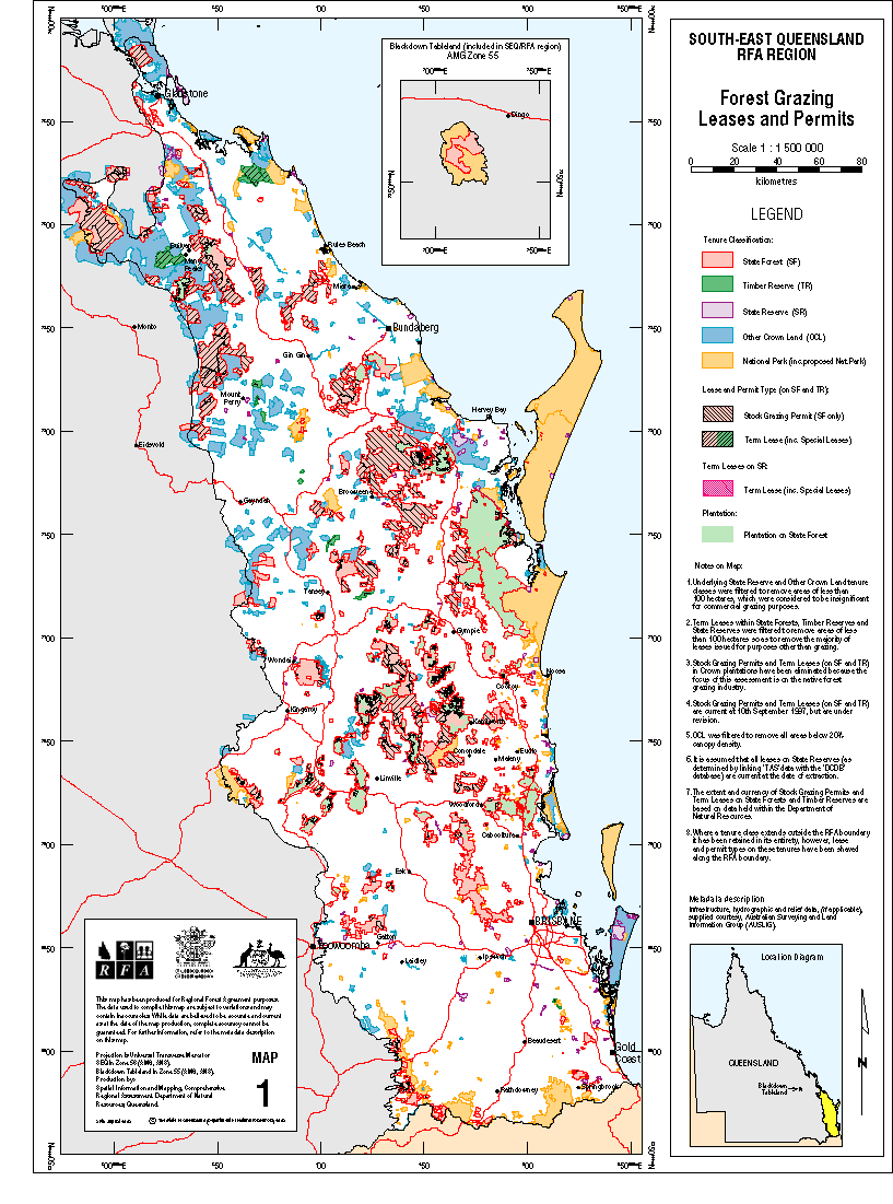
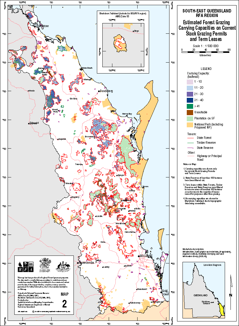
Forest Grazing (SE 4.2 Final Report) (April 1999)
If you have difficulty accessing these files, please visit web accessibility.
Resource, Forest Industry and Employee Catchment Analysis for the SEQ RFA Region (SE 5.4)
| Document | Pages | File size |
|---|---|---|
| Resource, Forest Industry and Employee Catchment Analysis for the SEQ RFA Region (SE 5.4) PDF | 122 | 15 KB |
If you have difficulty accessing this file, please visit web accessibility.
Water resources & management (SE 4.3)
| Document | Pages | File size |
|---|---|---|
| Water resources & management (SE 4.3) PDF | 55 | 460 KB |
| Water resources & management (SE 4.3) ZIP | 79 KB |
If you have difficulty accessing these files, please visit web accessibility.
Social and Economic Reports
Social Assessment Report (April 1999)
If you have difficulty accessing these files, please visit web accessibility.
Post Impact Studies Analysis (SE 5.1 Final Report) (March 1999)
| Document | Pages | File size |
|---|---|---|
| Post Impact Studies Analysis (SE 5.1 Final Report) PDF | 44 | 160 KB |
| Post Impact Studies Analysis (SE 5.1 Final Report) ZIP | 41 KB |
If you have difficulty accessing these files, please visit web accessibility.
Review of impacts of changes in forest use and management on indigenous communities (SE 5.1.2)
If you have difficulty accessing these files, please visit web accessibility.
Regional Social Profile (SE 5.2 Final Report) (March 1999)
If you have difficulty accessing these files, please visit web accessibility.
Indigenous social profile report for SEQ RFA (SE 5.2.2) (May 1999)
| Document | Pages | File size |
|---|---|---|
| Indigenous Social Profile Report for SEQ RFA May 1999 PDF | 86 | 276 KB |
If you have difficulty accessing this file, please visit web accessibility.
Social Case Study Areas (SE 5.3 Final Report) (March 1999)
| Document | Pages | File size |
|---|---|---|
| Social Case Study Areas (SE 5.3) PDF | 146 | 398 KB |
If you have difficulty accessing this file, please visit web accessibility.
Economic survey of log processing facilities in the South East region of Queensland (SE 2.2) (May 1999)
If you have difficulty accessing these files, please visit web accessibility.
Recreation Assessment (SE 4.1a) (April 1999)
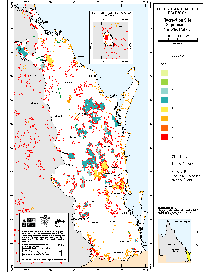
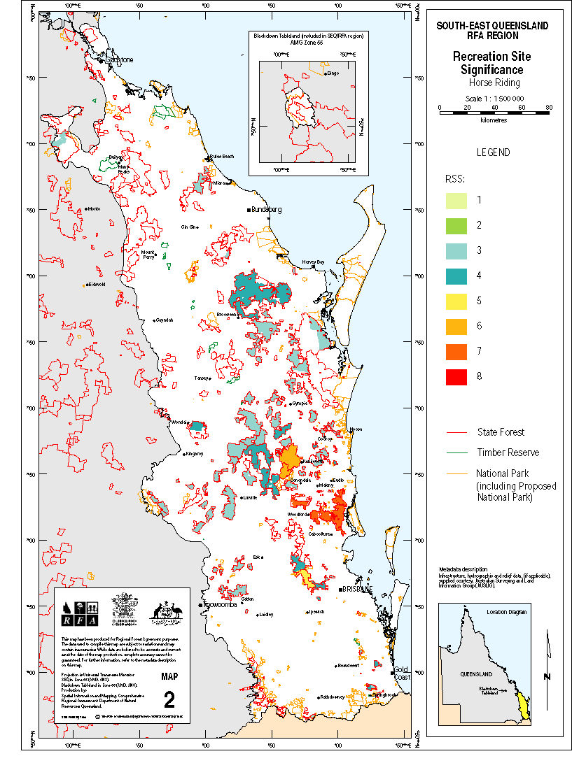
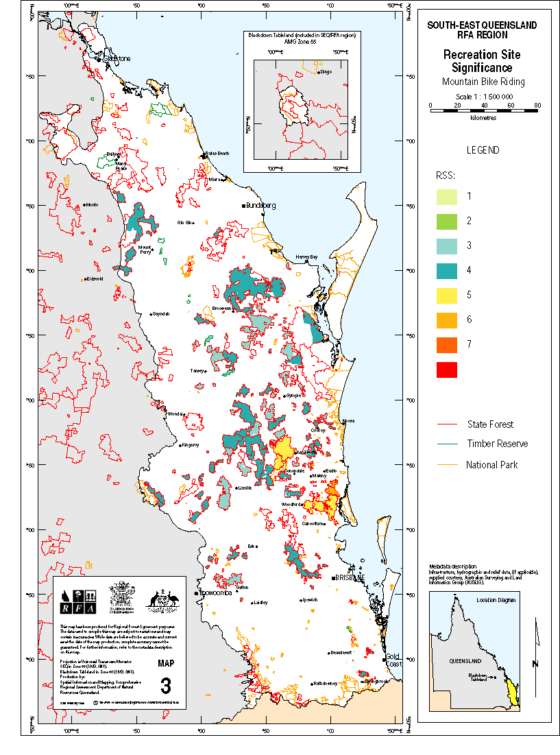
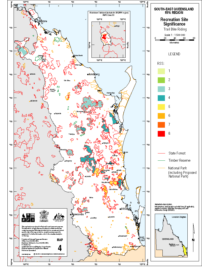
If you have difficulty accessing these files, please visit web accessibility.
Assessment of the Significance of Forests to the Recreation and Tourism Industries of South-East Queensland (SE 4.1b Final Report) (April 1999)
| Document | Pages | File size |
|---|---|---|
| Assessment of the Significance of Forests to the Recreation and Tourism Industries of South-East Queensland (SE 4.1b Final Report) PDF | 136 | 488 KB |
If you have difficulty accessing this file, please visit web accessibility.
People and Trees: A Thematic History of South East Queensland with Particular Reference to Forested Areas 1823-1997
If you have difficulty accessing these files, please visit web accessibility.